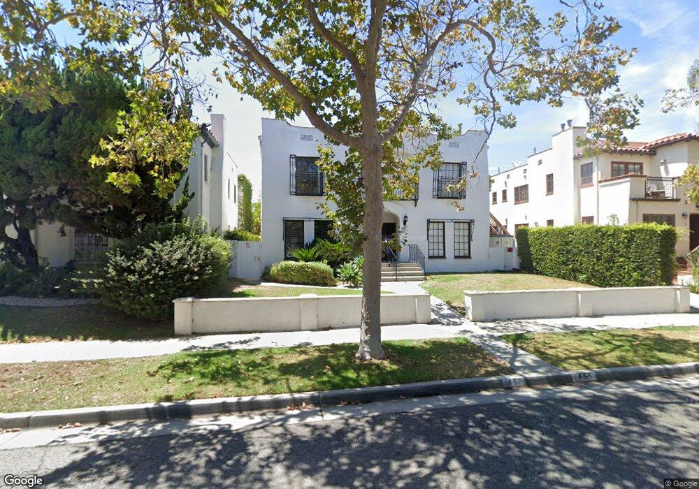
455 S Rexford Dr Unit 1/2 Beverly Hills, CA 90212
Estimated Value: $2,257,000 - $3,120,276
2
Beds
1
Bath
4,804
Sq Ft
$599/Sq Ft
Est. Value
About This Home
This home is located at 455 S Rexford Dr Unit 1/2, Beverly Hills, CA 90212 and is currently estimated at $2,875,319, approximately $598 per square foot. 455 S Rexford Dr Unit 1/2 is a home located in Los Angeles County with nearby schools including Beverly Vista Elementary School, Beverly Hills High School, and Harkham Hillel Hebrew Academy.
Ownership History
Date
Name
Owned For
Owner Type
Purchase Details
Closed on
May 21, 2015
Sold by
Choi Kwang Yui
Bought by
Andrita Properties Llc
Current Estimated Value
Purchase Details
Closed on
Dec 17, 2004
Sold by
Sabbah Raphael
Bought by
Choi Kwang Yui and Choi Mi O
Home Financials for this Owner
Home Financials are based on the most recent Mortgage that was taken out on this home.
Original Mortgage
$1,000,000
Interest Rate
5.67%
Mortgage Type
Purchase Money Mortgage
Purchase Details
Closed on
Nov 23, 1998
Sold by
Sabbah Raphael and Sabbah Annie C
Bought by
Sabbah Raphael and Sabbah Annie C
Home Financials for this Owner
Home Financials are based on the most recent Mortgage that was taken out on this home.
Original Mortgage
$637,000
Interest Rate
6.82%
Create a Home Valuation Report for This Property
The Home Valuation Report is an in-depth analysis detailing your home's value as well as a comparison with similar homes in the area
Home Values in the Area
Average Home Value in this Area
Purchase History
| Date | Buyer | Sale Price | Title Company |
|---|---|---|---|
| Andrita Properties Llc | $1,730,000 | Western Resources Title | |
| Choi Kwang Yui | $1,630,000 | North American Title | |
| Sabbah Raphael | -- | Old Republic Title Company |
Source: Public Records
Mortgage History
| Date | Status | Borrower | Loan Amount |
|---|---|---|---|
| Previous Owner | Choi Kwang Yui | $1,000,000 | |
| Previous Owner | Sabbah Raphael | $637,000 |
Source: Public Records
Tax History Compared to Growth
Tax History
| Year | Tax Paid | Tax Assessment Tax Assessment Total Assessment is a certain percentage of the fair market value that is determined by local assessors to be the total taxable value of land and additions on the property. | Land | Improvement |
|---|---|---|---|---|
| 2025 | $25,435 | $2,122,428 | $1,382,123 | $740,305 |
| 2024 | $25,435 | $2,080,813 | $1,355,023 | $725,790 |
| 2023 | $24,984 | $2,040,013 | $1,328,454 | $711,559 |
| 2022 | $24,273 | $2,000,013 | $1,302,406 | $697,607 |
| 2021 | $23,551 | $1,960,798 | $1,276,869 | $683,929 |
| 2019 | $22,876 | $1,902,643 | $1,238,998 | $663,645 |
| 2018 | $21,521 | $1,827,337 | $1,214,704 | $612,633 |
| 2016 | $20,625 | $1,756,382 | $1,167,537 | $588,845 |
| 2015 | $21,556 | $1,890,483 | $1,333,778 | $556,705 |
| 2014 | $20,861 | $1,853,452 | $1,307,652 | $545,800 |
Source: Public Records
Map
Nearby Homes
- 423 S Rexford Dr Unit 202
- 423 S Rexford Dr Unit 106
- 462 S Maple Dr Unit 104 PH
- 370 S Elm Dr Unit 2
- 1115 S Elm Dr Unit 301
- 1115 S Elm Dr Unit 417
- 1220 Smithwood Dr
- 502 Smithwood Dr
- 324 Rexford Dr
- 437 S Doheny Dr
- 341 S Canon Dr
- 352 S Oakhurst Dr
- 361 S Doheny Dr
- 301 S Rexford Dr Unit 1
- 301 S Rexford Dr Unit 4
- 301 S Rexford Dr Unit 3
- 149 -159 S Maple Dr
- 309 S Canon Dr
- 1450 S Beverly Dr Unit 105
- 252 S Maple Dr
- 455 S Rexford Dr
- 457 S Rexford Dr
- 461 S Rexford Dr
- 459 S Rexford Dr
- 453 S Rexford Dr
- 459 S Rexford Dr
- 451 S Rexford Dr
- 449 1/4 S Rexford Dr
- 445 S Rexford Dr
- 463 S Rexford Dr Unit 202
- 463 Rexford Dr Unit 203
- 463 S Rexford Dr Unit 203
- 463 S Rexford Dr Unit 301
- 463 S Rexford Dr
- 463 S Rexford Dr
- 463 Rexford Dr Unit 101
- 463 S Rexford Dr
- 463 S Rexford Dr Unit 302
- 463 S Rexford Dr Unit 205
- 463 S Rexford Dr Unit 304