M
Landlord's Agent in 2025
Misty Sexton
Main Street Renewal, LLC
(901) 334-1850
6 in this area
66 Total Sales
Estimated Value: $179,000 - $192,000
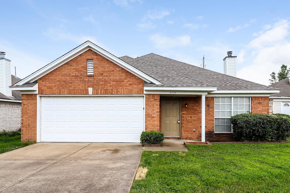
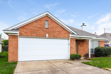
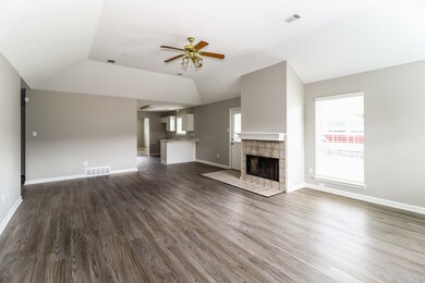
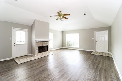
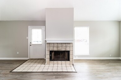
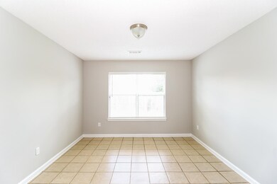
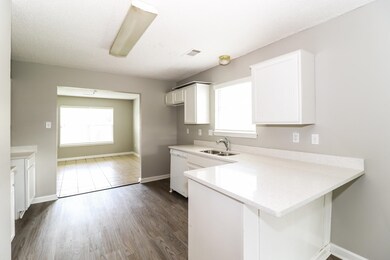
This pet-friendly home features modern finishes and a functional layout with ample kitchen storage, spacious living areas, and abundant natural light throughout. The private yard offers space suitable for gardening or outdoor relaxation. Conveniently located near schools, parks, dining, and local amenities. Technology-enabled maintenance services provide added convenience, and self-touring is available daily from 8 AM to 8 PM. Application details: one-time application fee of $50 per adult, a security deposit equal to one month’s rent, and applicable fees for pets ($250 non-refundable deposit + $35/month per pet), pools ($150/month), septic systems ($15/month), and any applicable HOA amenity fees. We do not advertise on Craigslist or request payment by check, cash, wire transfer, or cash apps.
Last Agent to Rent the Property
Main Street Renewal, LLC License #311947 Listed on: 11/25/2025
| Date | Buyer | Sale Price | Title Company |
|---|---|---|---|
| Sunfire 3 Llc | $70,000 | Summit Title & Escrow Llc | |
| Hollandsworth Donald | $40,000 | Assured Escrow & Title | |
| Reed Michael R | -- | Assured Escrow & Title | |
| Anderson Sharon K | -- | -- | |
| Reed Michael R | $124,000 | -- |
| Date | Status | Borrower | Loan Amount |
|---|---|---|---|
| Previous Owner | Reed Michael R | $99,200 |
| Date | Event | Price | List to Sale | Price per Sq Ft |
|---|---|---|---|---|
| 11/30/2025 11/30/25 | Rented | $1,440 | -15.8% | -- |
| 11/25/2025 11/25/25 | For Rent | $1,710 | -- | -- |
| Year | Tax Paid | Tax Assessment Tax Assessment Total Assessment is a certain percentage of the fair market value that is determined by local assessors to be the total taxable value of land and additions on the property. | Land | Improvement |
|---|---|---|---|---|
| 2025 | $1,220 | $48,625 | $3,250 | $45,375 |
| 2024 | $1,220 | $36,000 | $2,900 | $33,100 |
| 2023 | $1,220 | $36,000 | $2,900 | $33,100 |
| 2022 | $1,220 | $36,000 | $2,900 | $33,100 |
| 2021 | $1,242 | $36,000 | $2,900 | $33,100 |
| 2020 | $829 | $20,475 | $2,900 | $17,575 |
| 2019 | $0 | $20,475 | $2,900 | $17,575 |
| 2018 | $829 | $20,475 | $2,900 | $17,575 |
| 2017 | $842 | $20,475 | $2,900 | $17,575 |
| 2016 | $886 | $20,275 | $0 | $0 |
| 2014 | $886 | $20,275 | $0 | $0 |
M
Landlord's Agent in 2025
Misty Sexton
Main Street Renewal, LLC
(901) 334-1850
6 in this area
66 Total Sales
Source: Memphis Area Association of REALTORS®
MLS Number: 10210410
APN: D0-147O-I0-0013
Disclaimer: Certain information contained herein is derived from information provided by parties other than Homes.com. All information provided is deemed reliable, but is not guaranteed to be accurate and should be independently verified.
![]() Listing content and images Copyright 2026 Memphis Area Association of REALTORS®. Information provided is for the consumer’s personal, non-commercial use and may not be used for any purpose other than to identify prospective properties consumers may be interested in purchasing. Do not rely upon listing data without independently verifying it.
Listing content and images Copyright 2026 Memphis Area Association of REALTORS®. Information provided is for the consumer’s personal, non-commercial use and may not be used for any purpose other than to identify prospective properties consumers may be interested in purchasing. Do not rely upon listing data without independently verifying it.
Some or all of the listings displayed may not belong to the firm whose website is being visited.
Ask me questions while you tour the home.
