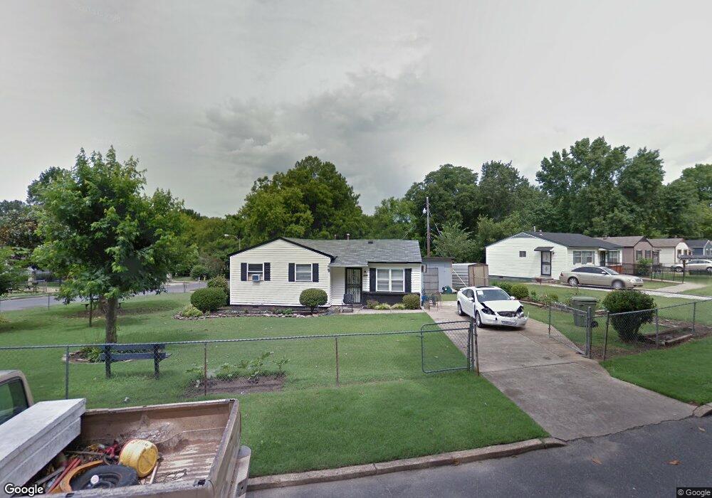
4555 Range Line Rd Memphis, TN 38127
Frayser NeighborhoodEstimated Value: $75,160 - $86,000
3
Beds
1
Bath
854
Sq Ft
$93/Sq Ft
Est. Value
About This Home
This home is located at 4555 Range Line Rd, Memphis, TN 38127 and is currently estimated at $79,540, approximately $93 per square foot. 4555 Range Line Rd is a home located in Shelby County with nearby schools including Hawkins Mill Elementary School, Georgian Hills Middle School, and Trezevant High School.
Ownership History
Date
Name
Owned For
Owner Type
Purchase Details
Closed on
May 31, 2024
Sold by
Childs Parker Irene
Bought by
Childs Gwendolyn and Childs Kenneth
Current Estimated Value
Purchase Details
Closed on
Jul 8, 1998
Sold by
Childs Kenneth
Bought by
Parker Irene Childs
Purchase Details
Closed on
Mar 25, 1998
Sold by
Homecomings Financial Network Inc
Bought by
Childs Kenneth
Purchase Details
Closed on
Feb 14, 1997
Sold by
Stutts Stutts C and Stutts Tretha
Bought by
Stutts C L
Purchase Details
Closed on
Jan 3, 1997
Sold by
Weiss Arnold M
Bought by
Ocwen Federal Bank Fsb
Create a Home Valuation Report for This Property
The Home Valuation Report is an in-depth analysis detailing your home's value as well as a comparison with similar homes in the area
Home Values in the Area
Average Home Value in this Area
Purchase History
| Date | Buyer | Sale Price | Title Company |
|---|---|---|---|
| Childs Gwendolyn | -- | Home & Farm Title Services | |
| Parker Irene Childs | -- | -- | |
| Childs Kenneth | $15,000 | -- | |
| Stutts C L | -- | -- | |
| Ocwen Federal Bank Fsb | $20,902 | -- |
Source: Public Records
Tax History Compared to Growth
Tax History
| Year | Tax Paid | Tax Assessment Tax Assessment Total Assessment is a certain percentage of the fair market value that is determined by local assessors to be the total taxable value of land and additions on the property. | Land | Improvement |
|---|---|---|---|---|
| 2025 | $296 | $14,450 | $1,375 | $13,075 |
| 2024 | $296 | $9,900 | $1,250 | $8,650 |
| 2023 | $569 | $9,900 | $1,250 | $8,650 |
| 2022 | $569 | $9,900 | $1,250 | $8,650 |
| 2021 | $575 | $9,900 | $1,250 | $8,650 |
| 2020 | $529 | $7,300 | $1,250 | $6,050 |
| 2019 | $529 | $7,300 | $1,250 | $6,050 |
| 2018 | $529 | $7,300 | $1,250 | $6,050 |
| 2017 | $300 | $7,300 | $1,250 | $6,050 |
| 2016 | $330 | $7,550 | $0 | $0 |
| 2014 | $330 | $7,550 | $0 | $0 |
Source: Public Records
Map
Nearby Homes
- 2620 Maverick Ave
- 4579 Range Line Rd
- 4589 Range Line Rd
- 4530 Beacon Hill Dr
- 4511 Range Line Rd
- 4520 Beacon Hill Dr
- 4502 Beacon Hill Cove
- 4499 Range Line Rd
- 4498 Beacon Hill Cove
- 4623 Sunnybrook St
- 4511 Beacon Hill Dr
- 4494 Beacon Hill Cove
- 4503 Beacon Hill Dr
- 4518 Suncrest Dr
- 4464 Range Line Rd
- 4514 Suncrest Dr
- 2548 Sunny Hill Dr
- 4489 Beacon Hill Dr
- 4537 Suncrest Dr
- 4485 Beacon Hill Dr
- 2628 Maverick Ave
- 4563 Range Line Rd
- 2624 Maverick Ave
- 4569 Range Line Rd
- 2631 Maverick Ave
- 2633 Maverick Ave
- 2627 Maverick Ave
- 4562 Range Line Rd
- 4566 Range Line Rd
- 2623 Maverick Ave
- 4573 Range Line Rd
- 4540 Range Line Rd
- 4570 Range Line Rd
- 2619 Maverick Ave
- 2616 Maverick Ave
- 4574 Range Line Rd
- 2618 Mirror Ave
- 2614 Mirror Ave
- 2610 Mirror Ave
- 2615 Maverick Ave