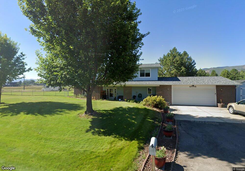
4555 Spurgin Rd Missoula, MT 59804
Estimated Value: $850,139 - $926,000
3
Beds
3
Baths
3,242
Sq Ft
$272/Sq Ft
Est. Value
About This Home
This home is located at 4555 Spurgin Rd, Missoula, MT 59804 and is currently estimated at $881,046, approximately $271 per square foot. 4555 Spurgin Rd is a home located in Missoula County with nearby schools including Target Range School, Big Sky High School, and Valley Christian School.
Ownership History
Date
Name
Owned For
Owner Type
Purchase Details
Closed on
Sep 3, 2008
Sold by
Trautman Allen E
Bought by
Gingerich Dean and Esi #178 Llc
Current Estimated Value
Home Financials for this Owner
Home Financials are based on the most recent Mortgage that was taken out on this home.
Original Mortgage
$200,000
Interest Rate
6.59%
Mortgage Type
Seller Take Back
Purchase Details
Closed on
Mar 3, 2004
Sold by
Buss Craig Allen and Buss Lorna Kirchner
Bought by
Buss Craig A and Buss Lorna K
Home Financials for this Owner
Home Financials are based on the most recent Mortgage that was taken out on this home.
Original Mortgage
$140,000
Interest Rate
4.37%
Mortgage Type
Stand Alone Refi Refinance Of Original Loan
Create a Home Valuation Report for This Property
The Home Valuation Report is an in-depth analysis detailing your home's value as well as a comparison with similar homes in the area
Home Values in the Area
Average Home Value in this Area
Purchase History
| Date | Buyer | Sale Price | Title Company |
|---|---|---|---|
| Gingerich Dean | -- | Stm | |
| Buss Craig A | -- | Title Services Inc |
Source: Public Records
Mortgage History
| Date | Status | Borrower | Loan Amount |
|---|---|---|---|
| Closed | Gingerich Dean | $200,000 | |
| Previous Owner | Buss Craig A | $140,000 |
Source: Public Records
Tax History Compared to Growth
Tax History
| Year | Tax Paid | Tax Assessment Tax Assessment Total Assessment is a certain percentage of the fair market value that is determined by local assessors to be the total taxable value of land and additions on the property. | Land | Improvement |
|---|---|---|---|---|
| 2025 | $5,923 | $745,000 | $273,080 | $471,920 |
| 2024 | $6,223 | $597,700 | $243,125 | $354,575 |
| 2023 | $5,703 | $597,700 | $243,125 | $354,575 |
| 2022 | $4,766 | $439,300 | $0 | $0 |
| 2021 | $4,441 | $439,300 | $0 | $0 |
| 2020 | $4,272 | $404,100 | $0 | $0 |
| 2019 | $4,239 | $404,100 | $0 | $0 |
| 2018 | $3,834 | $372,260 | $0 | $0 |
| 2017 | $3,835 | $372,260 | $0 | $0 |
| 2016 | $3,803 | $369,000 | $0 | $0 |
| 2015 | $3,675 | $369,000 | $0 | $0 |
| 2014 | $4,341 | $242,104 | $0 | $0 |
Source: Public Records
Map
Nearby Homes
- 1211 Kenwood Dr
- 3720 Sierra Dr
- 4316 North Ave W
- 1522 Clements Rd
- 2201 Rafferty Ln
- 2222 Pauline Dr
- NHN Howard St
- 2275 Ruth Louise Ln
- 296 Big Flat Rd
- 8165 Double Tree Ln
- 3101 Humble Rd
- 3073 Catherine Ct
- 455 Stonybrook Dr
- 3522 South Ave W
- Nhn 40th Ave
- 306 Tower St
- 3330 S 3rd St W
- 7950 Toby Way
- 6145 Mullan Rd Unit 27
- 796 Eliza Ct
- 4565 Spurgin Rd
- 4550 Spurgin Rd
- 4575 Spurgin Rd
- 1100 Spurgin Ct
- 1105 Spurgin Ct
- 4500 Spurgin Rd
- 4635 Spurgin Rd
- 1080 Spurgin Ct
- 1085 Spurgin Ct
- 1015 Humble Rd
- 4630 Spurgin Rd
- 1060 Spurgin Ct
- 1180 Kenwood Dr
- 1065 Spurgin Ct
- 1210 Kenwood Dr
- 4640 Spurgin Rd
- NHN Humble
- 4412 Spurgin Rd
- 4413 Sierra Dr
- 1151 Kenwood Dr