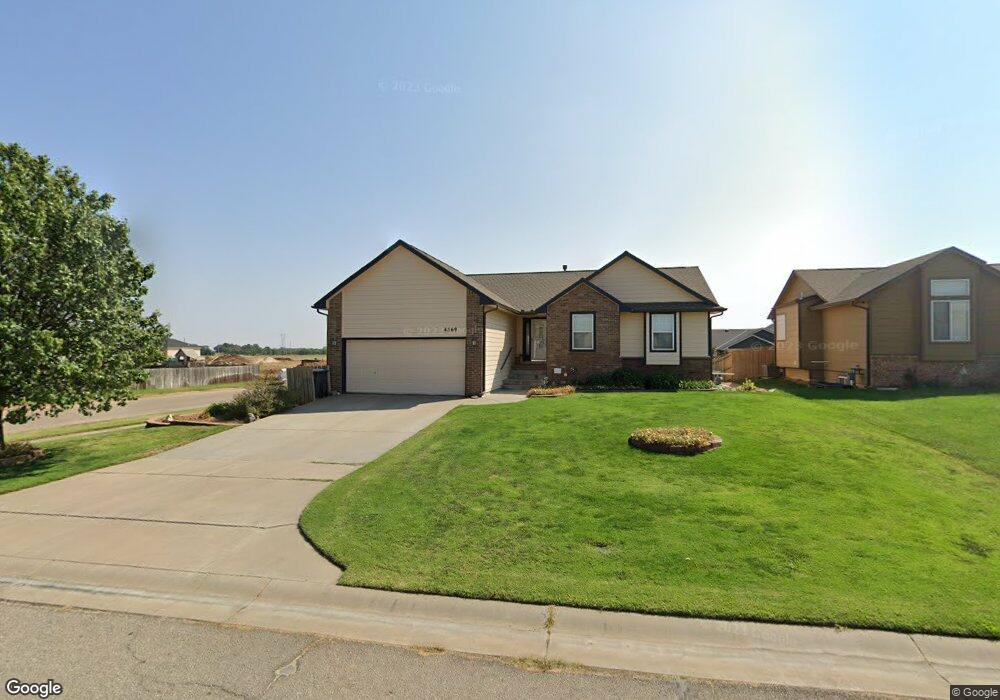
4569 S Doris Ct Wichita, KS 67215
Oatville NeighborhoodEstimated Value: $296,946 - $308,000
3
Beds
3
Baths
2,141
Sq Ft
$141/Sq Ft
Est. Value
About This Home
This home is located at 4569 S Doris Ct, Wichita, KS 67215 and is currently estimated at $302,473, approximately $141 per square foot. 4569 S Doris Ct is a home located in Sedgwick County with nearby schools including Oatville Elementary School, Haysville West Middle School, and Campus High School.
Ownership History
Date
Name
Owned For
Owner Type
Purchase Details
Closed on
Nov 1, 2008
Sold by
Bank Of New York
Bought by
Downey Michael S and Downey Anita J
Current Estimated Value
Home Financials for this Owner
Home Financials are based on the most recent Mortgage that was taken out on this home.
Original Mortgage
$137,400
Interest Rate
5.98%
Mortgage Type
New Conventional
Purchase Details
Closed on
Jul 20, 2006
Sold by
Moeder Construction Llc
Bought by
Bounyavong Bustady
Home Financials for this Owner
Home Financials are based on the most recent Mortgage that was taken out on this home.
Original Mortgage
$28,847
Interest Rate
6.66%
Mortgage Type
Stand Alone Second
Create a Home Valuation Report for This Property
The Home Valuation Report is an in-depth analysis detailing your home's value as well as a comparison with similar homes in the area
Home Values in the Area
Average Home Value in this Area
Purchase History
| Date | Buyer | Sale Price | Title Company |
|---|---|---|---|
| Downey Michael S | -- | None Available | |
| Bounyavong Bustady | -- | None Available |
Source: Public Records
Mortgage History
| Date | Status | Borrower | Loan Amount |
|---|---|---|---|
| Closed | Downey Michael S | $137,400 | |
| Previous Owner | Bounyavong Bustady | $28,847 |
Source: Public Records
Tax History Compared to Growth
Tax History
| Year | Tax Paid | Tax Assessment Tax Assessment Total Assessment is a certain percentage of the fair market value that is determined by local assessors to be the total taxable value of land and additions on the property. | Land | Improvement |
|---|---|---|---|---|
| 2025 | $3,358 | $31,936 | $7,487 | $24,449 |
| 2024 | $3,358 | $29,372 | $6,107 | $23,265 |
| 2023 | $3,358 | $27,451 | $6,107 | $21,344 |
| 2022 | $2,793 | $23,817 | $5,762 | $18,055 |
| 2021 | $2,628 | $22,058 | $2,749 | $19,309 |
| 2020 | $3,091 | $18,608 | $2,749 | $15,859 |
| 2019 | $3,192 | $18,608 | $2,749 | $15,859 |
| 2018 | $3,258 | $19,079 | $2,312 | $16,767 |
| 2017 | $2,987 | $0 | $0 | $0 |
| 2016 | $2,928 | $0 | $0 | $0 |
| 2015 | $2,926 | $0 | $0 | $0 |
| 2014 | $2,928 | $0 | $0 | $0 |
Source: Public Records
Map
Nearby Homes
- 4633 S Doris Ct
- 4517 S Doris Ct
- 4682 S Doris Ct
- 4415 S Doris St
- 5112 W 46th St S
- 4645 S Doris Ct
- 4649 S Doris Ct
- 5116 W 46th St S
- Lot 17 Block C Trinity Point Addition
- 5509 W 44th St S
- 4519 S Flora Ct
- 5301 W 42nd Ct S
- 3930 S Hoover Rd
- 5350 W 42nd St S
- 5424 W 42nd St S
- 5534 42nd St
- 5530 42nd St
- 5538 42nd St
- 5419 W York St
- 3846 S Bluelake St
- 4565 S Doris Ct
- 4538 S Doris Ct
- 4575 S Doris Ct
- 4561 S Doris Ct
- 4509 S Doris Ct
- 4513 S Doris Ct
- 4579 S Doris Ct
- 4542 S Doris Ct
- 4557 S Doris Ct
- 4534 S Doris Ct
- 4510 S Doris Ct
- 4583 S Doris Ct
- 4546 S Doris Ct
- 4521 S Doris Ct
- 4553 S Doris Ct
- 4514 S Doris Ct
- 5201 W 44th St S
- 5205 W 44th St S
- 4530 S Doris Ct
- 4629 S Doris Ct