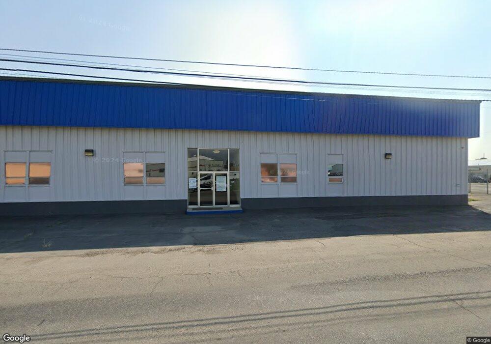
457 Daniel St B-1 Lease Billings, MT 59102
East Central Billings Neighborhood
--
Bed
--
Bath
21,610
Sq Ft
2.02
Acres
About This Home
This home is located at 457 Daniel St B-1 Lease, Billings, MT 59102. 457 Daniel St B-1 Lease is a home located in Yellowstone County with nearby schools including Washington School, Lewis & Clark Junior High School, and Billings West High School.
Ownership History
Date
Name
Owned For
Owner Type
Purchase Details
Closed on
Mar 28, 2013
Sold by
Eagle Watch Investments Inc
Bought by
Thomas & Tate Holdings Llc
Purchase Details
Closed on
Jun 16, 2008
Sold by
Interstate Plaza Llc
Bought by
Eagle Watch Investments Inc
Home Financials for this Owner
Home Financials are based on the most recent Mortgage that was taken out on this home.
Original Mortgage
$1,098,750
Interest Rate
6.05%
Mortgage Type
Purchase Money Mortgage
Create a Home Valuation Report for This Property
The Home Valuation Report is an in-depth analysis detailing your home's value as well as a comparison with similar homes in the area
Home Values in the Area
Average Home Value in this Area
Purchase History
| Date | Buyer | Sale Price | Title Company |
|---|---|---|---|
| Thomas & Tate Holdings Llc | -- | None Available | |
| Eagle Watch Investments Inc | -- | None Available | |
| Eagle Watch Investments Inc | -- | None Available |
Source: Public Records
Mortgage History
| Date | Status | Borrower | Loan Amount |
|---|---|---|---|
| Previous Owner | Eagle Watch Investments Inc | $1,098,750 |
Source: Public Records
Tax History Compared to Growth
Tax History
| Year | Tax Paid | Tax Assessment Tax Assessment Total Assessment is a certain percentage of the fair market value that is determined by local assessors to be the total taxable value of land and additions on the property. | Land | Improvement |
|---|---|---|---|---|
| 2025 | $25,901 | $2,305,600 | $793,289 | $1,512,311 |
| 2024 | $25,901 | $1,824,300 | $623,538 | $1,200,762 |
| 2023 | $26,672 | $1,824,300 | $623,538 | $1,200,762 |
| 2022 | $18,544 | $1,402,900 | $0 | $0 |
| 2021 | $22,530 | $1,402,900 | $0 | $0 |
| 2020 | $21,187 | $1,252,500 | $0 | $0 |
| 2019 | $20,267 | $1,252,500 | $0 | $0 |
| 2018 | $20,629 | $1,262,300 | $0 | $0 |
| 2017 | $16,359 | $1,262,300 | $0 | $0 |
| 2016 | $18,640 | $1,183,200 | $0 | $0 |
| 2015 | $19,525 | $1,284,200 | $0 | $0 |
| 2014 | $20,342 | $1,010,374 | $0 | $0 |
Source: Public Records
Map
Nearby Homes
- 12 Macarthur Ave
- 19 Patton Ave
- 231 S 12th St W
- 1219 Fairvale Dr
- 141 S 12th St W
- 226 Moore Ln
- 1212 Concord Dr
- 2014 George St
- 240 Birchwood Dr
- 2016 Monad Rd
- 1205 Lynn Ave
- 2109 George St
- 1231 Saint Johns Ave
- 1532 Howard Ave
- 126 Ardmore Dr
- 1113 Lynn Ave
- 16 19th St W
- 28 19th St W
- 305 17th St W
- 669 S 22nd St W
- 457 Daniel Street A Lease
- 525 Daniel St
- 619 Daniel St
- 609 Charles St
- 609 Charles (Lease)
- 39 Macarthur Ave
- 41 Macarthur Ave
- 37 Macarthur Ave
- 43 Macarthur Ave
- 35 Macarthur Ave
- 33 Macarthur Ave
- 31 Macarthur Ave
- 39 Mac Arthur Ave
- 29 Macarthur Ave
- 27 Macarthur Ave
- 29 Mac Arthur Ave
- 25 Macarthur Ave
- 23 Macarthur Ave
- 6 Marshall Dr
- 21 Macarthur Ave