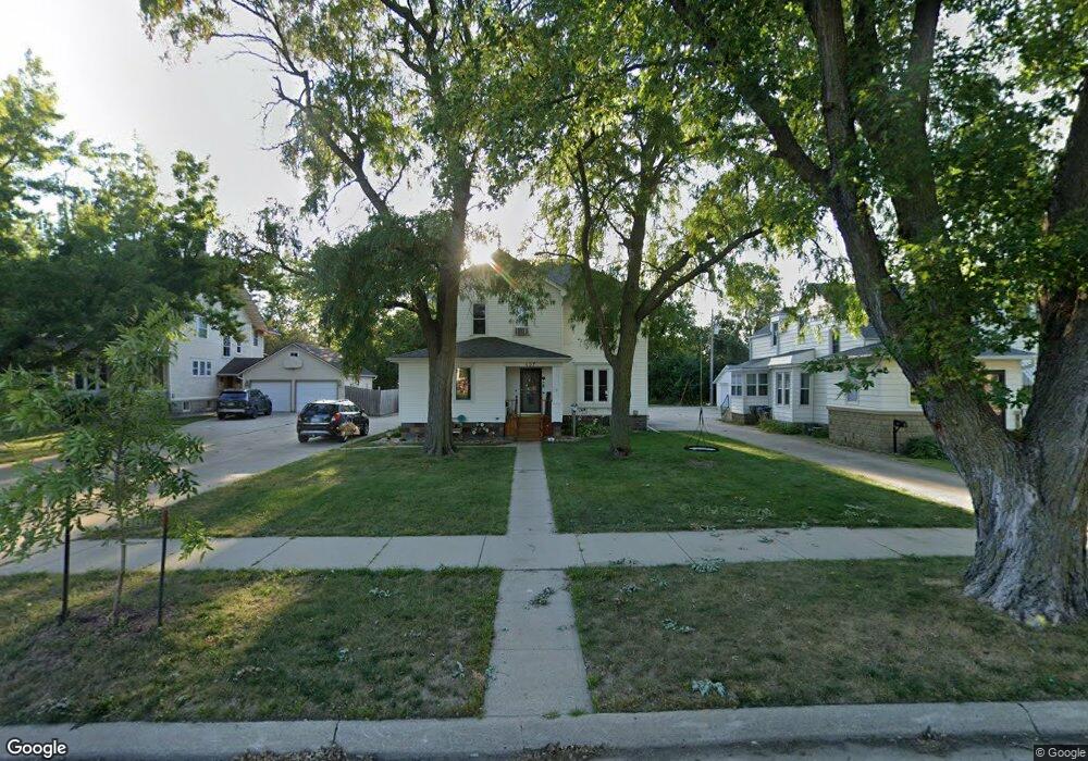
457 Euclid Ave Cherokee, IA 51012
Estimated Value: $173,000 - $202,000
5
Beds
2
Baths
2,094
Sq Ft
$87/Sq Ft
Est. Value
About This Home
This home is located at 457 Euclid Ave, Cherokee, IA 51012 and is currently estimated at $183,157, approximately $87 per square foot. 457 Euclid Ave is a home located in Cherokee County with nearby schools including Cherokee Elementary School, Cherokee Middle School, and Washington High School.
Ownership History
Date
Name
Owned For
Owner Type
Purchase Details
Closed on
Feb 22, 2012
Sold by
Ellis David J and Ellis Cheryl R
Bought by
Lucas Douglas Andrew and Lucas Angela Sue
Current Estimated Value
Home Financials for this Owner
Home Financials are based on the most recent Mortgage that was taken out on this home.
Original Mortgage
$92,150
Outstanding Balance
$63,494
Interest Rate
4.01%
Mortgage Type
New Conventional
Estimated Equity
$119,663
Purchase Details
Closed on
Mar 12, 2007
Sold by
Roberts Robert D and Roberts Lavon A
Bought by
Ellis David J and Ellis Cheryl R
Home Financials for this Owner
Home Financials are based on the most recent Mortgage that was taken out on this home.
Original Mortgage
$85,000
Interest Rate
6.4%
Mortgage Type
New Conventional
Create a Home Valuation Report for This Property
The Home Valuation Report is an in-depth analysis detailing your home's value as well as a comparison with similar homes in the area
Home Values in the Area
Average Home Value in this Area
Purchase History
| Date | Buyer | Sale Price | Title Company |
|---|---|---|---|
| Lucas Douglas Andrew | $97,000 | None Available | |
| Ellis David J | $85,000 | None Available |
Source: Public Records
Mortgage History
| Date | Status | Borrower | Loan Amount |
|---|---|---|---|
| Open | Lucas Douglas Andrew | $92,150 | |
| Previous Owner | Ellis David J | $85,000 |
Source: Public Records
Tax History Compared to Growth
Tax History
| Year | Tax Paid | Tax Assessment Tax Assessment Total Assessment is a certain percentage of the fair market value that is determined by local assessors to be the total taxable value of land and additions on the property. | Land | Improvement |
|---|---|---|---|---|
| 2025 | $2,318 | $168,450 | $13,690 | $154,760 |
| 2024 | $2,318 | $149,900 | $13,690 | $136,210 |
| 2023 | $2,348 | $149,900 | $13,690 | $136,210 |
| 2022 | $1,990 | $117,070 | $10,270 | $106,800 |
| 2021 | $1,990 | $117,070 | $10,270 | $106,800 |
| 2020 | $2,046 | $117,070 | $10,270 | $106,800 |
| 2019 | $2,168 | $117,070 | $0 | $0 |
| 2018 | $1,954 | $109,155 | $0 | $0 |
| 2017 | $1,990 | $109,155 | $0 | $0 |
| 2016 | $1,944 | $109,155 | $0 | $0 |
| 2015 | $1,676 | $93,295 | $0 | $0 |
| 2014 | $1,676 | $93,295 | $0 | $0 |
Source: Public Records
Map
Nearby Homes