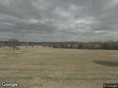
4572 Highway 124 Center Ridge, AR 72027
Estimated Value: $153,000 - $183,000
--
Bed
2
Baths
1,344
Sq Ft
$127/Sq Ft
Est. Value
About This Home
This home is located at 4572 Highway 124, Center Ridge, AR 72027 and is currently estimated at $171,277, approximately $127 per square foot. 4572 Highway 124 is a home located in Conway County with nearby schools including Nemo Vista Elementary School, Nemo Vista Middle School, and Nemo Vista High School.
Ownership History
Date
Name
Owned For
Owner Type
Purchase Details
Closed on
Jul 31, 2024
Sold by
Flowers Mark and Flowers Joyce
Bought by
Chapman Ronnie L
Current Estimated Value
Home Financials for this Owner
Home Financials are based on the most recent Mortgage that was taken out on this home.
Original Mortgage
$142,500
Outstanding Balance
$142,260
Interest Rate
6.87%
Mortgage Type
New Conventional
Purchase Details
Closed on
Dec 19, 2001
Bought by
Flowers Mark
Purchase Details
Closed on
May 8, 1989
Bought by
Flowers Mark
Create a Home Valuation Report for This Property
The Home Valuation Report is an in-depth analysis detailing your home's value as well as a comparison with similar homes in the area
Home Values in the Area
Average Home Value in this Area
Purchase History
| Date | Buyer | Sale Price | Title Company |
|---|---|---|---|
| Chapman Ronnie L | $150,000 | Benchmark Title | |
| Flowers Mark | -- | -- | |
| Flowers Mark | -- | -- |
Source: Public Records
Mortgage History
| Date | Status | Borrower | Loan Amount |
|---|---|---|---|
| Open | Chapman Ronnie L | $142,500 | |
| Previous Owner | Fowers Mark | $141,500 |
Source: Public Records
Tax History Compared to Growth
Tax History
| Year | Tax Paid | Tax Assessment Tax Assessment Total Assessment is a certain percentage of the fair market value that is determined by local assessors to be the total taxable value of land and additions on the property. | Land | Improvement |
|---|---|---|---|---|
| 2024 | $499 | $22,650 | $1,580 | $21,070 |
| 2023 | $960 | $22,650 | $1,580 | $21,070 |
| 2022 | $880 | $22,650 | $1,580 | $21,070 |
| 2021 | $800 | $16,600 | $1,490 | $15,110 |
| 2020 | $800 | $16,600 | $1,490 | $15,110 |
| 2019 | $800 | $16,600 | $1,490 | $15,110 |
| 2018 | $800 | $16,600 | $1,490 | $15,110 |
| 2017 | $800 | $16,600 | $1,490 | $15,110 |
| 2016 | $762 | $15,620 | $1,290 | $14,330 |
| 2015 | $740 | $15,620 | $1,290 | $14,330 |
| 2014 | $733 | $15,620 | $1,290 | $14,330 |
Source: Public Records
Map
Nearby Homes
- 23 Bear Cir
- lot 4 Grandview Rd
- lot 6 Grandview Rd
- lot 5 Grandview Rd
- lot 3 Grandview Rd
- lot 7 Grandview
- 20 Randall Dixon Rd
- TBD Wilderness Rd
- 97 O'Brien Ln
- 0 Catholic Point Rd Unit 25003889
- 00 Catholic Point Rd
- 196 Harris Loop
- 458 Cedar Creek Rd
- 61 Maupin Ln
- 230 Cedar Creek Rd
- 000 Morris Mountain Rd
- 00 Wright Place
- 877 Tucker Mountain Rd
- 0 Gadberry Rd
- 4378 Highway 95
- 4572 Highway 124
- 4618 Highway 124
- 4595 Highway 124
- 4619 Highway 124
- 4617 Highway 124
- 4565 Highway 124
- 1048 Sunny Side Rd
- 4632 Highway 124
- 40 Hendricks Dr
- 4541 Highway 124
- 4517 Highway 124
- 4503 Highway 124
- 15 Bear Cir
- 4713 Highway 124
- 80 Sheepskin Rd
- 23 Bear Cir Unit (Lick Mountain Road)
- 81 Sheepskin Rd
- 881 Sunny Side Rd
- 82 Sheepskin Rd
- 933 Sunny Side Rd
