N
Seller's Agent in 2025
Nicole Boss
Sankey Real Estate
1 in this area
7 Total Sales

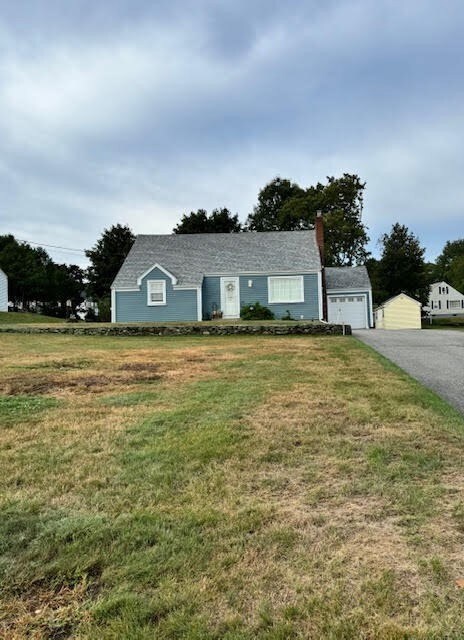
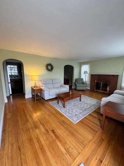
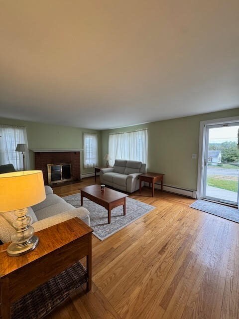

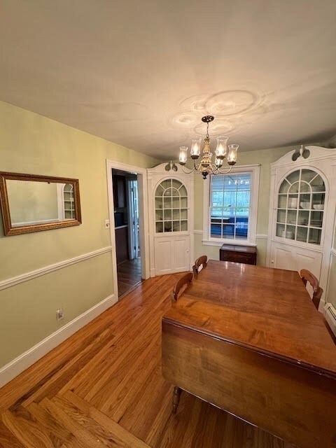
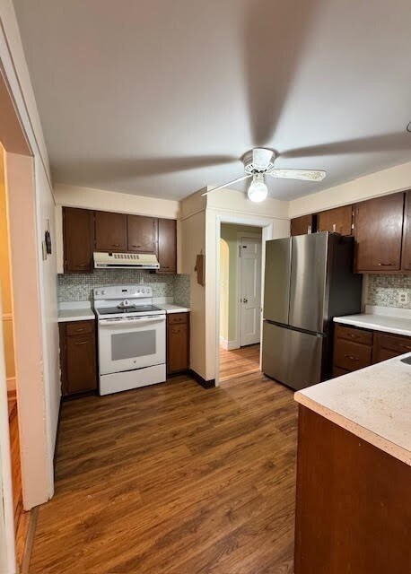
Well kept cape in a family friendly neighborhood ready for your personal touches! Lots of updates throughout! Vinyl siding (2025), roof (2019), leaf filter system (2024) & front walkway (2025) make exterior maintenance simple for years ahead. Large living room has a fireplace w a blower & hardwoods that lead to a dining room w built in corner cabinets. Kitchen has plenty of space & new stainless steel fridge (2025). Off the kitchen is an oversized year round Sunroom w plenty of light, perfect for a plant lover! Two 1st floor bedrooms w hardwood floors. 1st floor has 3 ductless mini splits & most windows were replaced. Upstairs are 2 more generous sized bedrooms w hardwood floors, insulated eave storage, baseboard heat & a ductless mini split. Attached 1 car garage is inustaled w eletricity & an automatic garage door. Set back from the street, enjoy a quiet nature filled backyard perfect for gatherings & a shed for storage. Conveniently located to highways, schools, shopping more!
| Date | Type | Sale Price | Title Company |
|---|---|---|---|
| Warranty Deed | $395,000 | -- | |
| Quit Claim Deed | -- | None Available | |
| Quit Claim Deed | -- | None Available | |
| Quit Claim Deed | -- | None Available | |
| Quit Claim Deed | -- | None Available | |
| Deed | -- | -- | |
| Deed | -- | -- | |
| Deed | -- | -- |
| Date | Status | Loan Amount | Loan Type |
|---|---|---|---|
| Open | $395,000 | Purchase Money Mortgage | |
| Previous Owner | $283,500 | New Conventional | |
| Previous Owner | $10,000 | No Value Available |
| Date | Event | Price | List to Sale | Price per Sq Ft |
|---|---|---|---|---|
| 10/03/2025 10/03/25 | Sold | $395,000 | -8.1% | $232 / Sq Ft |
| 09/08/2025 09/08/25 | Pending | -- | -- | -- |
| 09/05/2025 09/05/25 | For Sale | $430,000 | -- | $253 / Sq Ft |
| Year | Tax Paid | Tax Assessment Tax Assessment Total Assessment is a certain percentage of the fair market value that is determined by local assessors to be the total taxable value of land and additions on the property. | Land | Improvement |
|---|---|---|---|---|
| 2025 | $6,012 | $444,700 | $175,600 | $269,100 |
| 2024 | $5,557 | $320,300 | $123,100 | $197,200 |
| 2023 | $5,282 | $320,300 | $123,100 | $197,200 |
| 2022 | $5,269 | $320,300 | $123,100 | $197,200 |
| 2021 | $3,187 | $257,700 | $91,900 | $165,800 |
| 2020 | $3,163 | $257,000 | $91,900 | $165,100 |
| 2018 | $5,018 | $224,500 | $76,500 | $148,000 |
| 2017 | $4,866 | $222,200 | $76,500 | $145,700 |
| 2016 | $4,800 | $222,200 | $76,500 | $145,700 |
| 2015 | $4,560 | $193,800 | $66,800 | $127,000 |
| 2014 | $4,568 | $193,800 | $66,800 | $127,000 |
N
Seller's Agent in 2025
Nicole Boss
Sankey Real Estate
1 in this area
7 Total Sales

Buyer's Agent in 2025
Emilio DiSpirito
Engel & Volkers Oceanside
(401) 638-0010
1 in this area
7 Total Sales
Source: MLS Property Information Network (MLS PIN)
MLS Number: 73426553
APN: LINC-000014-000050-000000
Disclaimer: Certain information contained herein is derived from information provided by parties other than Homes.com. All information provided is deemed reliable, but is not guaranteed to be accurate and should be independently verified.
![]() The property listing data and information, or the Images, set forth herein were provided to MLS Property Information Network, Inc. from third party sources, including sellers, lessors and public records, and were compiled by MLS Property Information Network, Inc. The property listing data and information, and the Images, are for the personal, non-commercial use of consumers having a good faith interest in purchasing or leasing listed properties of the type displayed to them and may not be used for any purpose other than to identify prospective properties which such consumers may have a good faith interest in purchasing or leasing. MLS Property Information Network, Inc. and its subscribers disclaim any and all representations and warranties as to the accuracy of the property listing data and information, or as to the accuracy of any of the Images, set forth herein.
The property listing data and information, or the Images, set forth herein were provided to MLS Property Information Network, Inc. from third party sources, including sellers, lessors and public records, and were compiled by MLS Property Information Network, Inc. The property listing data and information, and the Images, are for the personal, non-commercial use of consumers having a good faith interest in purchasing or leasing listed properties of the type displayed to them and may not be used for any purpose other than to identify prospective properties which such consumers may have a good faith interest in purchasing or leasing. MLS Property Information Network, Inc. and its subscribers disclaim any and all representations and warranties as to the accuracy of the property listing data and information, or as to the accuracy of any of the Images, set forth herein.
Ask me questions while you tour the home.