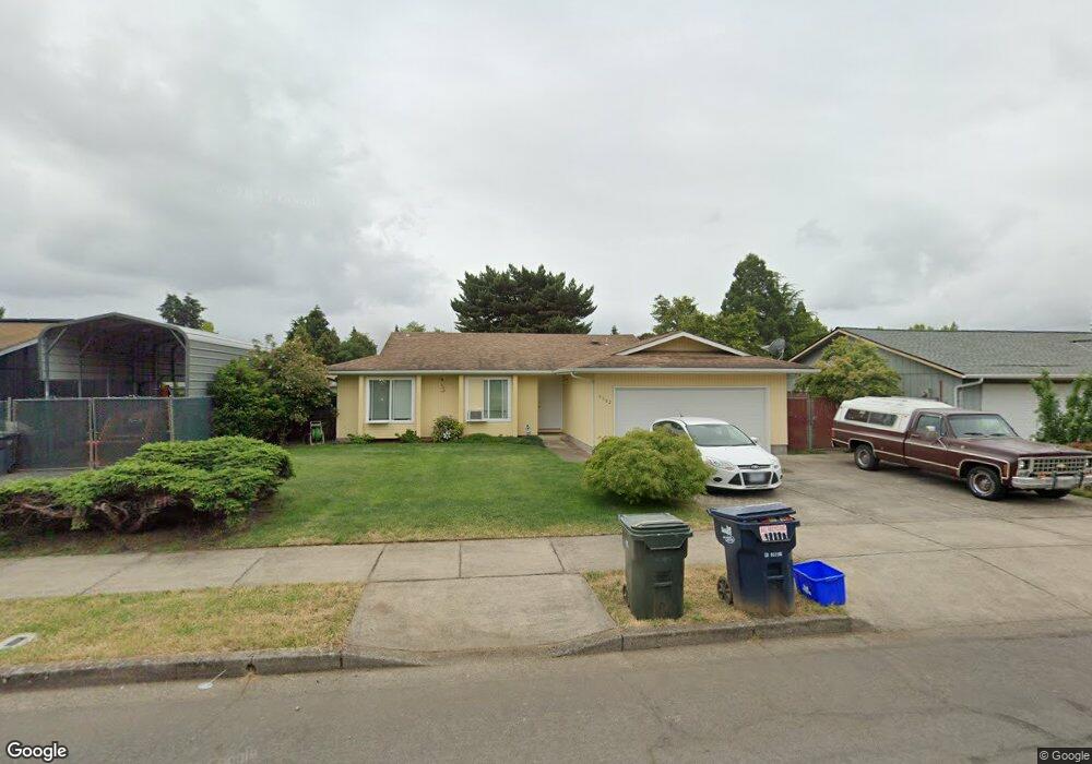
4582 Souza St Eugene, OR 97402
Bethel NeighborhoodEstimated Value: $328,000 - $368,000
3
Beds
2
Baths
1,059
Sq Ft
$332/Sq Ft
Est. Value
About This Home
This home is located at 4582 Souza St, Eugene, OR 97402 and is currently estimated at $351,997, approximately $332 per square foot. 4582 Souza St is a home located in Lane County with nearby schools including Danebo Elementary School, Shasta Middle School, and Willamette High School.
Ownership History
Date
Name
Owned For
Owner Type
Purchase Details
Closed on
Apr 23, 2025
Sold by
Demuth Robert M and Demuth Garnette W
Bought by
Rgmaad Living Trust and Demuth
Current Estimated Value
Purchase Details
Closed on
Jul 10, 2013
Sold by
Mudd Jeanine M
Bought by
Demuth Robert M and Demuth Garnette W
Purchase Details
Closed on
Dec 15, 1998
Sold by
Coggins John W
Bought by
Mudd Jeanine M
Home Financials for this Owner
Home Financials are based on the most recent Mortgage that was taken out on this home.
Original Mortgage
$105,820
Interest Rate
6.86%
Mortgage Type
FHA
Create a Home Valuation Report for This Property
The Home Valuation Report is an in-depth analysis detailing your home's value as well as a comparison with similar homes in the area
Home Values in the Area
Average Home Value in this Area
Purchase History
| Date | Buyer | Sale Price | Title Company |
|---|---|---|---|
| Rgmaad Living Trust | -- | None Listed On Document | |
| Demuth Robert M | $114,000 | Western Title & Escrow Co | |
| Mudd Jeanine M | $107,000 | Cascade Title Co |
Source: Public Records
Mortgage History
| Date | Status | Borrower | Loan Amount |
|---|---|---|---|
| Previous Owner | Mudd Jeanine M | $105,820 |
Source: Public Records
Tax History
| Year | Tax Paid | Tax Assessment Tax Assessment Total Assessment is a certain percentage of the fair market value that is determined by local assessors to be the total taxable value of land and additions on the property. | Land | Improvement |
|---|---|---|---|---|
| 2025 | $3,219 | $185,063 | -- | -- |
| 2024 | $3,138 | $179,673 | -- | -- |
| 2023 | $3,138 | $174,440 | -- | -- |
| 2022 | $2,921 | $169,360 | $0 | $0 |
| 2021 | $2,859 | $164,428 | $0 | $0 |
| 2020 | $2,776 | $159,639 | $0 | $0 |
| 2019 | $2,639 | $154,990 | $0 | $0 |
| 2018 | $2,566 | $146,093 | $0 | $0 |
| 2017 | $2,452 | $146,093 | $0 | $0 |
| 2016 | $2,390 | $141,838 | $0 | $0 |
| 2015 | $2,342 | $137,707 | $0 | $0 |
| 2014 | $2,307 | $133,696 | $0 | $0 |
Source: Public Records
Map
Nearby Homes
- 1562 Philip St
- 4554 Woodsboro St
- 4800 Barger Dr Unit 60
- 4548 Cambon St
- 1400 Candlelight Dr Unit 162
- 1400 Candlelight Dr Unit 208
- 1400 Candlelight Dr
- 1400 Candlelight Dr Unit 226
- 1145 Ludgate Dr
- 1159 Throne Dr
- 2055 Devos St
- 1699 N Terry St Unit 89
- 1699 N Terry St Unit 272
- 4280 Avalon St
- 1153 Elizabeth St
- 4941 Stagecoach Rd
- 2093 W Irwin Way
- 870 Laurelhurst Dr
- 1199 N Terry St
- 1199 N Terry St Unit 248
Your Personal Tour Guide
Ask me questions while you tour the home.