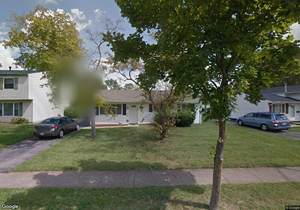
4588 Paxton Dr S Hilliard, OH 43026
Estimated Value: $249,000 - $277,000
3
Beds
1
Bath
1,160
Sq Ft
$227/Sq Ft
Est. Value
About This Home
This home is located at 4588 Paxton Dr S, Hilliard, OH 43026 and is currently estimated at $263,628, approximately $227 per square foot. 4588 Paxton Dr S is a home located in Franklin County with nearby schools including Beacon Elementary School, Hilliard Tharp Sixth Grade Elementary School, and Hilliard Weaver Middle School.
Ownership History
Date
Name
Owned For
Owner Type
Purchase Details
Closed on
Jul 14, 2003
Sold by
Zawatski Frank J and Frank J Zawatski Jr Revocable
Bought by
Munsell Heather L
Current Estimated Value
Home Financials for this Owner
Home Financials are based on the most recent Mortgage that was taken out on this home.
Original Mortgage
$87,200
Outstanding Balance
$37,185
Interest Rate
5.3%
Mortgage Type
Purchase Money Mortgage
Estimated Equity
$226,443
Purchase Details
Closed on
Jan 29, 2002
Sold by
Zawatski Gay P
Bought by
Zawatski Frank J and Frank J Zawatski Jr Revocable
Create a Home Valuation Report for This Property
The Home Valuation Report is an in-depth analysis detailing your home's value as well as a comparison with similar homes in the area
Home Values in the Area
Average Home Value in this Area
Purchase History
| Date | Buyer | Sale Price | Title Company |
|---|---|---|---|
| Munsell Heather L | $87,200 | -- | |
| Zawatski Frank J | $77,700 | Peterson Title Agency |
Source: Public Records
Mortgage History
| Date | Status | Borrower | Loan Amount |
|---|---|---|---|
| Open | Munsell Heather L | $87,200 |
Source: Public Records
Tax History Compared to Growth
Tax History
| Year | Tax Paid | Tax Assessment Tax Assessment Total Assessment is a certain percentage of the fair market value that is determined by local assessors to be the total taxable value of land and additions on the property. | Land | Improvement |
|---|---|---|---|---|
| 2024 | $4,527 | $67,590 | $26,220 | $41,370 |
| 2023 | $3,686 | $67,585 | $26,215 | $41,370 |
| 2022 | $3,258 | $45,080 | $15,610 | $29,470 |
| 2021 | $3,400 | $45,080 | $15,610 | $29,470 |
| 2020 | $3,471 | $45,080 | $15,610 | $29,470 |
| 2019 | $2,972 | $33,320 | $11,550 | $21,770 |
| 2018 | $2,844 | $33,320 | $11,550 | $21,770 |
| 2017 | $2,813 | $33,320 | $11,550 | $21,770 |
| 2016 | $2,888 | $33,430 | $9,910 | $23,520 |
| 2015 | $2,875 | $33,430 | $9,910 | $23,520 |
| 2014 | $2,732 | $33,430 | $9,910 | $23,520 |
| 2013 | $1,459 | $35,175 | $10,430 | $24,745 |
Source: Public Records
Map
Nearby Homes
- 3416 Leap Rd
- 4524 Moraine Ave
- 4862 Stoneybrook Blvd Unit 24E
- 4843 Stoneybrook Blvd Unit 30E
- 4857 Stoneybrook Blvd Unit 29E
- 3643 Carriage Run Dr
- 3012 Papin St Unit 39
- 4933 Travers Ct
- 5041 Stoneybrook Blvd Unit 9E
- 5062 Stoneybrook Blvd Unit 3F
- 5053 Stoneybrook Blvd
- 4695 Cemetery Rd
- 5080 Stoneybrook Blvd Unit 2D
- 5078 Stoneybrook Blvd Unit 2E
- 4967 Carroll Ct
- 1774 Zucchina Dr
- 3111 Castlebrook Ave
- 5126 Bigelow Dr
- 5222 Bonner Dr
- 5213 Frisco Dr
- 4600 Paxton Dr S
- 4580 Paxton Dr S
- 4608 Paxton Dr S
- 4576 Paxton Dr S
- 4559 Moraine Ave
- 4571 Moraine Ave
- 4555 Moraine Ave
- 3391 Paxton Ct
- 4616 Paxton Dr S
- 4570 Paxton Dr S
- 4601 Paxton Dr S
- 4577 Moraine Ave
- 4547 Moraine Ave
- 4609 Paxton Dr S
- 3393 Paxton Ct
- 4624 Paxton Dr S
- 4556 Paxton Dr S
- 4569 Paxton Dr S
- 4539 Moraine Ave
- 3380 Paxton Ct