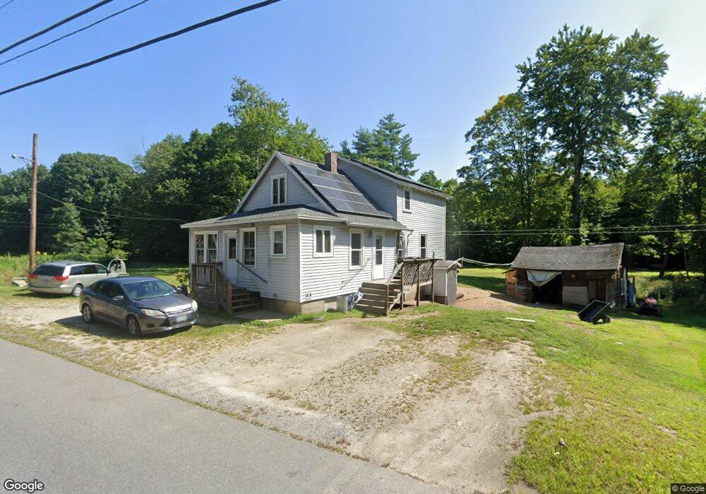
46 Beede Rd Epping, NH 03042
Estimated Value: $432,548 - $496,000
4
Beds
2
Baths
1,296
Sq Ft
$355/Sq Ft
Est. Value
About This Home
This home is located at 46 Beede Rd, Epping, NH 03042 and is currently estimated at $460,387, approximately $355 per square foot. 46 Beede Rd is a home located in Rockingham County with nearby schools including Epping Elementary School, Epping Middle School, and Epping High School.
Ownership History
Date
Name
Owned For
Owner Type
Purchase Details
Closed on
Jan 18, 2013
Sold by
Hartford Howard E Est
Bought by
T C
Current Estimated Value
Purchase Details
Closed on
Jun 28, 2011
Sold by
Hartford Reginald E and Hartford Annette M
Bought by
Mills Richard M and Mills Jessica A
Home Financials for this Owner
Home Financials are based on the most recent Mortgage that was taken out on this home.
Original Mortgage
$141,477
Interest Rate
4.63%
Mortgage Type
Purchase Money Mortgage
Create a Home Valuation Report for This Property
The Home Valuation Report is an in-depth analysis detailing your home's value as well as a comparison with similar homes in the area
Home Values in the Area
Average Home Value in this Area
Purchase History
| Date | Buyer | Sale Price | Title Company |
|---|---|---|---|
| T C | $55,000 | -- | |
| Mills Richard M | $138,500 | -- |
Source: Public Records
Mortgage History
| Date | Status | Borrower | Loan Amount |
|---|---|---|---|
| Previous Owner | Mills Richard M | $141,477 |
Source: Public Records
Tax History
| Year | Tax Paid | Tax Assessment Tax Assessment Total Assessment is a certain percentage of the fair market value that is determined by local assessors to be the total taxable value of land and additions on the property. | Land | Improvement |
|---|---|---|---|---|
| 2024 | $6,237 | $247,200 | $108,600 | $138,600 |
| 2023 | $5,784 | $247,200 | $108,600 | $138,600 |
| 2022 | $5,560 | $247,200 | $108,600 | $138,600 |
| 2021 | $4,834 | $215,600 | $108,600 | $107,000 |
| 2020 | $5,814 | $215,600 | $108,600 | $107,000 |
| 2019 | $4,928 | $177,900 | $88,000 | $89,900 |
| 2018 | $4,615 | $177,900 | $88,000 | $89,900 |
| 2017 | $5,370 | $177,900 | $88,000 | $89,900 |
| 2016 | $4,615 | $177,900 | $88,000 | $89,900 |
| 2015 | $4,615 | $177,900 | $88,000 | $89,900 |
| 2014 | $4,354 | $178,300 | $88,000 | $90,300 |
| 2013 | $4,327 | $178,300 | $88,000 | $90,300 |
Source: Public Records
Map
Nearby Homes
- 26 Barrell Run Rd
- 145 Gristmill Rd
- 65 Sunset Ridge Rd Unit 65A
- 65 Sunset Ridge Rd Unit 65B
- 63 Sunset Ridge Rd Unit 63A
- 63 Sunset Ridge Rd Unit 63B
- 27 Old State Rd
- 54 Sunset Ridge Rd Unit 54B
- 3B Connor Ct Unit 3B
- 3A Connor Ct Unit 3A
- 55 Sunset Ridge Rd Unit 55A
- 55 Sunset Ridge Rd Unit 55B
- 1A Connor Ct Unit 1A
- 1B Connor Ct Unit 1B
- 41 Midnight Sun Dr
- 39 Hunter Dr
- 7 Boulder Ct
- 16 Molly Way
- 110 Tuck Dr
- 11 Royal Ln
Your Personal Tour Guide
Ask me questions while you tour the home.