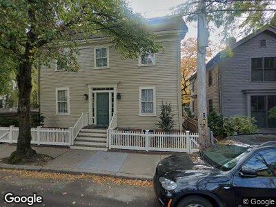
46 Foster St Cambridge, MA 02138
West Cambridge NeighborhoodEstimated Value: $2,269,913 - $3,432,000
3
Beds
4
Baths
1,878
Sq Ft
$1,457/Sq Ft
Est. Value
About This Home
This home is located at 46 Foster St, Cambridge, MA 02138 and is currently estimated at $2,736,478, approximately $1,457 per square foot. 46 Foster St is a home located in Middlesex County with nearby schools including St Peter School, Cambridge Montessori School, and Shady Hill School.
Ownership History
Date
Name
Owned For
Owner Type
Purchase Details
Closed on
Aug 11, 1994
Sold by
Dykema Annette S
Bought by
Tucker Elise I
Current Estimated Value
Home Financials for this Owner
Home Financials are based on the most recent Mortgage that was taken out on this home.
Original Mortgage
$150,000
Interest Rate
8.52%
Mortgage Type
Purchase Money Mortgage
Purchase Details
Closed on
Jul 15, 1988
Sold by
Stevens Phyllis
Bought by
Dykema Jere H
Create a Home Valuation Report for This Property
The Home Valuation Report is an in-depth analysis detailing your home's value as well as a comparison with similar homes in the area
Home Values in the Area
Average Home Value in this Area
Purchase History
| Date | Buyer | Sale Price | Title Company |
|---|---|---|---|
| Tucker Elise I | $525,000 | -- | |
| Tucker Elise I | $525,000 | -- | |
| Dykema Jere H | $407,700 | -- |
Source: Public Records
Mortgage History
| Date | Status | Borrower | Loan Amount |
|---|---|---|---|
| Open | Dykema Jere H | $100,000 | |
| Closed | Dykema Jere H | $150,000 |
Source: Public Records
Tax History Compared to Growth
Tax History
| Year | Tax Paid | Tax Assessment Tax Assessment Total Assessment is a certain percentage of the fair market value that is determined by local assessors to be the total taxable value of land and additions on the property. | Land | Improvement |
|---|---|---|---|---|
| 2025 | $10,857 | $1,709,700 | $946,500 | $763,200 |
| 2024 | $10,002 | $1,689,600 | $958,700 | $730,900 |
| 2023 | $9,205 | $1,570,800 | $938,300 | $632,500 |
| 2022 | $8,870 | $1,498,300 | $938,000 | $560,300 |
| 2021 | $8,430 | $1,441,100 | $919,800 | $521,300 |
| 2020 | $7,948 | $1,382,300 | $887,900 | $494,400 |
| 2019 | $7,353 | $1,237,800 | $778,600 | $459,200 |
| 2018 | $7,627 | $1,212,600 | $774,100 | $438,500 |
| 2017 | $7,608 | $1,172,300 | $774,100 | $398,200 |
| 2016 | $7,351 | $1,051,600 | $680,700 | $370,900 |
| 2015 | $7,494 | $958,300 | $626,100 | $332,200 |
| 2014 | $7,529 | $898,400 | $569,200 | $329,200 |
Source: Public Records
Map
Nearby Homes
- 11 Brown St
- 92 Foster St Unit 94
- 15 Hubbard Park Rd
- 20 Maynard Place
- 7 Gibson St Unit 7
- 1010 Memorial Dr Unit 6G
- 159 Mount Auburn St
- 57 Brewster St
- 17 Berkeley St
- 33 Ash St Unit 33
- 14 Concord Ave Unit 416
- 14 Concord Ave Unit 422
- 988 Memorial Dr Unit 287
- 18 Ash St
- 29 Concord Ave Unit 608
- 54 Concord Ave Unit 203
- 12 Ash Street Place
- 172 Brattle St
- 52 Garden St Unit 49
- 52 Garden St Unit 4