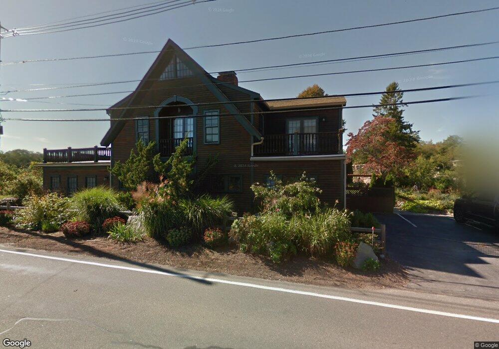
46 Granite St Unit D Rockport, MA 01966
Estimated Value: $666,054 - $894,000
1
Bed
2
Baths
977
Sq Ft
$816/Sq Ft
Est. Value
About This Home
This home is located at 46 Granite St Unit D, Rockport, MA 01966 and is currently estimated at $797,264, approximately $816 per square foot. 46 Granite St Unit D is a home located in Essex County with nearby schools including Rockport Elementary School, Rockport Middle School, and Rockport High School.
Ownership History
Date
Name
Owned For
Owner Type
Purchase Details
Closed on
Mar 26, 2024
Sold by
Fonseca Rena
Bought by
Fonseca Ret and Fonseca
Current Estimated Value
Purchase Details
Closed on
Sep 13, 2021
Sold by
Mordue John C and Mordue Virginia C
Bought by
Fornseca Rena
Home Financials for this Owner
Home Financials are based on the most recent Mortgage that was taken out on this home.
Original Mortgage
$225,000
Interest Rate
2.8%
Mortgage Type
Purchase Money Mortgage
Purchase Details
Closed on
Jul 13, 2017
Sold by
Keith C Stemp Ret and Stemp
Bought by
Mordue John C and Mordue Virginia C
Home Financials for this Owner
Home Financials are based on the most recent Mortgage that was taken out on this home.
Original Mortgage
$364,000
Interest Rate
3.94%
Mortgage Type
New Conventional
Purchase Details
Closed on
Feb 23, 2004
Sold by
Stemp Keith C
Bought by
Stemp Tr Keith C
Purchase Details
Closed on
Aug 15, 2003
Sold by
Poirot William K and Poirot Lois V
Bought by
Stemp Keith C
Create a Home Valuation Report for This Property
The Home Valuation Report is an in-depth analysis detailing your home's value as well as a comparison with similar homes in the area
Home Values in the Area
Average Home Value in this Area
Purchase History
| Date | Buyer | Sale Price | Title Company |
|---|---|---|---|
| Fonseca Ret | -- | None Available | |
| Fonseca Ret | -- | None Available | |
| Fornseca Rena | $655,000 | None Available | |
| Fornseca Rena | $655,000 | None Available | |
| Mordue John C | $455,000 | -- | |
| Mordue John C | $455,000 | -- | |
| Stemp Tr Keith C | -- | -- | |
| Stemp Tr Keith C | -- | -- | |
| Stemp Keith C | $388,500 | -- | |
| Stemp Keith C | $388,500 | -- |
Source: Public Records
Mortgage History
| Date | Status | Borrower | Loan Amount |
|---|---|---|---|
| Previous Owner | Fornseca Rena | $225,000 | |
| Previous Owner | Mordue John C | $364,000 |
Source: Public Records
Tax History Compared to Growth
Tax History
| Year | Tax Paid | Tax Assessment Tax Assessment Total Assessment is a certain percentage of the fair market value that is determined by local assessors to be the total taxable value of land and additions on the property. | Land | Improvement |
|---|---|---|---|---|
| 2025 | $5,606 | $639,900 | $0 | $639,900 |
| 2024 | $5,227 | $620,800 | $0 | $620,800 |
| 2023 | $5,585 | $592,300 | $0 | $592,300 |
| 2022 | $5,847 | $595,400 | $0 | $595,400 |
| 2021 | $4,029 | $413,700 | $0 | $413,700 |
| 2020 | $3,658 | $362,200 | $0 | $362,200 |
| 2019 | $3,897 | $395,200 | $0 | $395,200 |
| 2018 | $3,056 | $302,300 | $0 | $302,300 |
| 2017 | $3,977 | $352,600 | $0 | $352,600 |
| 2016 | $3,137 | $278,800 | $0 | $278,800 |
| 2015 | $3,311 | $301,000 | $0 | $301,000 |
| 2014 | $3,002 | $266,400 | $0 | $266,400 |
Source: Public Records
Map
Nearby Homes
- 2 Wharf Rd
- 2 Boulder Top
- 13 Rowe Point
- 26 Quarry Ridge Ln
- 1 Doctors Run
- 165 Granite St
- 63R Main St Unit 2
- 73-77 Main St
- 25 Stockholm Ave
- 36 Broadway Ave
- 123 Main St Unit 2
- 2 Mount Pleasant St Unit 3
- 15 High St Unit D
- 135 A&B Main St
- 13 Phillips Ave
- 4 Norwood Ave
- 5 Marshall Ln
- 5 Allen Ave
- 13 Pleasant St Unit 3
- 57 Mt Pleasant St Unit 2B
- 46 Granite St Unit E
- 46 Granite St Unit D
- 46 Granite St Unit C
- 46 Granite St Unit B
- 46 Granite St Unit A
- 46 Granite St Unit 5
- 46 Granite St Unit 2
- 46 Granite St Unit 1
- 46 Granite St
- 48 Granite St
- 85 Granite St Unit 4
- 85 Granite St
- 85 Granite St Unit 1
- 83 Granite St
- 87 Granite St
- 4 Wharf Rd
- 0 Rowe Ave
- 93A Granite St Unit WINTER
- 93A Granite St Unit a
- 93A Granite St Unit WINTER