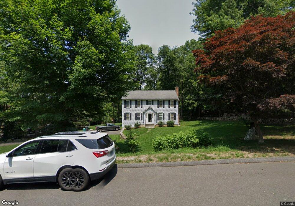
46 N Benham Rd Seymour, CT 06483
Estimated Value: $561,000 - $656,000
4
Beds
3
Baths
2,096
Sq Ft
$285/Sq Ft
Est. Value
About This Home
This home is located at 46 N Benham Rd, Seymour, CT 06483 and is currently estimated at $597,010, approximately $284 per square foot. 46 N Benham Rd is a home located in New Haven County with nearby schools including Bungay Elementary School, Seymour Middle School, and Seymour High School.
Ownership History
Date
Name
Owned For
Owner Type
Purchase Details
Closed on
Oct 15, 1997
Sold by
Scuteri Michael A and Scuteri Diane
Bought by
Groves Sharon M and Brezina David M
Current Estimated Value
Home Financials for this Owner
Home Financials are based on the most recent Mortgage that was taken out on this home.
Original Mortgage
$169,600
Interest Rate
7.46%
Mortgage Type
Unknown
Purchase Details
Closed on
May 1, 1997
Sold by
Johnson Douglas A and Johnson Joyce T
Bought by
Scuteri Michael A and Scuteri Diane
Create a Home Valuation Report for This Property
The Home Valuation Report is an in-depth analysis detailing your home's value as well as a comparison with similar homes in the area
Home Values in the Area
Average Home Value in this Area
Purchase History
| Date | Buyer | Sale Price | Title Company |
|---|---|---|---|
| Groves Sharon M | $212,000 | -- | |
| Scuteri Michael A | $63,000 | -- |
Source: Public Records
Mortgage History
| Date | Status | Borrower | Loan Amount |
|---|---|---|---|
| Open | Scuteri Michael A | $250,000 | |
| Closed | Scuteri Michael A | $250,000 | |
| Closed | Scuteri Michael A | $108,000 | |
| Closed | Scuteri Michael A | $169,600 |
Source: Public Records
Tax History Compared to Growth
Tax History
| Year | Tax Paid | Tax Assessment Tax Assessment Total Assessment is a certain percentage of the fair market value that is determined by local assessors to be the total taxable value of land and additions on the property. | Land | Improvement |
|---|---|---|---|---|
| 2025 | $9,291 | $335,160 | $63,280 | $271,880 |
| 2024 | $8,115 | $220,290 | $63,770 | $156,520 |
| 2023 | $7,926 | $220,290 | $63,770 | $156,520 |
| 2022 | $7,840 | $220,290 | $63,770 | $156,520 |
| 2021 | $7,646 | $220,290 | $63,770 | $156,520 |
| 2020 | $7,429 | $206,360 | $74,760 | $131,600 |
| 2019 | $7,429 | $206,360 | $74,760 | $131,600 |
| 2018 | $7,429 | $206,360 | $74,760 | $131,600 |
| 2017 | $7,429 | $206,360 | $74,760 | $131,600 |
| 2016 | $7,429 | $206,360 | $74,760 | $131,600 |
| 2015 | $7,479 | $216,230 | $81,480 | $134,750 |
| 2014 | $7,360 | $216,230 | $81,480 | $134,750 |
Source: Public Records
Map
Nearby Homes
- 14 Spruce Brook Rd
- 95 Squantuck Rd
- 113 Squantuck Rd
- 181 Great Hill Rd
- 256 Roosevelt Dr
- 17 Shari Dr
- 12 Deerfield Dr
- 21 Glen Cir
- 56 Great Hill Rd
- 19 Davis Rd
- 154 S Benham Rd
- 452 Roosevelt Dr
- 25 Davis Rd
- 23 Davis Rd
- 29 Great Hill Rd
- 88 Brookfield Rd
- 109 Davis Rd
- 80 Birchbank Rd
- 73 Botsford Rd
- 190 Thoreau Dr
- 44 N Benham Rd
- 50 N Benham Rd
- 47 N Benham Rd
- 42 N Benham Rd
- 51 N Benham Rd
- 45 N Benham Rd
- 43 N Benham Rd
- 41 N Benham Rd
- 38 N Benham Rd
- 57 N Benham Rd
- 39 N Benham Rd
- 109 Tomlinson Rd
- 61 N Benham Rd
- 36 N Benham Rd
- 58 N Benham Rd
- 107 Tomlinson Rd
- 32 N Benham Rd
- 54 N Benham Rd
- 97 Tomlinson Rd
- 103 Tomlinson Rd