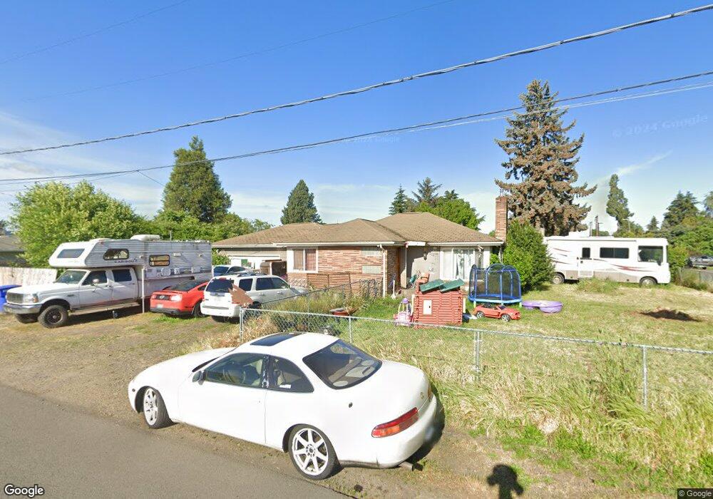
460 Rutledge St Eugene, OR 97402
Bethel NeighborhoodEstimated Value: $348,000 - $373,517
3
Beds
2
Baths
1,234
Sq Ft
$292/Sq Ft
Est. Value
About This Home
This home is located at 460 Rutledge St, Eugene, OR 97402 and is currently estimated at $359,879, approximately $291 per square foot. 460 Rutledge St is a home located in Lane County with nearby schools including Danebo Elementary School, Shasta Middle School, and Willamette High School.
Ownership History
Date
Name
Owned For
Owner Type
Purchase Details
Closed on
Feb 21, 2013
Sold by
Federal Home Loan Mortgage Corporation
Bought by
Allard Jeffrey
Current Estimated Value
Home Financials for this Owner
Home Financials are based on the most recent Mortgage that was taken out on this home.
Original Mortgage
$122,735
Outstanding Balance
$85,338
Interest Rate
3.37%
Mortgage Type
FHA
Estimated Equity
$274,541
Purchase Details
Closed on
Jul 25, 2012
Sold by
Gmac Mortgage Llc
Bought by
Federal Home Loan Mortgage Corporation
Purchase Details
Closed on
Jun 29, 2012
Sold by
Felix Leobardo I and Nielsen Tamara L
Bought by
Gmac Mortgage Llc
Create a Home Valuation Report for This Property
The Home Valuation Report is an in-depth analysis detailing your home's value as well as a comparison with similar homes in the area
Home Values in the Area
Average Home Value in this Area
Purchase History
| Date | Buyer | Sale Price | Title Company |
|---|---|---|---|
| Allard Jeffrey | $125,000 | Evergreen Land Title Company | |
| Federal Home Loan Mortgage Corporation | $90,220 | First American Title | |
| Gmac Mortgage Llc | $90,220 | First American Title |
Source: Public Records
Mortgage History
| Date | Status | Borrower | Loan Amount |
|---|---|---|---|
| Open | Allard Jeffrey | $122,735 |
Source: Public Records
Tax History
| Year | Tax Paid | Tax Assessment Tax Assessment Total Assessment is a certain percentage of the fair market value that is determined by local assessors to be the total taxable value of land and additions on the property. | Land | Improvement |
|---|---|---|---|---|
| 2025 | $2,928 | $168,331 | -- | -- |
| 2024 | $2,854 | $163,429 | -- | -- |
| 2023 | $2,854 | $158,669 | $0 | $0 |
| 2022 | $2,657 | $154,048 | $0 | $0 |
| 2021 | $2,601 | $149,562 | $0 | $0 |
| 2020 | $2,525 | $145,206 | $0 | $0 |
| 2019 | $2,401 | $140,977 | $0 | $0 |
| 2018 | $2,334 | $132,884 | $0 | $0 |
| 2017 | $2,230 | $132,884 | $0 | $0 |
| 2016 | $2,174 | $129,014 | $0 | $0 |
| 2015 | $2,131 | $125,256 | $0 | $0 |
| 2014 | $2,098 | $121,608 | $0 | $0 |
Source: Public Records
Map
Nearby Homes
- 4041 Bell Ave
- 4165 Wood Ave
- 795 Red Cedar Ct
- 647 Ellsworth St
- 4285 Fergus Ave
- 4055 Royal Ave Unit 93
- 4055 Royal Ave Unit 22
- 4055 Royal Ave Unit 150
- 4055 Royal Ave Unit 69
- 4055 Royal Ave Unit 87
- 3939 Cross St
- 4467 Fergus Ave
- 4462 Fergus Ave
- 3970 Marshall Ave
- 338 Archie St
- 201 Lacasa St
- 1153 Elizabeth St
- 870 Laurelhurst Dr
- 3520 Elmira Rd
- 280 Baxter St
Your Personal Tour Guide
Ask me questions while you tour the home.