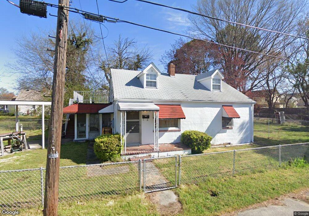
460 Thornette St Hampton, VA 23669
Westhampton NeighborhoodEstimated Value: $176,000 - $249,000
2
Beds
1
Bath
1,313
Sq Ft
$161/Sq Ft
Est. Value
About This Home
This home is located at 460 Thornette St, Hampton, VA 23669 and is currently estimated at $211,992, approximately $161 per square foot. 460 Thornette St is a home located in Hampton City with nearby schools including Bassette Elementary School, C. Alton Lindsay Middle School, and Phoebus High School.
Ownership History
Date
Name
Owned For
Owner Type
Purchase Details
Closed on
Aug 12, 2014
Sold by
George Exr Thyrane R
Bought by
Glassburn Scott A
Current Estimated Value
Home Financials for this Owner
Home Financials are based on the most recent Mortgage that was taken out on this home.
Original Mortgage
$42,000
Outstanding Balance
$31,625
Interest Rate
4.09%
Mortgage Type
New Conventional
Estimated Equity
$180,368
Create a Home Valuation Report for This Property
The Home Valuation Report is an in-depth analysis detailing your home's value as well as a comparison with similar homes in the area
Home Values in the Area
Average Home Value in this Area
Purchase History
| Date | Buyer | Sale Price | Title Company |
|---|---|---|---|
| Glassburn Scott A | $53,000 | -- |
Source: Public Records
Mortgage History
| Date | Status | Borrower | Loan Amount |
|---|---|---|---|
| Open | Glassburn Scott A | $42,000 |
Source: Public Records
Tax History
| Year | Tax Paid | Tax Assessment Tax Assessment Total Assessment is a certain percentage of the fair market value that is determined by local assessors to be the total taxable value of land and additions on the property. | Land | Improvement |
|---|---|---|---|---|
| 2025 | $1,769 | $154,700 | $36,000 | $118,700 |
| 2024 | $1,479 | $128,600 | $36,000 | $92,600 |
| 2023 | $1,437 | $123,900 | $36,000 | $87,900 |
| 2022 | $1,361 | $115,300 | $32,100 | $83,200 |
| 2021 | $1,405 | $102,800 | $27,600 | $75,200 |
| 2020 | $1,230 | $99,200 | $27,600 | $71,600 |
| 2019 | $1,146 | $92,400 | $27,600 | $64,800 |
| 2018 | $1,196 | $88,900 | $27,600 | $61,300 |
| 2017 | $1,196 | $0 | $0 | $0 |
| 2016 | $1,196 | $88,900 | $0 | $0 |
| 2015 | $1,196 | $0 | $0 | $0 |
| 2014 | $1,233 | $92,700 | $27,600 | $65,100 |
Source: Public Records
Map
Nearby Homes
- 430 Newport News Ave
- 429 Lee St
- 521 Lee St
- 406 Lee St
- 3912 Victoria Blvd
- 416 Worster Ave
- 241 Newport News Ave
- 410 Worster Ave
- 381 W Queen St
- 363 W Queen St
- 373 W Queen St
- 39 W Sunset Rd
- 622 Chapel St
- 3818 Shell Rd
- 19 Maplewood St
- 217 S Armistead Ave
- 28 Maplewood St
- 44 Henry St
- 144 Meredith St
- 163 Columbia Ave
- 449 Newport News Ave
- 451 Newport News Ave
- 351 S Back River Rd
- 447 Newport News Ave
- 445 Newport News Ave
- 453 Newport News Ave
- 443 Newport News Ave
- 450 Thornette St
- 501 Newport News Ave
- 441 Newport News Ave
- 448 Thornette St
- 503 Newport News Ave
- 450 Newport News Ave
- 452 Newport News Ave
- 448 Newport News Ave
- 446 Newport News Ave
- 456 Newport News Ave
- 435 Newport News Ave
- 444 Newport News Ave
- 444 Newport News Ave Unit 4
Your Personal Tour Guide
Ask me questions while you tour the home.