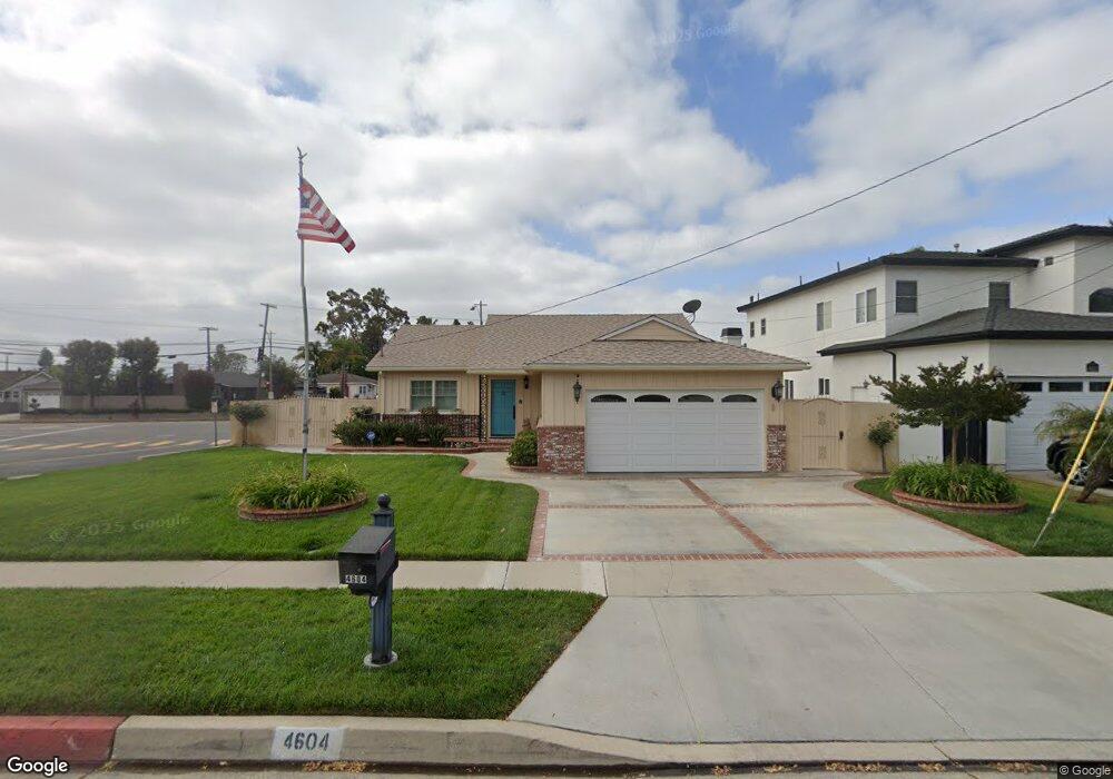
4604 Macafee Rd Torrance, CA 90505
Seaside NeighborhoodEstimated Value: $1,160,077 - $1,342,000
3
Beds
2
Baths
1,152
Sq Ft
$1,111/Sq Ft
Est. Value
About This Home
This home is located at 4604 Macafee Rd, Torrance, CA 90505 and is currently estimated at $1,280,019, approximately $1,111 per square foot. 4604 Macafee Rd is a home located in Los Angeles County with nearby schools including Seaside Elementary School, Calle Mayor Middle School, and South High School.
Ownership History
Date
Name
Owned For
Owner Type
Purchase Details
Closed on
Jul 30, 2017
Sold by
Vaccarezza Stephen E
Bought by
Vaccarezza Stephen E and The Stephen E Vaccarezza Livin
Current Estimated Value
Purchase Details
Closed on
Mar 4, 2005
Sold by
Vaccarezza Mayrina
Bought by
Vaccarezza Stephen E
Purchase Details
Closed on
Nov 1, 2001
Sold by
Wiser Harry M and Wiser Helene C
Bought by
Vaccarezza Lawrence and Vaccarezza Mayrina P
Home Financials for this Owner
Home Financials are based on the most recent Mortgage that was taken out on this home.
Original Mortgage
$240,000
Interest Rate
6.57%
Create a Home Valuation Report for This Property
The Home Valuation Report is an in-depth analysis detailing your home's value as well as a comparison with similar homes in the area
Home Values in the Area
Average Home Value in this Area
Purchase History
| Date | Buyer | Sale Price | Title Company |
|---|---|---|---|
| Vaccarezza Stephen E | -- | None Available | |
| Vaccarezza Stephen E | -- | -- | |
| Vaccarezza Lawrence | $360,000 | Chicago Title Co |
Source: Public Records
Mortgage History
| Date | Status | Borrower | Loan Amount |
|---|---|---|---|
| Previous Owner | Vaccarezza Lawrence | $240,000 |
Source: Public Records
Tax History
| Year | Tax Paid | Tax Assessment Tax Assessment Total Assessment is a certain percentage of the fair market value that is determined by local assessors to be the total taxable value of land and additions on the property. | Land | Improvement |
|---|---|---|---|---|
| 2025 | $6,111 | $531,805 | $425,451 | $106,354 |
| 2024 | $6,111 | $521,378 | $417,109 | $104,269 |
| 2023 | $5,999 | $511,156 | $408,931 | $102,225 |
| 2022 | $5,918 | $501,134 | $400,913 | $100,221 |
| 2021 | $5,809 | $491,308 | $393,052 | $98,256 |
| 2019 | $5,640 | $476,738 | $381,395 | $95,343 |
| 2018 | $5,441 | $467,391 | $373,917 | $93,474 |
| 2016 | $5,198 | $449,245 | $359,399 | $89,846 |
| 2015 | $5,084 | $442,498 | $354,001 | $88,497 |
| 2014 | $4,955 | $433,831 | $347,067 | $86,764 |
Source: Public Records
Map
Nearby Homes
- 4817 Macafee Rd
- 5013 Macafee Rd
- 23333 Anza Ave
- 22631 Kathryn Ave
- 4922 Reynolds Rd
- 23505 Ladeene Ave
- 23108 Los Codona Ave
- 3822 Jason Cir
- 4509 Vista Largo
- 425 Via el Chico
- 22508 Shadycroft Ave
- 523 Avenue G
- 4321 Paseo de Las Tortugas
- 5519 Calle de Ricardo
- 1041 Avenue D
- 23930 Los Codona Ave Unit 220
- 5407 Via Del Valle
- 4926 Jacques St
- 3649 Navajo Place
- 121 Via Ardilla
- 4612 Macafee Rd
- 4702 Macafee Rd
- 23126 Carlow Rd
- 4706 Macafee Rd
- 4607 Macafee Rd
- 4603 Macafee Rd
- 4619 Mayor Dr
- 4611 Macafee Rd
- 23122 Carlow Rd
- 4602 Mayor Dr
- 4701 Macafee Rd
- 4714 Macafee Rd
- 23118 Carlow Rd
- 4631 Mayor Dr
- 4705 Macafee Rd
- 4608 Mayor Dr
- 4525 Calle Mayor
- 4502 Calle Mayor
- 4718 Macafee Rd
- 23114 Carlow Rd
Your Personal Tour Guide
Ask me questions while you tour the home.