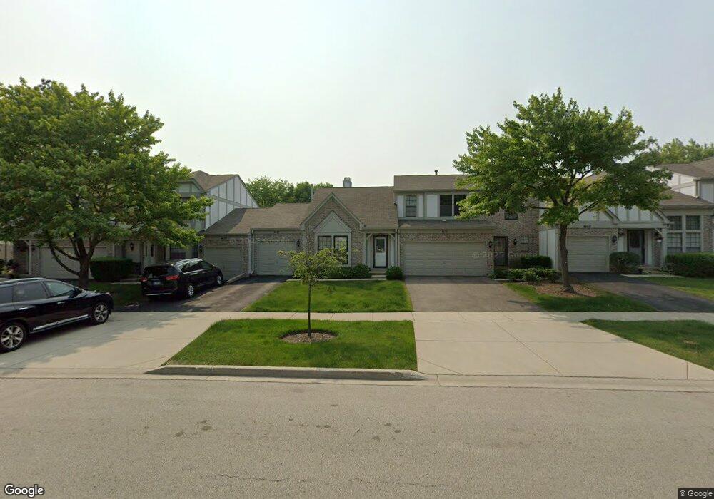
4607 Olmstead Dr Hoffman Estates, IL 60192
South Ridge NeighborhoodEstimated Value: $242,000 - $323,000
2
Beds
2
Baths
1,314
Sq Ft
$222/Sq Ft
Est. Value
About This Home
This home is located at 4607 Olmstead Dr, Hoffman Estates, IL 60192 and is currently estimated at $291,979, approximately $222 per square foot. 4607 Olmstead Dr is a home located in Cook County with nearby schools including Thomas Jefferson Elementary School, Frank C. Whiteley Elementary School, and William Fremd High School.
Ownership History
Date
Name
Owned For
Owner Type
Purchase Details
Closed on
Sep 26, 1997
Sold by
Pirsch David M and Pirsch Susan
Bought by
Salamone Joanne
Current Estimated Value
Home Financials for this Owner
Home Financials are based on the most recent Mortgage that was taken out on this home.
Original Mortgage
$80,000
Outstanding Balance
$10,986
Interest Rate
7.51%
Estimated Equity
$280,993
Create a Home Valuation Report for This Property
The Home Valuation Report is an in-depth analysis detailing your home's value as well as a comparison with similar homes in the area
Home Values in the Area
Average Home Value in this Area
Purchase History
| Date | Buyer | Sale Price | Title Company |
|---|---|---|---|
| Salamone Joanne | $75,333 | -- |
Source: Public Records
Mortgage History
| Date | Status | Borrower | Loan Amount |
|---|---|---|---|
| Open | Salamone Joanne | $80,000 |
Source: Public Records
Tax History
| Year | Tax Paid | Tax Assessment Tax Assessment Total Assessment is a certain percentage of the fair market value that is determined by local assessors to be the total taxable value of land and additions on the property. | Land | Improvement |
|---|---|---|---|---|
| 2025 | $5,059 | $25,000 | $4,176 | $20,824 |
| 2024 | $5,059 | $22,470 | $5,001 | $17,469 |
| 2023 | $4,834 | $22,470 | $5,001 | $17,469 |
| 2022 | $4,834 | $22,470 | $5,001 | $17,469 |
| 2021 | $4,768 | $20,232 | $1,631 | $18,601 |
| 2020 | $4,797 | $20,232 | $1,631 | $18,601 |
| 2019 | $5,554 | $22,431 | $1,631 | $20,800 |
| 2018 | $5,111 | $19,568 | $1,500 | $18,068 |
| 2017 | $5,034 | $19,568 | $1,500 | $18,068 |
| 2016 | $4,926 | $19,568 | $1,500 | $18,068 |
| 2015 | $4,451 | $16,944 | $1,370 | $15,574 |
| 2014 | $4,384 | $16,944 | $1,370 | $15,574 |
| 2013 | $4,255 | $16,944 | $1,370 | $15,574 |
Source: Public Records
Map
Nearby Homes
- 4620 Olmstead Dr
- 1404 W Sapphire Dr
- 1210 Downing Dr
- 1280 Clover Ln
- 4475 Olmstead Dr
- 4480 Thornbark Dr
- 1281 Old Timber Ct
- 4791 Amber Cir
- 4485 Bayside Cir
- 1690 Cape Breton Ct
- 4175 Victoria Dr
- 940 Freeman Rd
- 775 Summer Isle Ln
- 4075 N Parkside Dr
- 3881 Bordeaux Dr
- 61 E Rd
- 61 E Rd
- 61 E Palatine #4 Rd
- 10 Carnoustie Ln
- 61 E Palatine Rd
- 4605 Olmstead Dr
- 4605 Olmstead Dr
- 4609 Olmstead Dr Unit 1
- 4603 Olmstead Dr
- 4611 Olmstead Dr
- 4584 Topaz Dr
- 4586 Topaz Dr
- 4582 Topaz Dr
- 4601 Olmstead Dr
- 4588 Topaz Dr
- 4580 Topaz Dr Unit 1
- 4590 Topaz Dr
- 4626 Mumford Dr
- 4570 Topaz Dr
- 4591 Olmstead Dr
- 4622 Mumford Dr
- 4568 Topaz Dr
- 4608 Olmstead Dr Unit 2
- 4598 Olmstead Dr
- 4620 Mumford Dr Unit 1
Your Personal Tour Guide
Ask me questions while you tour the home.