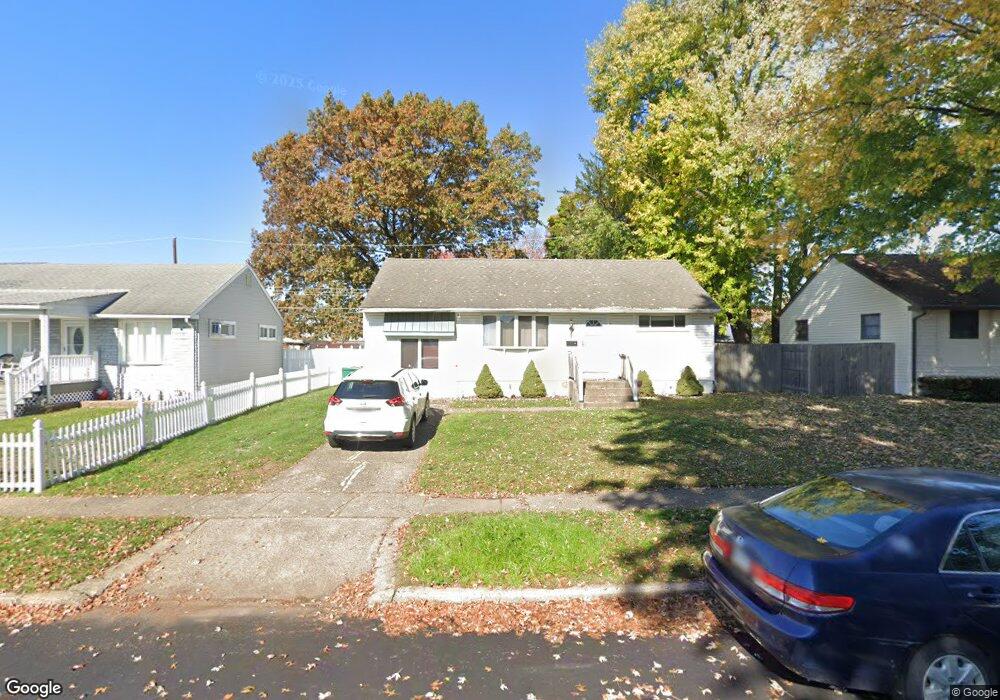
4611 Brookside Ave Bristol, PA 19007
Estimated Value: $306,000 - $346,000
3
Beds
1
Bath
1,386
Sq Ft
$241/Sq Ft
Est. Value
About This Home
This home is located at 4611 Brookside Ave, Bristol, PA 19007 and is currently estimated at $333,951, approximately $240 per square foot. 4611 Brookside Ave is a home located in Bucks County with nearby schools including Truman Senior High School, Hope Lutheran School, and St. Mark Elementary School.
Ownership History
Date
Name
Owned For
Owner Type
Purchase Details
Closed on
Jun 3, 2013
Sold by
Rivera Ivy and Davis Ivy L
Bought by
Rivera Ivy
Current Estimated Value
Purchase Details
Closed on
Aug 22, 2003
Sold by
Kim Chui
Bought by
Davis Ivy L
Home Financials for this Owner
Home Financials are based on the most recent Mortgage that was taken out on this home.
Original Mortgage
$108,800
Outstanding Balance
$49,996
Interest Rate
6.22%
Mortgage Type
Purchase Money Mortgage
Estimated Equity
$283,955
Create a Home Valuation Report for This Property
The Home Valuation Report is an in-depth analysis detailing your home's value as well as a comparison with similar homes in the area
Home Values in the Area
Average Home Value in this Area
Purchase History
| Date | Buyer | Sale Price | Title Company |
|---|---|---|---|
| Rivera Ivy | -- | None Available | |
| Davis Ivy L | $136,000 | Lawyers Title Insurance Co |
Source: Public Records
Mortgage History
| Date | Status | Borrower | Loan Amount |
|---|---|---|---|
| Open | Davis Ivy L | $108,800 | |
| Closed | Davis Ivy L | $20,400 |
Source: Public Records
Tax History Compared to Growth
Tax History
| Year | Tax Paid | Tax Assessment Tax Assessment Total Assessment is a certain percentage of the fair market value that is determined by local assessors to be the total taxable value of land and additions on the property. | Land | Improvement |
|---|---|---|---|---|
| 2025 | $3,911 | $14,400 | $4,240 | $10,160 |
| 2024 | $3,911 | $14,400 | $4,240 | $10,160 |
| 2023 | $3,882 | $14,400 | $4,240 | $10,160 |
| 2022 | $3,882 | $14,400 | $4,240 | $10,160 |
| 2021 | $3,882 | $14,400 | $4,240 | $10,160 |
| 2020 | $3,882 | $14,400 | $4,240 | $10,160 |
| 2019 | $3,867 | $14,400 | $4,240 | $10,160 |
| 2018 | $3,805 | $14,400 | $4,240 | $10,160 |
| 2017 | $3,747 | $14,400 | $4,240 | $10,160 |
| 2016 | $3,747 | $14,400 | $4,240 | $10,160 |
| 2015 | $2,632 | $14,400 | $4,240 | $10,160 |
| 2014 | $2,632 | $14,400 | $4,240 | $10,160 |
Source: Public Records
Map
Nearby Homes
- 150 Naomi Ct Unit 811
- 3021 Bath Rd
- 246 Colette Ct
- 145 Mill Dr
- 23 Misty Pine Rd
- 1515 Lakeland Ave
- 185 Delhaas Cir
- 183 Delhaas Cir
- 187 Delhaas Cir
- 189 Delhaas Cir
- 194 Delhaas Cir
- 186 Delhaas Cir
- 192 Delhaas Cir
- 190 Delhaas Cir
- 193 Delhaas Cir
- 184 Delhaas Cir
- 188 Delhaas Cir
- 191 Delhaas Cir
- 4510 Fayette Dr
- 206 Delhaas Cir
- 4613 Brookside Ave
- 4609 Brookside Ave
- 4612 Brookside Ave
- 4615 Brookside Ave
- 4614 Brookside Ave
- 2505 Winton Dr
- 4610 Brookside Ave
- 4616 Brookside Ave
- 2502 Green Ave
- 2507 Winton Dr
- 4618 Brookside Ave
- 2503 Winton Dr
- 4608 Brookside Ave
- 2501 Winton Dr
- 2504 Green Ave
- 4606 Brookside Ave
- 2506 Green Ave
- 2501 Green Ave
- 2500 Winton Dr
- 4700 Brookside Ave