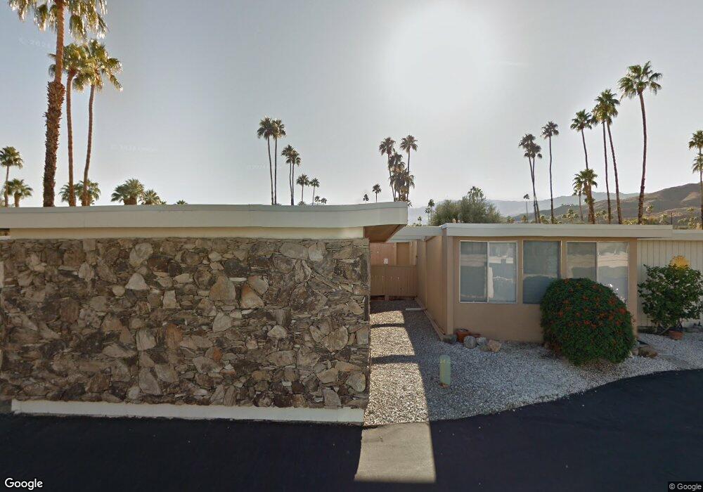
46131 State Highway 74 Palm Desert, CA 92260
Estimated Value: $415,000 - $561,270
2
Beds
2
Baths
1,898
Sq Ft
$260/Sq Ft
Est. Value
About This Home
This home is located at 46131 State Highway 74, Palm Desert, CA 92260 and is currently estimated at $493,818, approximately $260 per square foot. 46131 State Highway 74 is a home located in Riverside County with nearby schools including La Quinta Middle School, Palm Desert High School, and George Washington Charter School.
Ownership History
Date
Name
Owned For
Owner Type
Purchase Details
Closed on
Jun 24, 2020
Sold by
Da Fund 1 Llc
Bought by
Goros Mark and Vanherik Lisa Van
Current Estimated Value
Purchase Details
Closed on
Aug 1, 2019
Sold by
Dahi Gloria J
Bought by
Da Fund 1 Llc
Home Financials for this Owner
Home Financials are based on the most recent Mortgage that was taken out on this home.
Original Mortgage
$234,946
Interest Rate
3.8%
Mortgage Type
Commercial
Purchase Details
Closed on
Aug 1, 2006
Sold by
Dahl Gloria
Bought by
Dahl Gloria
Purchase Details
Closed on
Oct 4, 2005
Sold by
Dahl Gloria June
Bought by
Dahl Gloria J
Create a Home Valuation Report for This Property
The Home Valuation Report is an in-depth analysis detailing your home's value as well as a comparison with similar homes in the area
Home Values in the Area
Average Home Value in this Area
Purchase History
| Date | Buyer | Sale Price | Title Company |
|---|---|---|---|
| Goros Mark | $323,000 | Corinthian Title Company | |
| Da Fund 1 Llc | $190,000 | Equity Title Orange County | |
| Dahl Gloria | -- | None Available | |
| Dahl Gloria J | -- | None Available |
Source: Public Records
Mortgage History
| Date | Status | Borrower | Loan Amount |
|---|---|---|---|
| Previous Owner | Da Fund 1 Llc | $234,946 |
Source: Public Records
Tax History Compared to Growth
Tax History
| Year | Tax Paid | Tax Assessment Tax Assessment Total Assessment is a certain percentage of the fair market value that is determined by local assessors to be the total taxable value of land and additions on the property. | Land | Improvement |
|---|---|---|---|---|
| 2025 | $4,693 | $353,243 | $45,111 | $308,132 |
| 2023 | $4,693 | $339,528 | $43,360 | $296,168 |
| 2022 | $4,472 | $332,871 | $42,510 | $290,361 |
| 2021 | $4,369 | $326,345 | $41,677 | $284,668 |
| 2020 | $2,679 | $190,000 | $60,000 | $130,000 |
| 2019 | $2,852 | $204,260 | $68,694 | $135,566 |
| 2018 | $2,803 | $200,256 | $67,348 | $132,908 |
| 2017 | $2,751 | $196,330 | $66,028 | $130,302 |
| 2016 | $2,691 | $192,482 | $64,734 | $127,748 |
| 2015 | $2,699 | $189,592 | $63,762 | $125,830 |
| 2014 | $2,659 | $185,880 | $62,514 | $123,366 |
Source: Public Records
Map
Nearby Homes
- 46123 Highway 74
- 46173 Highway 74 Unit 5
- 46185 California 74 Unit 23
- 46183 Highway 74 Unit 20
- 46177 California 74 Unit 11
- 45990 Highway 74
- 72730 Yucca Ct
- 72690 Yucca Ct
- 46075 Verba Santa Dr
- 45817 California 74
- 331 Sandpiper St
- 333 Sandpiper St
- 132 Vista Monte
- 45760 Ocotillo Dr
- 72750 Citrus Ct
- 134 Vista Oro
- 45715 Verba Santa Dr
- 72610 Beavertail St
- 72629 Pitahaya St
- 72887 El Paseo Unit 601
- 46131 Highway 74 Unit 120
- 46131 California 74 Unit 120
- 46129 State Highway 74
- 46129 Highway 74
- 46129 Highway 74 Unit 121
- 46127 Highway 74
- 46127 Highway 74 Unit 122
- 46127 State Highway 74
- 46133 Highway 74 Unit 119
- 46133 Highway 74
- 46133 State Highway 74
- 46123 Highway 74 Unit 123
- 46123 State Highway 74
- 46123 State Highway 74
- 46123 California 74 Unit 123
- 46137 California 74 Unit 117
- 46137 California 74 Unit 117
- 46137 Highway 74
- 46137 Highway 74 Unit 117
- 46137 State Highway 74 Unit 117