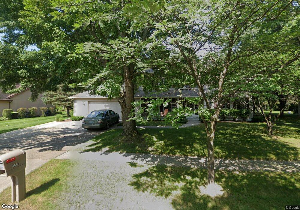
4617 Springbrook Ct Midland, MI 48642
Estimated Value: $330,000 - $451,000
4
Beds
3
Baths
2,771
Sq Ft
$145/Sq Ft
Est. Value
About This Home
This home is located at 4617 Springbrook Ct, Midland, MI 48642 and is currently estimated at $402,701, approximately $145 per square foot. 4617 Springbrook Ct is a home located in Midland County with nearby schools including Chestnut Hill School, Northeast Middle School, and Midland High School.
Ownership History
Date
Name
Owned For
Owner Type
Purchase Details
Closed on
Apr 26, 2024
Sold by
Michael Gerald Schafer and Michael Kiyomi Ann
Bought by
Kramer Charles Albert and Kramer Holly
Current Estimated Value
Home Financials for this Owner
Home Financials are based on the most recent Mortgage that was taken out on this home.
Original Mortgage
$306,000
Outstanding Balance
$301,594
Interest Rate
6.74%
Mortgage Type
New Conventional
Estimated Equity
$101,107
Create a Home Valuation Report for This Property
The Home Valuation Report is an in-depth analysis detailing your home's value as well as a comparison with similar homes in the area
Home Values in the Area
Average Home Value in this Area
Purchase History
| Date | Buyer | Sale Price | Title Company |
|---|---|---|---|
| Kramer Charles Albert | $360,000 | None Listed On Document | |
| Kramer Charles Albert | $360,000 | None Listed On Document |
Source: Public Records
Mortgage History
| Date | Status | Borrower | Loan Amount |
|---|---|---|---|
| Open | Kramer Charles Albert | $306,000 | |
| Closed | Kramer Charles Albert | $306,000 |
Source: Public Records
Tax History
| Year | Tax Paid | Tax Assessment Tax Assessment Total Assessment is a certain percentage of the fair market value that is determined by local assessors to be the total taxable value of land and additions on the property. | Land | Improvement |
|---|---|---|---|---|
| 2025 | $6,114 | $193,600 | $0 | $0 |
| 2024 | $4,754 | $179,000 | $0 | $0 |
| 2023 | $4,531 | $166,800 | $0 | $0 |
| 2022 | $5,561 | $134,900 | $0 | $0 |
| 2021 | $5,362 | $142,500 | $0 | $0 |
| 2020 | $5,417 | $142,000 | $0 | $0 |
| 2019 | $5,292 | $136,100 | $25,000 | $111,100 |
| 2018 | $5,125 | $157,600 | $25,000 | $132,600 |
| 2017 | $0 | $137,800 | $25,000 | $112,800 |
| 2016 | $5,486 | $136,100 | $25,000 | $111,100 |
| 2012 | -- | $131,800 | $25,000 | $106,800 |
Source: Public Records
Map
Nearby Homes
- 4621 Trotters Pointe Cir
- 2113 Belaire St
- 4616 Trotters Pointe Cir
- 1702 Plymouth St
- 4205 McKeith Rd
- 5214 Plainfield St
- 2817 Canterbury Dr
- 3713 Lawndale Dr
- 2203 Lambros Dr
- 4010 E Saint Andrews Rd
- 2709 Blairmont Dr
- 1519 Winchester Dr
- 3218 Fairlane St
- 3207 Greenway Dr
- 5631 Bloomfield Ct
- 1144 N Waldo Rd
- 1100 E Wheeler St
- 5705 Lantern Ln
- 3981 N Waldo Rd
- 5811 Diamond View E
- 4613 Springbrook Ct
- 4621 Springbrook Ct
- 4612 Lund Dr
- 4612 Springbrook Ct
- 4608 Lund Dr
- 4625 Springbrook Ct
- 4616 Springbrook Ct
- 4605 Springbrook Ct
- 4608 Springbrook Ct
- 4718 Blossom Cir
- 4614 Lund Dr
- 4604 Lund Dr
- 4714 Blossom Cir
- 4604 Springbrook Ct
- 4620 Springbrook Ct
- 4629 Springbrook Ct
- 4617 Lund Dr
- 4710 Blossom Cir
- 4624 Springbrook Ct
- 2309 Plymouth St
Your Personal Tour Guide
Ask me questions while you tour the home.