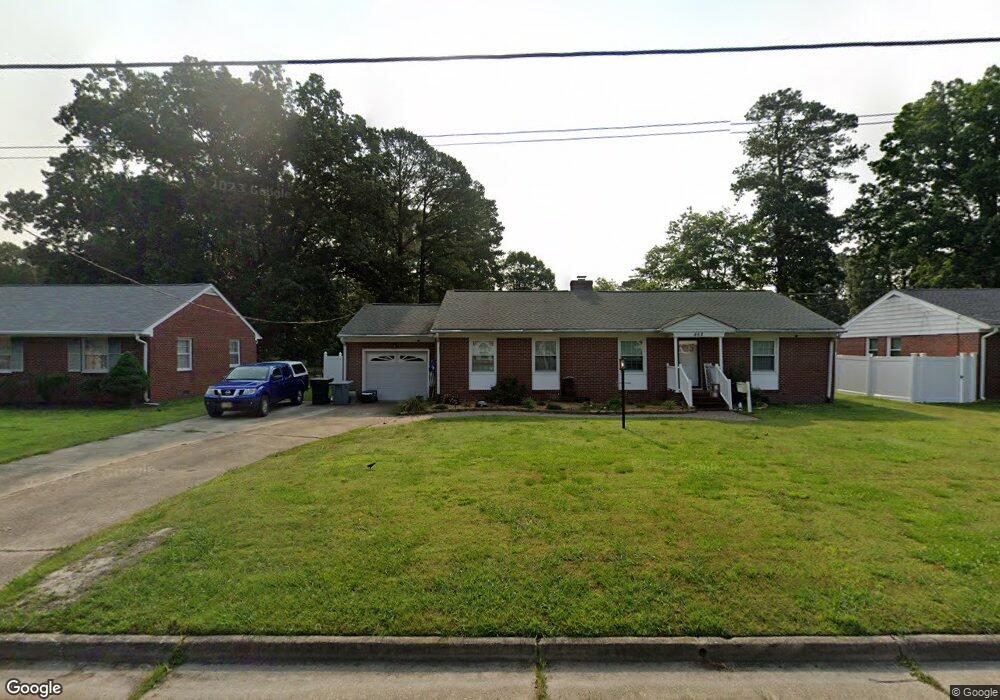
462 Strother Dr Hampton, VA 23666
Northampton NeighborhoodEstimated Value: $296,000 - $378,000
3
Beds
2
Baths
2,118
Sq Ft
$159/Sq Ft
Est. Value
About This Home
This home is located at 462 Strother Dr, Hampton, VA 23666 and is currently estimated at $336,101, approximately $158 per square foot. 462 Strother Dr is a home located in Hampton City with nearby schools including Forrest Elementary School, Cesar Tarrant Middle School, and Bethel High School.
Ownership History
Date
Name
Owned For
Owner Type
Purchase Details
Closed on
Oct 16, 2020
Sold by
Davis Doris D
Bought by
Taylor Derrek Michael
Current Estimated Value
Home Financials for this Owner
Home Financials are based on the most recent Mortgage that was taken out on this home.
Original Mortgage
$221,867
Outstanding Balance
$197,339
Interest Rate
2.9%
Mortgage Type
New Conventional
Estimated Equity
$138,762
Purchase Details
Closed on
May 20, 2002
Sold by
Girton Clayton R
Bought by
Davis Thomas L
Create a Home Valuation Report for This Property
The Home Valuation Report is an in-depth analysis detailing your home's value as well as a comparison with similar homes in the area
Home Values in the Area
Average Home Value in this Area
Purchase History
| Date | Buyer | Sale Price | Title Company |
|---|---|---|---|
| Taylor Derrek Michael | $185,500 | Attorney | |
| Davis Thomas L | $110,000 | -- |
Source: Public Records
Mortgage History
| Date | Status | Borrower | Loan Amount |
|---|---|---|---|
| Open | Taylor Derrek Michael | $221,867 |
Source: Public Records
Tax History
| Year | Tax Paid | Tax Assessment Tax Assessment Total Assessment is a certain percentage of the fair market value that is determined by local assessors to be the total taxable value of land and additions on the property. | Land | Improvement |
|---|---|---|---|---|
| 2025 | $3,789 | $336,400 | $65,000 | $271,400 |
| 2024 | $3,448 | $299,800 | $65,000 | $234,800 |
| 2023 | $3,191 | $275,100 | $60,000 | $215,100 |
| 2022 | $3,054 | $258,800 | $60,000 | $198,800 |
| 2021 | $2,937 | $226,400 | $50,000 | $176,400 |
| 2020 | $2,685 | $216,500 | $50,000 | $166,500 |
| 2019 | $2,621 | $211,400 | $50,000 | $161,400 |
| 2018 | $2,616 | $191,000 | $50,000 | $141,000 |
| 2017 | $2,462 | $0 | $0 | $0 |
| 2016 | $2,462 | $191,000 | $0 | $0 |
| 2015 | $2,615 | $0 | $0 | $0 |
| 2014 | $2,605 | $203,300 | $49,500 | $153,800 |
Source: Public Records
Map
Nearby Homes
- 454 Strother Dr
- 9 Omera Place
- 713 Big Bethel Rd
- 515 Big Bethel Rd
- 344 Brout Dr
- 512 Big Bethel Rd
- 46 Wellington Dr
- 66 Cline Dr
- 924 Old Big Bethel Rd
- 916 Old Big Bethel Rd
- 2 Bobs Ct
- 377 Kinsmen Way
- 4902 Hazelwood Rd
- 712 Macon Rd
- 25 Northampton Dr
- 8513 Orcutt Ave
- 54 Treasure Key
- 46 Emeraude Plage Unit A
- 504 Hollomon Dr
- 2907 Leta Ct
- 460 Strother Dr
- 464 Strother Dr
- 458 Strother Dr
- 6 Belmont Place
- 20 Roberta Dr
- 461 Strother Dr
- 22 Roberta Dr
- 463 Strother Dr
- 8 Belmont Place
- 459 Strother Dr
- 24 Roberta Dr
- 4 Belmont Place
- 456 Strother Dr
- 16 Roberta Dr
- 457 Strother Dr
- 26 Roberta Dr
- 14 Roberta Dr
- 455 Strother Dr
- 28 Roberta Dr
- 10 Belmont Place
Your Personal Tour Guide
Ask me questions while you tour the home.