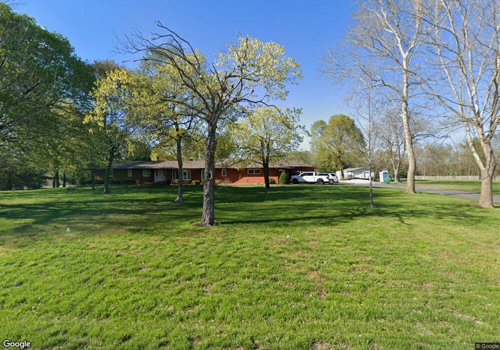
4621 E Farm Road 128 Springfield, MO 65802
Southeast Springfield NeighborhoodEstimated Value: $762,000 - $1,270,000
3
Beds
4
Baths
4,789
Sq Ft
$199/Sq Ft
Est. Value
About This Home
This home is located at 4621 E Farm Road 128, Springfield, MO 65802 and is currently estimated at $952,766, approximately $198 per square foot. 4621 E Farm Road 128 is a home located in Greene County with nearby schools including Hickory Hills K-8 School, Glendale High School, and Grace Classical Academy.
Ownership History
Date
Name
Owned For
Owner Type
Purchase Details
Closed on
Nov 15, 2019
Sold by
Sell Gary W and Sell Maribeth A
Bought by
Ross Andrew and Ross Emma
Current Estimated Value
Home Financials for this Owner
Home Financials are based on the most recent Mortgage that was taken out on this home.
Original Mortgage
$409,050
Outstanding Balance
$357,100
Interest Rate
3.65%
Mortgage Type
New Conventional
Estimated Equity
$595,666
Purchase Details
Closed on
Oct 10, 2017
Sold by
Ross Robert Sterling and Cardenas Ross Carolyn L
Bought by
Gill Jacob B and Jackson Sarah M
Create a Home Valuation Report for This Property
The Home Valuation Report is an in-depth analysis detailing your home's value as well as a comparison with similar homes in the area
Home Values in the Area
Average Home Value in this Area
Purchase History
| Date | Buyer | Sale Price | Title Company |
|---|---|---|---|
| Ross Andrew | -- | None Available | |
| Gill Jacob B | -- | None Available |
Source: Public Records
Mortgage History
| Date | Status | Borrower | Loan Amount |
|---|---|---|---|
| Open | Ross Andrew | $409,050 |
Source: Public Records
Tax History
| Year | Tax Paid | Tax Assessment Tax Assessment Total Assessment is a certain percentage of the fair market value that is determined by local assessors to be the total taxable value of land and additions on the property. | Land | Improvement |
|---|---|---|---|---|
| 2025 | $6,998 | $130,750 | $21,770 | $108,980 |
| 2024 | $3,956 | $70,050 | $17,800 | $52,250 |
| 2023 | $3,975 | $70,050 | $17,800 | $52,250 |
| 2022 | $3,770 | $64,600 | $17,800 | $46,800 |
| 2021 | $3,570 | $64,600 | $17,800 | $46,800 |
| 2020 | $1,840 | $31,690 | $10,660 | $21,030 |
| 2019 | $1,791 | $31,690 | $10,660 | $21,030 |
| 2018 | $1,802 | $31,860 | $10,660 | $21,200 |
| 2017 | $1,785 | $33,750 | $10,660 | $23,090 |
| 2016 | $1,890 | $33,750 | $10,660 | $23,090 |
| 2015 | $1,874 | $33,750 | $10,660 | $23,090 |
| 2014 | $1,845 | $32,970 | $10,660 | $22,310 |
Source: Public Records
Map
Nearby Homes
- 1100 N Farm Road 193
- 700 N Farm Road 193
- 4402 E Kanata Ct
- 817 N Grapevine Rd
- 1460 Glade Ave
- 4566 E Kentbrook Dr
- 4671 E Beaux Creek Ln
- 1527 N Edgemont Cir
- 1545 N Oakfair Place
- 4818 E Silverado Rd
- 1581 N Oakfair Place
- 4464 E Lancaster Way
- 4835 E Silverado Rd
- 4035 E Brookdale Terrace
- 1653 N Oakfair Place
- 4156 E Division St
- 1630 N Waterstone Ave
- Lot 23 N Mumford Ct
- 4584 E Hidden Oak St
- Lot 24 N Mumford Ct
- 949 N Farm Road 193
- 809 N Farm Road 193
- 4594 E Fox Run Dr
- 4657 E Farm Road 128
- 4588 E Fox Run Dr
- 4595 E Fox Run Dr
- 790 N Farm Road 193
- 4589 E Fox Run Dr
- 4582 E Fox Run Dr
- 4640 E Farm Road 128
- 4650 E Deer Valley Ln
- 4583 E Fox Run Dr
- 4576 E Fox Run Dr
- 884 N Pearson Ct
- 878 N Pearson Ct
- 4711 E Farm Road 128
- 4577 E Fox Run Dr
- 4570 E Fox Run Dr
- 879 N Pearson Ct
- 4672 E Farm Road 128
Your Personal Tour Guide
Ask me questions while you tour the home.