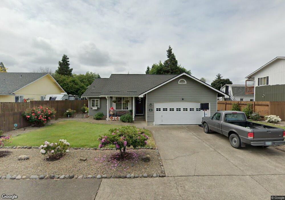
4622 Harriett St Eugene, OR 97402
Bethel NeighborhoodEstimated Value: $379,926 - $435,000
3
Beds
2
Baths
1,231
Sq Ft
$333/Sq Ft
Est. Value
About This Home
This home is located at 4622 Harriett St, Eugene, OR 97402 and is currently estimated at $409,482, approximately $332 per square foot. 4622 Harriett St is a home located in Lane County with nearby schools including Danebo Elementary School, Shasta Middle School, and Willamette High School.
Ownership History
Date
Name
Owned For
Owner Type
Purchase Details
Closed on
Sep 24, 1999
Sold by
Hartung Christopher W
Bought by
Emmons Elva K and Emmons Mitchell A
Current Estimated Value
Home Financials for this Owner
Home Financials are based on the most recent Mortgage that was taken out on this home.
Original Mortgage
$121,200
Outstanding Balance
$35,700
Interest Rate
7.97%
Estimated Equity
$373,782
Create a Home Valuation Report for This Property
The Home Valuation Report is an in-depth analysis detailing your home's value as well as a comparison with similar homes in the area
Home Values in the Area
Average Home Value in this Area
Purchase History
| Date | Buyer | Sale Price | Title Company |
|---|---|---|---|
| Emmons Elva K | $124,950 | Western Pioneer Title |
Source: Public Records
Mortgage History
| Date | Status | Borrower | Loan Amount |
|---|---|---|---|
| Open | Emmons Elva K | $121,200 |
Source: Public Records
Tax History
| Year | Tax Paid | Tax Assessment Tax Assessment Total Assessment is a certain percentage of the fair market value that is determined by local assessors to be the total taxable value of land and additions on the property. | Land | Improvement |
|---|---|---|---|---|
| 2025 | $3,373 | $193,934 | -- | -- |
| 2024 | $3,288 | $188,286 | -- | -- |
| 2023 | $3,288 | $182,802 | -- | -- |
| 2022 | $3,061 | $177,478 | $0 | $0 |
| 2021 | $2,996 | $172,309 | $0 | $0 |
| 2020 | $2,909 | $167,291 | $0 | $0 |
| 2019 | $2,766 | $162,419 | $0 | $0 |
| 2018 | $2,689 | $153,096 | $0 | $0 |
| 2017 | $2,570 | $153,096 | $0 | $0 |
| 2016 | $2,504 | $148,637 | $0 | $0 |
| 2015 | $2,455 | $144,308 | $0 | $0 |
| 2014 | $2,417 | $140,105 | $0 | $0 |
Source: Public Records
Map
Nearby Homes
- 870 Laurelhurst Dr
- 4548 Cambon St
- 4749 Royal Ave
- 1153 Elizabeth St
- 1145 Ludgate Dr
- 4554 Woodsboro St
- 1562 Philip St
- 1159 Throne Dr
- 4941 Stagecoach Rd
- 4280 Avalon St
- 1199 N Terry St
- 1199 N Terry St Unit 248
- 1199 N Terry St Unit 259
- 1199 N Terry St Unit 139
- 1199 N Terry St Unit 258
- 1199 N Terry St Unit SP113
- 1199 N Terry St Unit 309
- 1199 N Terry St Unit SP282
- 1199 N Terry St Unit 128
- 1199 N Terry St Unit 366
- 4610 Harriett St
- 4634 Harriett St
- 966 Laurelhurst Dr
- 1037 Williams St
- 4646 Harriett St
- 990 Laurelhurst Dr
- 970 Laurelhurst Dr
- 1033 Williams St
- 960 Laurelhurst Dr
- 1001 Williams St
- 1045 Williams St
- 950 Laurelhurst Dr
- 1029 Williams St
- 940 Laurelhurst Dr
- 999 Laurelhurst Dr
- 989 Laurelhurst Dr
- 1030 Williams St
- 1040 Williams St
- 979 Laurelhurst Dr
Your Personal Tour Guide
Ask me questions while you tour the home.