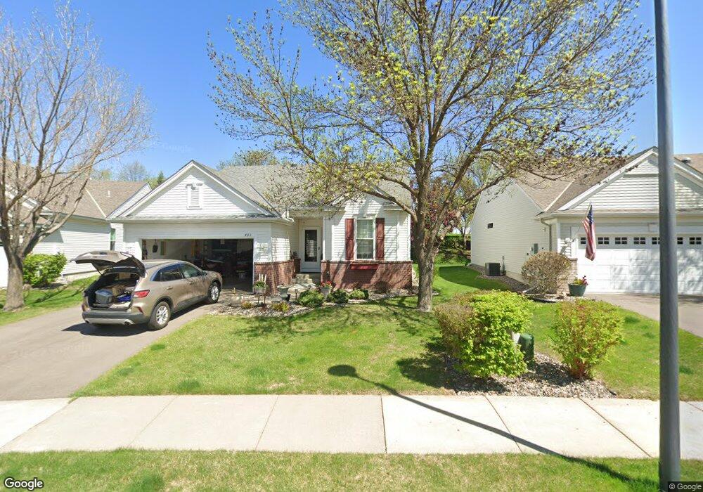
463 Campfire Curve Chaska, MN 55318
Estimated Value: $404,000 - $481,000
3
Beds
3
Baths
1,329
Sq Ft
$325/Sq Ft
Est. Value
About This Home
This home is located at 463 Campfire Curve, Chaska, MN 55318 and is currently estimated at $431,473, approximately $324 per square foot. 463 Campfire Curve is a home located in Carver County with nearby schools including Jonathan Elementary School, Chaska Middle School East, and Chaska High School.
Ownership History
Date
Name
Owned For
Owner Type
Purchase Details
Closed on
Jul 17, 2015
Sold by
Spaulding David W and Spaulding Cheryl M
Bought by
Spaulding Cheryl M
Current Estimated Value
Purchase Details
Closed on
Apr 3, 2006
Sold by
Bemmels Patricia S and Bemmels Wade A
Bought by
Spaulding David W and Spaulding Cheryl M
Purchase Details
Closed on
Aug 29, 2002
Sold by
Pulte Homes Of Minnesota Corp
Bought by
Bemmels Patricia S and Bemmels Wade A
Create a Home Valuation Report for This Property
The Home Valuation Report is an in-depth analysis detailing your home's value as well as a comparison with similar homes in the area
Home Values in the Area
Average Home Value in this Area
Purchase History
| Date | Buyer | Sale Price | Title Company |
|---|---|---|---|
| Spaulding Cheryl M | -- | Attorney | |
| Spaulding David W | $291,500 | -- | |
| Bemmels Patricia S | $204,965 | -- |
Source: Public Records
Tax History Compared to Growth
Tax History
| Year | Tax Paid | Tax Assessment Tax Assessment Total Assessment is a certain percentage of the fair market value that is determined by local assessors to be the total taxable value of land and additions on the property. | Land | Improvement |
|---|---|---|---|---|
| 2025 | $4,458 | $387,900 | $75,000 | $312,900 |
| 2024 | $4,402 | $380,900 | $75,000 | $305,900 |
| 2023 | $4,464 | $377,500 | $75,000 | $302,500 |
| 2022 | $3,746 | $397,900 | $71,500 | $326,400 |
| 2021 | $3,334 | $284,300 | $59,600 | $224,700 |
| 2020 | $3,360 | $284,300 | $59,600 | $224,700 |
| 2019 | $3,250 | $264,400 | $56,800 | $207,600 |
| 2018 | $3,244 | $264,400 | $56,800 | $207,600 |
| 2017 | $3,192 | $261,400 | $51,600 | $209,800 |
| 2016 | $3,226 | $230,800 | $0 | $0 |
| 2015 | $2,632 | $212,200 | $0 | $0 |
| 2014 | $2,632 | $179,000 | $0 | $0 |
Source: Public Records
Map
Nearby Homes
- 379 Wagon Wheel Ln
- 2732 Wagon Wheel Curve Unit 11
- 312 Wagon Wheel Ln Unit 16
- 314 Campfire Curve
- 670 Weston Ridge Pkwy
- 2890 Autumn Woods Dr
- 3110 N Chestnut St Unit 414
- 110696 Village Rd Unit 219
- 110282 Village Rd
- 110309 Center Green Cir
- 3130 Sugar Maple Dr
- 110102 Arboretum Way
- 3019 Sugar Maple Dr
- 2888 Forest Ridge
- 349 Pleasant Ln
- 441 Pleasant Ln
- 2906 Butternut Dr
- 1078 Overlook Dr
- 936 Bluff Pointe Dr
- 554 Satori Way
- 467 Campfire Curve
- 459 Campfire Curve
- 471 Campfire Curve
- 455 Campfire Curve
- 475 Campfire Curve
- 451 Campfire Curve
- 479 Campfire Curve
- 483 Campfire Curve
- 447 Campfire Curve
- 487 Campfire Curve
- 443 Campfire Curve
- 439 Campfire Curve
- 453 Wilderness Dr
- 449 Wilderness Dr
- 459 Wilderness Dr
- 443 Wilderness Dr
- 439 Wilderness Dr
- 409 Campfire Curve
- 469 Wilderness Dr
- 429 Wilderness Dr