Estimated Value: $365,134
--
Bed
2
Baths
1,164
Sq Ft
$314/Sq Ft
Est. Value
About This Home
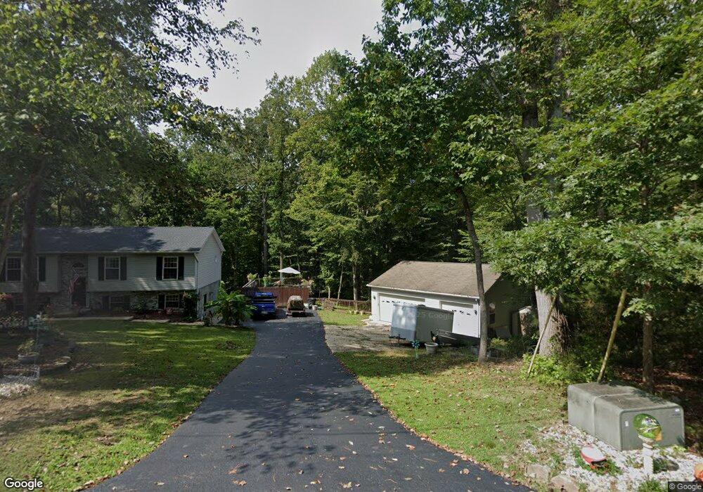
This home is located at 463 Comstock Dr, Lusby, MD 20657 and is currently estimated at $365,134, approximately $313 per square foot. 463 Comstock Dr is a home located in Calvert County with nearby schools including Dowell Elementary School, Mill Creek Middle School, and Patuxent High School.
Ownership History
Date
Name
Owned For
Owner Type
Purchase Details
Closed on
Nov 16, 2000
Sold by
Andreassi Arthur
Bought by
Jacoby William T and Jacoby Evangelina B
Current Estimated Value
Purchase Details
Closed on
Aug 21, 1997
Sold by
Mayo Jeffrey T
Bought by
Jacoby William T and Jacoby Evangelina B
Purchase Details
Closed on
Nov 18, 1992
Sold by
Cooper Anthony
Bought by
Mayo Jeffrey T
Home Financials for this Owner
Home Financials are based on the most recent Mortgage that was taken out on this home.
Original Mortgage
$950
Interest Rate
8.32%
Purchase Details
Closed on
Oct 27, 1992
Sold by
Howes Spencer R and Howes Judith A
Bought by
Cooper Anthony
Home Financials for this Owner
Home Financials are based on the most recent Mortgage that was taken out on this home.
Original Mortgage
$950
Interest Rate
8.32%
Create a Home Valuation Report for This Property
The Home Valuation Report is an in-depth analysis detailing your home's value as well as a comparison with similar homes in the area
Home Values in the Area
Average Home Value in this Area
Purchase History
| Date | Buyer | Sale Price | Title Company |
|---|---|---|---|
| Jacoby William T | $3,000 | -- | |
| Jacoby William T | $111,900 | -- | |
| Jacoby William T | $111,900 | -- | |
| Mayo Jeffrey T | $100,000 | -- | |
| Cooper Anthony | $5,500 | -- |
Source: Public Records
Mortgage History
| Date | Status | Borrower | Loan Amount |
|---|---|---|---|
| Previous Owner | Mayo Jeffrey T | $950 | |
| Closed | Jacoby William T | -- |
Source: Public Records
Tax History Compared to Growth
Tax History
| Year | Tax Paid | Tax Assessment Tax Assessment Total Assessment is a certain percentage of the fair market value that is determined by local assessors to be the total taxable value of land and additions on the property. | Land | Improvement |
|---|---|---|---|---|
| 2025 | $432 | $342,700 | $0 | $0 |
| 2024 | $432 | $306,900 | $0 | $0 |
| 2023 | $154 | $271,100 | $55,200 | $215,900 |
| 2022 | $2,741 | $263,800 | $0 | $0 |
| 2021 | $2,533 | $256,500 | $0 | $0 |
| 2020 | $3,086 | $249,200 | $55,200 | $194,000 |
| 2019 | $2,909 | $237,600 | $0 | $0 |
| 2018 | $2,347 | $226,000 | $0 | $0 |
| 2017 | $2,657 | $214,400 | $0 | $0 |
| 2016 | -- | $214,400 | $0 | $0 |
| 2015 | $2,635 | $214,400 | $0 | $0 |
| 2014 | $2,635 | $216,700 | $0 | $0 |
Source: Public Records
Map
Nearby Homes
- 12667 Amarillo Dr
- 356 Clubhouse Dr
- 12759 Tonkawa Trail
- 12728 Cordova Ct
- 1076 San Angelo Dr
- 428 Buffalo Rd
- 425 Rodeo Rd
- 12817 Abilene Trail
- 1049 Golden Way W
- 12805 Bay Dr
- 463 Bronco Trail
- 12501 San Jose Ct
- 256 Frontier Trail
- 502 Dodge Trail
- 454 Dogwood Dr
- 12948 Hauser Ct
- 484 Lake Dr
- 219 Calvert Dr
- 12476 Catalina Dr
- 12742 Mill Creek Dr
- 12716 Waco Ct
- 12710 Waco Ct
- 466 Comstock Dr
- 455 Comstock Dr
- 12704 Butte Ln
- 462 Comstock Dr
- 470 Comstock Dr
- 471 San Antonio Dr
- 447 Comstock Dr
- 477 San Antonio Dr
- 471 Comstock Dr
- 12617 Amarillo Dr
- 12700 Waco Ct
- 12700 Butte Ln
- 481 San Antonio Dr
- 478 Comstock Dr
- 12709 Waco Ct
- 12711 Waco Ct
- 458 Comstock Dr
- 12703 Butte Ln