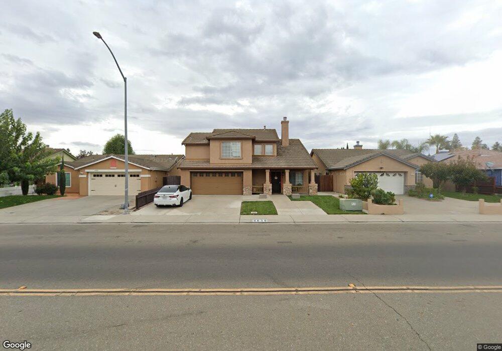
4635 McDougald Blvd Stockton, CA 95206
Weston Ranch NeighborhoodEstimated Value: $328,000 - $509,000
3
Beds
3
Baths
1,668
Sq Ft
$265/Sq Ft
Est. Value
About This Home
This home is located at 4635 McDougald Blvd, Stockton, CA 95206 and is currently estimated at $441,488, approximately $264 per square foot. 4635 McDougald Blvd is a home located in San Joaquin County with nearby schools including Great Valley Elementary School and Weston Ranch High School.
Ownership History
Date
Name
Owned For
Owner Type
Purchase Details
Closed on
Mar 27, 2006
Sold by
Villasenor Alfonso L
Bought by
Montoya Jose V and Montoya Lilia V
Current Estimated Value
Home Financials for this Owner
Home Financials are based on the most recent Mortgage that was taken out on this home.
Original Mortgage
$40,000
Interest Rate
6.25%
Mortgage Type
Purchase Money Mortgage
Purchase Details
Closed on
Jul 18, 1997
Sold by
Kb One Inc
Bought by
Montoya Jose V and Montoya Lilia V
Home Financials for this Owner
Home Financials are based on the most recent Mortgage that was taken out on this home.
Original Mortgage
$137,374
Interest Rate
7.58%
Mortgage Type
FHA
Create a Home Valuation Report for This Property
The Home Valuation Report is an in-depth analysis detailing your home's value as well as a comparison with similar homes in the area
Home Values in the Area
Average Home Value in this Area
Purchase History
| Date | Buyer | Sale Price | Title Company |
|---|---|---|---|
| Montoya Jose V | -- | First American Title Company | |
| Montoya Jose V | $140,000 | First American Title Co |
Source: Public Records
Mortgage History
| Date | Status | Borrower | Loan Amount |
|---|---|---|---|
| Closed | Montoya Jose V | $40,000 | |
| Previous Owner | Montoya Jose V | $137,374 |
Source: Public Records
Tax History Compared to Growth
Tax History
| Year | Tax Paid | Tax Assessment Tax Assessment Total Assessment is a certain percentage of the fair market value that is determined by local assessors to be the total taxable value of land and additions on the property. | Land | Improvement |
|---|---|---|---|---|
| 2025 | $3,402 | $223,369 | $47,896 | $175,473 |
| 2024 | $3,291 | $218,990 | $46,957 | $172,033 |
| 2023 | $3,175 | $214,697 | $46,037 | $168,660 |
| 2022 | $3,103 | $210,488 | $45,135 | $165,353 |
| 2021 | $3,043 | $206,361 | $44,250 | $162,111 |
| 2020 | $2,933 | $204,246 | $43,797 | $160,449 |
| 2019 | $2,885 | $200,242 | $42,939 | $157,303 |
| 2018 | $2,863 | $196,317 | $42,098 | $154,219 |
| 2017 | $2,814 | $192,469 | $41,273 | $151,196 |
| 2016 | $2,708 | $188,696 | $40,464 | $148,232 |
| 2015 | $2,875 | $185,861 | $39,856 | $146,005 |
| 2014 | $3,635 | $182,221 | $39,075 | $143,146 |
Source: Public Records
Map
Nearby Homes
- 761 Sandstone Dr
- 668 Flagstone Dr
- 4309 Blake Cir
- 1044 Henry Long Blvd
- 4154 Kassady Ct
- 4144 Blake Cir
- 3812 Steve Lillie Cir
- 1141 Klemeyer Cir
- 1131 Klemeyer Cir
- 3839 Zitlau Ct
- 703 Villanueva Ct
- 971 Kate Linde Cir
- 3707 French Camp
- 4910 Hearthwood Ct
- 627 Queensland Cir
- 1611 Magnum Ct
- 1117 Glenmohr Ct
- 4116 Vercelli St
- 1702 Sicily St Unit 1
- 3412 Shogoro Ln
- 4627 McDougald Blvd
- 4707 McDougald Blvd
- 4714 Mossbrook Ln
- 4719 McDougald Blvd
- 4619 McDougald Blvd
- 4702 Mossbrook Ln
- 4726 Mossbrook Ln
- 4731 McDougald Blvd
- 4611 McDougald Blvd
- 807 Waterford Ave
- 4738 Mossbrook Ln
- 4636 McDougald Blvd
- 4628 McDougald Blvd
- 4704 McDougald Blvd
- 4620 McDougald Blvd
- 4716 McDougald Blvd
- 4743 McDougald Blvd
- 812 Henry Long Blvd
- 4603 McDougald Blvd
- 4612 McDougald Blvd