Estimated Value: $296,000 - $354,000
3
Beds
2
Baths
1,408
Sq Ft
$230/Sq Ft
Est. Value
About This Home
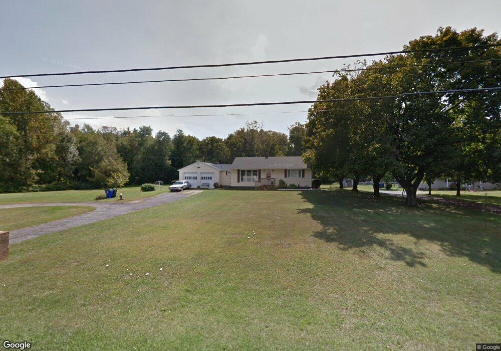
This home is located at 4637 Forrest Ave, Dover, DE 19904 and is currently estimated at $323,640, approximately $229 per square foot. 4637 Forrest Ave is a home located in Kent County with nearby schools including William Henry Middle School, South Dover Elementary School, and Central Middle School.
Ownership History
Date
Name
Owned For
Owner Type
Purchase Details
Closed on
Sep 3, 2009
Sold by
Cordeiro Kenneth W and Yvonne Cordeiro J
Bought by
Cordeiro 4661 Forrest Trust
Current Estimated Value
Purchase Details
Closed on
Apr 30, 2009
Sold by
Hurd Willard Lee
Bought by
Bilas Carol A and Bilas Justine
Home Financials for this Owner
Home Financials are based on the most recent Mortgage that was taken out on this home.
Original Mortgage
$143,100
Interest Rate
4.86%
Mortgage Type
Purchase Money Mortgage
Create a Home Valuation Report for This Property
The Home Valuation Report is an in-depth analysis detailing your home's value as well as a comparison with similar homes in the area
Home Values in the Area
Average Home Value in this Area
Purchase History
| Date | Buyer | Sale Price | Title Company |
|---|---|---|---|
| Cordeiro 4661 Forrest Trust | -- | None Available | |
| Bilas Carol A | $159,000 | None Available |
Source: Public Records
Mortgage History
| Date | Status | Borrower | Loan Amount |
|---|---|---|---|
| Previous Owner | Bilas Carol A | $143,100 |
Source: Public Records
Tax History
| Year | Tax Paid | Tax Assessment Tax Assessment Total Assessment is a certain percentage of the fair market value that is determined by local assessors to be the total taxable value of land and additions on the property. | Land | Improvement |
|---|---|---|---|---|
| 2025 | $1,663 | $280,600 | $91,800 | $188,800 |
| 2024 | $1,607 | $280,600 | $91,800 | $188,800 |
| 2023 | $1,235 | $41,500 | $9,200 | $32,300 |
| 2022 | $1,195 | $41,500 | $9,200 | $32,300 |
| 2021 | $1,151 | $41,500 | $9,200 | $32,300 |
| 2020 | $1,112 | $41,500 | $9,200 | $32,300 |
| 2019 | $1,052 | $41,500 | $9,200 | $32,300 |
| 2018 | $962 | $41,500 | $9,200 | $32,300 |
| 2017 | $946 | $41,500 | $0 | $0 |
| 2016 | $949 | $41,500 | $0 | $0 |
| 2015 | $949 | $41,500 | $0 | $0 |
| 2014 | $951 | $41,500 | $0 | $0 |
Source: Public Records
Map
Nearby Homes
- 108 Birchfield Dr
- 39 W Huntington Cir
- 0 Winding Creek Rd
- 45 Mitchlyn Way
- 1950 Pearsons Corner Rd
- 0 Halltown Rd Unit DEKT2042778
- 1255 Rose Valley School Rd
- 84 Spotted Acres Farm Ln
- 128 Meadow Ridge Pkwy
- 0 Rose Valley School Rd
- 617 Rose Valley School Rd
- 639 Deer Track Ln
- 3384 Pearsons Corner Rd
- 1340 Hazlettville Rd
- 321 Blue Heron Rd
- 2505 W Denneys Rd
- 2392 Hazlettville Rd
- 520 Quails Nest Dr
- 500 Quails Nest Dr
- 143 Pearsons Corner Rd
- 4661 Forrest Ave
- 4614 Forrest Ave
- 4662 Forrest Ave
- 4636 Forrest Ave
- 4594 Forrest Ave
- 4568 Forrest Ave
- 4713 Forrest Ave
- 4698 Forrest Ave
- 4733 Forrest Ave
- 4678 Forrest Ave
- 4728 Forrest Ave
- 4745 Forrest Ave
- 4748 Forrest Ave
- 4757 Forrest Ave
- 4471 Forrest Ave
- 110 Sanderson Farm Ln
- 4786 Forrest Ave
- 29 E Huntington Cir
- 29 E Huntington Cir
- 4783 Forrest Ave
Your Personal Tour Guide
Ask me questions while you tour the home.