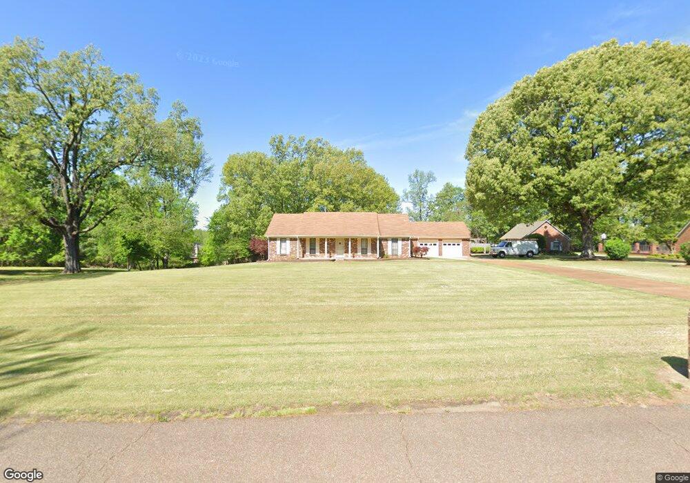
4645 Wild Fern Dr Memphis, TN 38135
Estimated Value: $352,000 - $444,000
4
Beds
3
Baths
2,942
Sq Ft
$137/Sq Ft
Est. Value
About This Home
This home is located at 4645 Wild Fern Dr, Memphis, TN 38135 and is currently estimated at $401,901, approximately $136 per square foot. 4645 Wild Fern Dr is a home located in Shelby County with nearby schools including Rivercrest Elementary School, Appling Middle School, and Bartlett High School.
Ownership History
Date
Name
Owned For
Owner Type
Purchase Details
Closed on
Oct 31, 2008
Sold by
Dozier Maddellynne R
Bought by
Hunter Scott A
Current Estimated Value
Home Financials for this Owner
Home Financials are based on the most recent Mortgage that was taken out on this home.
Original Mortgage
$261,294
Outstanding Balance
$171,774
Interest Rate
6.11%
Mortgage Type
FHA
Estimated Equity
$230,127
Purchase Details
Closed on
Nov 30, 2006
Sold by
Benfield Jerry L and Benfield Kimberly S
Bought by
Hunter Scott A and Dozier Maddellynne R
Home Financials for this Owner
Home Financials are based on the most recent Mortgage that was taken out on this home.
Original Mortgage
$192,650
Interest Rate
6.36%
Mortgage Type
Unknown
Create a Home Valuation Report for This Property
The Home Valuation Report is an in-depth analysis detailing your home's value as well as a comparison with similar homes in the area
Home Values in the Area
Average Home Value in this Area
Purchase History
| Date | Buyer | Sale Price | Title Company |
|---|---|---|---|
| Hunter Scott A | -- | Tam Title & Escrow Llc | |
| Hunter Scott A | $256,900 | None Available |
Source: Public Records
Mortgage History
| Date | Status | Borrower | Loan Amount |
|---|---|---|---|
| Open | Hunter Scott A | $261,294 | |
| Previous Owner | Hunter Scott A | $192,650 |
Source: Public Records
Tax History Compared to Growth
Tax History
| Year | Tax Paid | Tax Assessment Tax Assessment Total Assessment is a certain percentage of the fair market value that is determined by local assessors to be the total taxable value of land and additions on the property. | Land | Improvement |
|---|---|---|---|---|
| 2025 | $2,693 | $92,300 | $19,425 | $72,875 |
| 2024 | $2,693 | $79,425 | $13,350 | $66,075 |
| 2023 | $4,067 | $79,425 | $13,350 | $66,075 |
| 2022 | $4,067 | $79,425 | $13,350 | $66,075 |
| 2021 | $4,130 | $79,425 | $13,350 | $66,075 |
| 2020 | $3,180 | $54,075 | $13,350 | $40,725 |
| 2019 | $3,180 | $54,075 | $13,350 | $40,725 |
| 2018 | $3,180 | $54,075 | $13,350 | $40,725 |
| 2017 | $2,222 | $54,075 | $13,350 | $40,725 |
| 2016 | $2,035 | $46,575 | $0 | $0 |
| 2014 | $2,035 | $46,575 | $0 | $0 |
Source: Public Records
Map
Nearby Homes
- 6450 Wells Grove Dr
- 4450 Guinevere Ln
- 6495 Wells Grove Cove
- 4860 Rivercrest Ln
- 6460 Wellsgate Cove
- 6135 Abigail Bluffs Dr
- 6155 Trail Creek Ln
- 6074 Abigail Bluffs Dr
- 4382 Ellendale Rd
- 6008 Maher Valley Cove
- 4260 Steffan Woods Cove
- 6003 Abigail Bluffs Cove
- 4567 Garner Place
- 0 Egypt Central Rd Unit 10191682
- 5035 Forest Oasis Ln
- 4170 Calla Dr
- 5094 Foggy River Ln
- 4349 Cedar Hills Rd
- 6153 Forest Oasis Cove
- 5128 N Fluss Cove
- 4626 Molsonwood Dr
- 4638 Molsonwood Dr
- 4657 Wild Fern Dr
- 4604 Molsonwood Dr
- 4658 Molsonwood Dr
- 6275 Ferncrest Dr
- 6302 Ferncrest Dr
- 4596 Molsonwood Dr
- 4662 Molsonwood Dr
- 4633 Molsonwood Dr
- 4621 Molsonwood Dr
- 4685 Wild Fern Dr
- 4609 Molsonwood Dr
- 4586 Molsonwood Dr
- 4670 Molsonwood Dr
- 6303 Ferncrest Dr
- 4659 Molsonwood Dr
- 6211 Frances Wood Dr
- 6260 Carolot Ln
- 6270 Carolot Ln