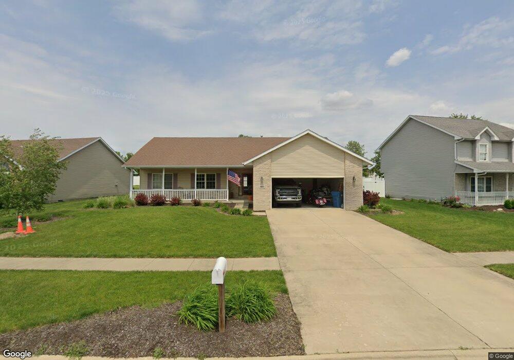
465 Highpoint Cir S Bourbonnais, IL 60914
Estimated Value: $300,000 - $363,000
--
Bed
--
Bath
--
Sq Ft
9,932
Sq Ft Lot
About This Home
This home is located at 465 Highpoint Cir S, Bourbonnais, IL 60914 and is currently estimated at $321,442. 465 Highpoint Cir S is a home located in Kankakee County with nearby schools including Noel Levasseur Elementary School, Liberty Intermediate School, and Bourbonnais Upper Grade Center.
Ownership History
Date
Name
Owned For
Owner Type
Purchase Details
Closed on
Sep 1, 2005
Sold by
Kevin Wilson
Bought by
Mullen Mark E
Current Estimated Value
Home Financials for this Owner
Home Financials are based on the most recent Mortgage that was taken out on this home.
Original Mortgage
$143,920
Interest Rate
5.12%
Mortgage Type
New Conventional
Create a Home Valuation Report for This Property
The Home Valuation Report is an in-depth analysis detailing your home's value as well as a comparison with similar homes in the area
Home Values in the Area
Average Home Value in this Area
Purchase History
| Date | Buyer | Sale Price | Title Company |
|---|---|---|---|
| Mullen Mark E | $180,000 | Standard Title |
Source: Public Records
Mortgage History
| Date | Status | Borrower | Loan Amount |
|---|---|---|---|
| Previous Owner | Mullen Mark E | $143,920 |
Source: Public Records
Tax History Compared to Growth
Tax History
| Year | Tax Paid | Tax Assessment Tax Assessment Total Assessment is a certain percentage of the fair market value that is determined by local assessors to be the total taxable value of land and additions on the property. | Land | Improvement |
|---|---|---|---|---|
| 2024 | $6,126 | $84,969 | $12,030 | $72,939 |
| 2023 | $5,817 | $76,708 | $11,139 | $65,569 |
| 2022 | $5,543 | $70,661 | $10,736 | $59,925 |
| 2021 | $5,344 | $67,957 | $10,500 | $57,457 |
| 2020 | $5,290 | $66,138 | $10,219 | $55,919 |
| 2019 | $5,175 | $64,211 | $9,921 | $54,290 |
| 2018 | $4,967 | $61,704 | $9,774 | $51,930 |
| 2017 | $4,701 | $58,376 | $9,536 | $48,840 |
| 2016 | $4,572 | $57,037 | $9,395 | $47,642 |
| 2015 | $4,539 | $56,033 | $9,302 | $46,731 |
| 2014 | $4,643 | $59,298 | $9,302 | $49,996 |
| 2013 | -- | $59,724 | $9,302 | $50,422 |
Source: Public Records
Map
Nearby Homes
- 360 Centerpoint Dr S
- 330 Centerpoint Dr S
- 444 Highpoint Cir N
- 1582 Mid Court Dr
- 172 Anita Dr
- 675 Kathy Dr
- 197 Kristina Dr
- 1230 Eagle Bluff Dr
- 54 Bonds Dr
- 2082 Craftsman Ave
- 52 Hanson Dr
- 1533 Stefanie Ln
- 882 Pheasant Run
- 1613 Stefanie Ln
- 1565 Stefanie Ln
- 631 Concord Place
- 1293 Hartley Ave
- 118 Meadows Ct
- 14 Saint Michaels Dr
- 6 Berry Ln
- 445 Highpoint Cir S
- 485 Highpoint Cir S
- 372 Centerpoint Dr S
- 378 Centerpoint Dr S
- 425 Highpoint Cir S
- 366 Centerpoint Dr S
- 470 Halfway Rd
- 384 Centerpoint Dr S
- 405 Highpoint Cir S
- 570 Highpoint Cir N
- 440 Highpoint Cir S
- 465 Halfway Rd
- 430 Highpoint Cir S
- 410 Highpoint Cir S
- 390 Centerpoint Dr S
- 575 Highpoint Cir N
- 385 Highpoint Cir S
- 556 Highpoint Cir N
- 375 Centerpoint Dr S
- 390 Highpoint Cir S