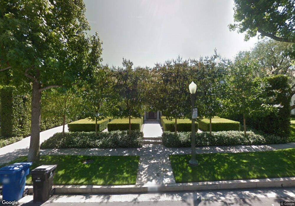
465 Loring Ave Los Angeles, CA 90024
Westwood NeighborhoodEstimated Value: $4,673,689 - $6,071,000
3
Beds
4
Baths
3,617
Sq Ft
$1,505/Sq Ft
Est. Value
About This Home
This home is located at 465 Loring Ave, Los Angeles, CA 90024 and is currently estimated at $5,442,172, approximately $1,504 per square foot. 465 Loring Ave is a home located in Los Angeles County with nearby schools including Warner Avenue Elementary, Ralph Waldo Emerson Community Charter Middle School, and University High School Charter.
Ownership History
Date
Name
Owned For
Owner Type
Purchase Details
Closed on
Sep 25, 2012
Sold by
Rosenbaum Sandra D and Rosenbaum Arthur L
Bought by
Rosenbaum Sandra D and Sandra D Rosenbaum Family Trus
Current Estimated Value
Purchase Details
Closed on
Jun 17, 2005
Sold by
Rosenbaum Arthur L and Rosenbaum Sandra D
Bought by
Rosenbaum Dr Arthur L and Rosenbaum Sandra
Home Financials for this Owner
Home Financials are based on the most recent Mortgage that was taken out on this home.
Original Mortgage
$310,000
Interest Rate
5.72%
Mortgage Type
New Conventional
Purchase Details
Closed on
Nov 20, 1993
Sold by
Rosenbaum Arthur L and Rosenbaum Sandra D
Bought by
Rosenbaum Arthur L and Rosenbaum Sandra D
Create a Home Valuation Report for This Property
The Home Valuation Report is an in-depth analysis detailing your home's value as well as a comparison with similar homes in the area
Home Values in the Area
Average Home Value in this Area
Purchase History
| Date | Buyer | Sale Price | Title Company |
|---|---|---|---|
| Rosenbaum Sandra D | -- | None Available | |
| Rosenbaum Dr Arthur L | -- | -- | |
| Rosenbaum Arthur L | -- | -- |
Source: Public Records
Mortgage History
| Date | Status | Borrower | Loan Amount |
|---|---|---|---|
| Closed | Rosenbaum Dr Arthur L | $310,000 |
Source: Public Records
Tax History Compared to Growth
Tax History
| Year | Tax Paid | Tax Assessment Tax Assessment Total Assessment is a certain percentage of the fair market value that is determined by local assessors to be the total taxable value of land and additions on the property. | Land | Improvement |
|---|---|---|---|---|
| 2025 | $24,182 | $2,016,385 | $1,171,446 | $844,939 |
| 2024 | $24,182 | $1,976,849 | $1,148,477 | $828,372 |
| 2023 | $23,715 | $1,938,088 | $1,125,958 | $812,130 |
| 2022 | $22,615 | $1,900,087 | $1,103,881 | $796,206 |
| 2021 | $22,330 | $1,862,832 | $1,082,237 | $780,595 |
| 2019 | $21,660 | $1,807,581 | $1,050,138 | $757,443 |
| 2018 | $21,556 | $1,772,140 | $1,029,548 | $742,592 |
| 2016 | $20,608 | $1,703,327 | $989,570 | $713,757 |
| 2015 | $20,305 | $1,677,742 | $974,706 | $703,036 |
| 2014 | $20,366 | $1,644,878 | $955,613 | $689,265 |
Source: Public Records
Map
Nearby Homes
- 453 Dalehurst Ave
- 601 Woodruff Ave
- 547 Loring Ave
- 365 Comstock Ave
- 570 S Beverly Glen Blvd
- 365 Norcroft Ave
- 10386 Strathmore Dr
- 10444 Charing Cross Rd
- 570 S Mapleton Dr
- 740 Warner Ave
- 10301 Strathmore Dr
- 850 Birchwood Dr
- 10452 Lindbrook Dr
- 10375 Wilshire Blvd Unit 2F
- 10375 Wilshire Blvd Unit 8F
- 10375 Wilshire Blvd Unit 1B
- 820 Glenmont Ave
- 850 Thayer Ave
- 10433 Wilshire Blvd Unit 808
- 200 S Mapleton Dr
- 471 Loring Ave
- 453 Loring Ave
- 479 Loring Ave
- 472 Dalehurst Ave
- 466 Dalehurst Ave
- 460 Dalehurst Ave
- 478 Dalehurst Ave
- 447 Loring Ave
- 485 Loring Ave
- 468 Loring Ave
- 454 Dalehurst Ave
- 484 Dalehurst Ave
- 460 Loring Ave
- 441 Loring Ave
- 452 Loring Ave
- 493 Loring Ave
- 448 Dalehurst Ave
- 488 Dalehurst Ave
- 10431 Wyton Dr
- 467 Dalehurst Ave