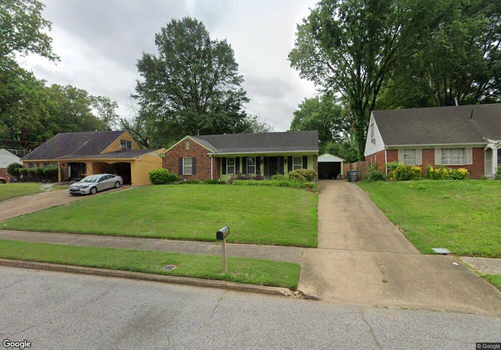
4651 Scottsdale Ave Memphis, TN 38118
Parkway Village NeighborhoodEstimated Value: $125,000 - $158,000
3
Beds
2
Baths
1,368
Sq Ft
$105/Sq Ft
Est. Value
About This Home
This home is located at 4651 Scottsdale Ave, Memphis, TN 38118 and is currently estimated at $144,021, approximately $105 per square foot. 4651 Scottsdale Ave is a home located in Shelby County with nearby schools including Parkway Village Elementary School, Sheffield High School, and Memphis School of Excellence.
Ownership History
Date
Name
Owned For
Owner Type
Purchase Details
Closed on
Jun 5, 1998
Sold by
Sisk Gladys H
Bought by
Sanders Jacquelyn G
Current Estimated Value
Home Financials for this Owner
Home Financials are based on the most recent Mortgage that was taken out on this home.
Original Mortgage
$72,420
Outstanding Balance
$14,715
Interest Rate
7.23%
Mortgage Type
VA
Estimated Equity
$129,306
Create a Home Valuation Report for This Property
The Home Valuation Report is an in-depth analysis detailing your home's value as well as a comparison with similar homes in the area
Home Values in the Area
Average Home Value in this Area
Purchase History
| Date | Buyer | Sale Price | Title Company |
|---|---|---|---|
| Sanders Jacquelyn G | $71,000 | Mid South Title |
Source: Public Records
Mortgage History
| Date | Status | Borrower | Loan Amount |
|---|---|---|---|
| Open | Sanders Jacquelyn G | $72,420 |
Source: Public Records
Tax History Compared to Growth
Tax History
| Year | Tax Paid | Tax Assessment Tax Assessment Total Assessment is a certain percentage of the fair market value that is determined by local assessors to be the total taxable value of land and additions on the property. | Land | Improvement |
|---|---|---|---|---|
| 2025 | $675 | $35,375 | $4,250 | $31,125 |
| 2024 | $675 | $19,925 | $3,350 | $16,575 |
| 2023 | $1,214 | $19,925 | $3,350 | $16,575 |
| 2022 | $1,214 | $19,925 | $3,350 | $16,575 |
| 2021 | $1,228 | $19,925 | $3,350 | $16,575 |
| 2020 | $1,223 | $16,875 | $3,350 | $13,525 |
| 2019 | $1,223 | $16,875 | $3,350 | $13,525 |
| 2018 | $1,223 | $16,875 | $3,350 | $13,525 |
| 2017 | $694 | $16,875 | $3,350 | $13,525 |
| 2016 | $716 | $16,375 | $0 | $0 |
| 2014 | $716 | $16,375 | $0 | $0 |
Source: Public Records
Map
Nearby Homes
- 4616 Blanding Dr
- 4612 Chuck Ave
- 3339 S Perkins Rd
- 3347 S Perkins Rd
- 3433 S Perkins Rd
- 3274 Gaylord Ln
- 3287 Boxdale St
- 4833 Scottsdale Ave
- 3240 Boxdale St
- 3118 Arrendale St
- 4763 Wooddale Ave
- 4817 Wooddale Ave
- 3083 Arrendale St
- 3419 Brutonwood Cove
- 4864 Cloister Ave
- 4773 Aloha Ave
- 4772 James Kent Ct
- 4947 Demeter Cove
- 3408 Clearbrook St
- 2969 Arrendale St
- 4659 Scottsdale Ave
- 4645 Scottsdale Ave
- 4650 Blanding Ave
- 4637 Scottsdale Ave
- 4658 Blanding Ave
- 4644 Blanding Ave
- 4644 Blanding Dr
- 4669 Scottsdale Ave
- 3331 Chancellor St
- 4636 Blanding Dr
- 4636 Blanding Ave
- 4652 Scottsdale Ave
- 4646 Scottsdale Ave
- 4631 Scottsdale Ave
- 4660 Scottsdale Ave
- 4638 Scottsdale Ave
- 4668 Blanding Ave
- 4630 Blanding Ave
- 4630 Blanding Dr
- 4670 Scottsdale Ave