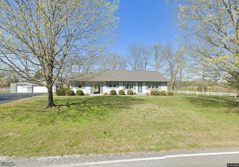
4651 Shady Grove Rd Morrison, TN 37357
Estimated Value: $189,857 - $492,000
Studio
1
Bath
2,816
Sq Ft
$121/Sq Ft
Est. Value
About This Home
This home is located at 4651 Shady Grove Rd, Morrison, TN 37357 and is currently estimated at $339,714, approximately $120 per square foot. 4651 Shady Grove Rd is a home located in Coffee County with nearby schools including Deerfield Elementary School, Coffee County Middle School, and Coffee County Central High School.
Ownership History
Date
Name
Owned For
Owner Type
Purchase Details
Closed on
Sep 7, 2001
Sold by
Rigsby Clarence B
Bought by
Rigsby Harold B and Rigsby Mary
Current Estimated Value
Purchase Details
Closed on
Jan 5, 2000
Sold by
Rigsby Harold and Rigsby Mary
Bought by
Rigsby Lucille
Purchase Details
Closed on
Sep 24, 1999
Sold by
Rigsby Raymond
Bought by
Rigsby Harold B and Rigsby Mary S
Purchase Details
Closed on
Apr 8, 1996
Sold by
Rigsby Raymond
Bought by
Kocak Mitchell
Create a Home Valuation Report for This Property
The Home Valuation Report is an in-depth analysis detailing your home's value as well as a comparison with similar homes in the area
Purchase History
| Date | Buyer | Sale Price | Title Company |
|---|---|---|---|
| Rigsby Harold B | -- | -- | |
| Rigsby Lucille | -- | -- | |
| Rigsby Harold B | $1,000 | -- | |
| Kocak Mitchell | $83,000 | -- |
Source: Public Records
Tax History
| Year | Tax Paid | Tax Assessment Tax Assessment Total Assessment is a certain percentage of the fair market value that is determined by local assessors to be the total taxable value of land and additions on the property. | Land | Improvement |
|---|---|---|---|---|
| 2025 | $713 | $30,575 | $10,675 | $19,900 |
| 2024 | $713 | $30,575 | $10,675 | $19,900 |
| 2023 | $713 | $30,575 | $0 | $0 |
| 2022 | $713 | $30,575 | $10,675 | $19,900 |
| 2021 | $678 | $23,125 | $6,575 | $16,550 |
| 2020 | $678 | $23,125 | $6,575 | $16,550 |
| 2019 | $678 | $23,125 | $6,575 | $16,550 |
| 2018 | $678 | $23,125 | $6,575 | $16,550 |
| 2017 | $726 | $22,250 | $8,475 | $13,775 |
| 2016 | $726 | $22,250 | $8,475 | $13,775 |
| 2015 | $726 | $22,250 | $8,475 | $13,775 |
| 2014 | $726 | $22,242 | $0 | $0 |
Source: Public Records
Map
Nearby Homes
- 0 Mcafee Rd
- 967 Mud Creek Rd
- 0 Goforth Rd
- 110 Saddle St
- 631 W Maple St
- 101 S Mill St
- 511 N Main St
- 0 Jacksboro Trail Unit 7
- 0 Jacksboro Trail Unit 10
- 0 Jacksboro Trail Unit 11
- 0 Jacksboro Trail Unit 8
- 0 Jacksboro Trail Unit 9
- 1051 Herman Lance Rd
- 0 Ramsey Rd
- 120 Boyd St
- 667 Pete Sain Rd
- 22 Hickory Dr
- 431 S Fair St
- 0 Pocahontas Rd
- 233 Taylor Lake Rd
- 2391 Mud Creek Rd
- 4779 Shady Grove Rd
- 981 Rigney Ln
- 2085 Mud Creek Rd
- 4324 Shady Grove Rd
- 4247 Shady Grove Rd
- 5077 Shady Grove Rd
- 5098 Shady Grove Rd
- 2657 Mcafee Rd
- 5386 Shady Grove Rd
- 2563 Mcafee Rd
- 5582 Shady Grove Rd
- 1885 Mud Creek Rd
- 1870 Mud Creek Rd
- 0 Deberry Rd (Lot 6) Unit 2103929
- 5602 Shady Grove Rd
- 80 Casey Rd
- 2532 Mcafee Rd
- 2532 Mcafee Rd
- 4049 Shady Grove Rd
Your Personal Tour Guide
Ask me questions while you tour the home.