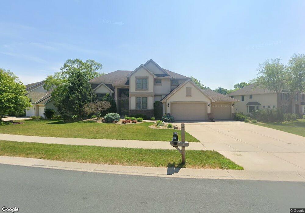
4654 Stonecliffe Dr Saint Paul, MN 55122
Estimated Value: $780,187 - $837,000
4
Beds
4
Baths
4,554
Sq Ft
$177/Sq Ft
Est. Value
About This Home
This home is located at 4654 Stonecliffe Dr, Saint Paul, MN 55122 and is currently estimated at $805,797, approximately $176 per square foot. 4654 Stonecliffe Dr is a home located in Dakota County with nearby schools including Thomas Lake Elementary School, Falcon Ridge Middle School, and Eastview Senior High School.
Ownership History
Date
Name
Owned For
Owner Type
Purchase Details
Closed on
May 16, 2022
Sold by
Dey Nathan and Dey Lina
Bought by
Niyazi Fadi and Al-Musa Reem
Current Estimated Value
Home Financials for this Owner
Home Financials are based on the most recent Mortgage that was taken out on this home.
Original Mortgage
$600,000
Outstanding Balance
$566,915
Interest Rate
4.67%
Mortgage Type
New Conventional
Estimated Equity
$238,882
Purchase Details
Closed on
Nov 14, 2018
Sold by
Hall Daniel L and Hall Kimberly R
Bought by
Dey Nathan A and Dey Lina
Home Financials for this Owner
Home Financials are based on the most recent Mortgage that was taken out on this home.
Original Mortgage
$509,575
Interest Rate
4.8%
Mortgage Type
New Conventional
Purchase Details
Closed on
Jun 10, 1999
Sold by
Lundgren Bros Construction Inc
Bought by
Hall Daniel L and Hall Kimberly R
Create a Home Valuation Report for This Property
The Home Valuation Report is an in-depth analysis detailing your home's value as well as a comparison with similar homes in the area
Home Values in the Area
Average Home Value in this Area
Purchase History
| Date | Buyer | Sale Price | Title Company |
|---|---|---|---|
| Niyazi Fadi | $750,000 | -- | |
| Dey Nathan A | $599,500 | Edina Realty Title Inc | |
| Hall Daniel L | $437,370 | -- |
Source: Public Records
Mortgage History
| Date | Status | Borrower | Loan Amount |
|---|---|---|---|
| Open | Niyazi Fadi | $600,000 | |
| Previous Owner | Dey Nathan A | $509,575 |
Source: Public Records
Tax History
| Year | Tax Paid | Tax Assessment Tax Assessment Total Assessment is a certain percentage of the fair market value that is determined by local assessors to be the total taxable value of land and additions on the property. | Land | Improvement |
|---|---|---|---|---|
| 2024 | $8,738 | $803,600 | $223,400 | $580,200 |
| 2023 | $8,738 | $757,900 | $224,100 | $533,800 |
| 2022 | $7,998 | $759,000 | $223,500 | $535,500 |
| 2021 | $7,578 | $664,100 | $194,300 | $469,800 |
| 2020 | $7,586 | $618,600 | $185,100 | $433,500 |
| 2019 | $6,645 | $603,900 | $176,300 | $427,600 |
| 2018 | $6,715 | $576,500 | $152,600 | $423,900 |
| 2017 | $7,261 | $565,200 | $145,400 | $419,800 |
| 2016 | $7,427 | $579,800 | $138,400 | $441,400 |
| 2015 | $6,866 | $586,700 | $138,400 | $448,300 |
| 2014 | -- | $556,300 | $134,700 | $421,600 |
| 2013 | -- | $517,500 | $122,200 | $395,300 |
Source: Public Records
Map
Nearby Homes
- 4755 Eriks Blvd
- XXXX Eriks Blvd
- 4670 Ridge Cliff Dr
- 4613 1/2 Penkwe Way
- 4902 Steeplechase Ct Unit 35
- 1389 Camelback Dr
- 4731 Prairie Dunes Way
- 4673 Jackstone Point
- 4626 Lenore Ln
- 1276 Dunberry Ln
- 4228 Boulder Ridge Point
- 4234 Boulder Ridge Point
- 4249 Boulder Ridge Point
- 4687 Parkridge Dr
- 12451 Drayton Trail
- 1665 Oakbrooke Way
- 4134 Oakbrooke Trail
- 4185 Hilltop Point
- 4125 Arbor Ln
- 12439 Drayton Trail
- 4650 Stonecliffe Dr
- 4658 Stonecliffe Dr
- 4642 Summit Pass
- 4662 Stonecliffe Dr
- 4646 Stonecliffe Dr
- 4657 Stonecliffe Dr
- 4653 Summit Pass
- 4661 Stonecliffe Dr
- 4645 Stonecliffe Dr
- 4649 Summit Pass
- 4666 Stonecliffe Dr
- 4641 Stonecliffe Dr
- 4665 Stonecliffe Dr
- 4638 Summit Pass
- 4642 Stonecliffe Dr
- 4645 Summit Pass
- 4669 Stonecliffe Dr
- 4672 Cambridge Dr
- 4666 Cambridge Dr
- 4641 Summit Pass
Your Personal Tour Guide
Ask me questions while you tour the home.