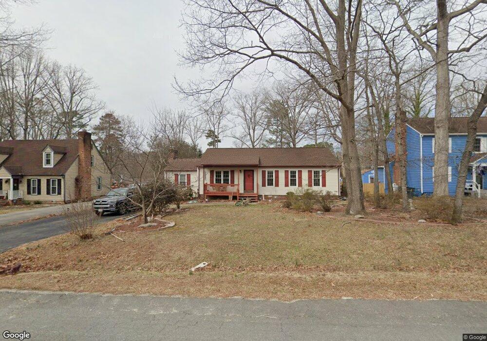
4660 Brookridge Rd Chesterfield, VA 23832
Estimated Value: $313,000 - $342,000
3
Beds
2
Baths
1,472
Sq Ft
$223/Sq Ft
Est. Value
About This Home
This home is located at 4660 Brookridge Rd, Chesterfield, VA 23832 and is currently estimated at $327,727, approximately $222 per square foot. 4660 Brookridge Rd is a home located in Chesterfield County with nearby schools including Thelma Crenshaw Elementary School, Bailey Bridge Middle School, and Manchester High.
Ownership History
Date
Name
Owned For
Owner Type
Purchase Details
Closed on
Nov 19, 2021
Sold by
Lawson Robert A and Lawson Karen Tyler
Bought by
Lawson Jonathan and Vaughan Erica
Current Estimated Value
Home Financials for this Owner
Home Financials are based on the most recent Mortgage that was taken out on this home.
Original Mortgage
$8,050
Outstanding Balance
$7,372
Interest Rate
3.1%
Estimated Equity
$320,355
Purchase Details
Closed on
Apr 28, 2005
Sold by
Lawson Ibbie
Bought by
Lawson Robert
Home Financials for this Owner
Home Financials are based on the most recent Mortgage that was taken out on this home.
Original Mortgage
$110,000
Interest Rate
5.95%
Mortgage Type
New Conventional
Create a Home Valuation Report for This Property
The Home Valuation Report is an in-depth analysis detailing your home's value as well as a comparison with similar homes in the area
Home Values in the Area
Average Home Value in this Area
Purchase History
| Date | Buyer | Sale Price | Title Company |
|---|---|---|---|
| Lawson Jonathan | $230,000 | Champion Title & Stlmnts Inc | |
| Lawson Robert | $145,000 | -- |
Source: Public Records
Mortgage History
| Date | Status | Borrower | Loan Amount |
|---|---|---|---|
| Open | Lawson Jonathan | $8,050 | |
| Open | Lawson Jonathan | $225,834 | |
| Previous Owner | Lawson Robert | $110,000 |
Source: Public Records
Tax History
| Year | Tax Paid | Tax Assessment Tax Assessment Total Assessment is a certain percentage of the fair market value that is determined by local assessors to be the total taxable value of land and additions on the property. | Land | Improvement |
|---|---|---|---|---|
| 2025 | $2,829 | $315,100 | $60,000 | $255,100 |
| 2024 | $2,829 | $286,200 | $52,000 | $234,200 |
| 2023 | $2,467 | $271,100 | $49,000 | $222,100 |
| 2022 | $2,248 | $244,400 | $47,000 | $197,400 |
| 2021 | $2,083 | $216,600 | $45,000 | $171,600 |
| 2020 | $1,898 | $197,200 | $45,000 | $152,200 |
| 2019 | $1,820 | $191,600 | $42,000 | $149,600 |
| 2018 | $1,671 | $178,000 | $42,000 | $136,000 |
| 2017 | $1,626 | $166,800 | $42,000 | $124,800 |
| 2016 | $1,497 | $155,900 | $42,000 | $113,900 |
| 2015 | $1,408 | $146,700 | $42,000 | $104,700 |
| 2014 | $1,370 | $142,700 | $42,000 | $100,700 |
Source: Public Records
Map
Nearby Homes
- 10908 August Ct
- 11019 Blossomwood Rd
- 10383 Qualla Trace Dr
- 10370 Qualla Trace Dr
- 10362 Qualla Trace Dr
- 5408 Qualla Trace Terrace
- 10357 Qualla Trace Dr
- 10351 Qualla Trace Dr
- 10350 Qualla Trace Dr
- 5409 Qualla Trace Terrace
- 10333 Qualla Trace Dr
- 10507 Sarata Ln
- 5318 Qualla Trace Ct
- 5418 Qualla Trace Ln
- 5300 Qualla Trace Ct
- 5012 Alberta Rd
- 5301 Qualla Trace Ct
- 5307 Qualla Trace Ct
- 5401 Qualla Trace Ln
- 5413 Qualla Trace Ln
- 4654 Brookridge Rd
- 4664 Brookridge Rd
- 10619 Bexwood Ct
- 4672 Brookridge Rd
- 4648 Brookridge Rd
- 10625 Bexwood Ct
- 4659 Brookridge Rd
- 4665 Brookridge Rd
- 10613 Bexwood Ct
- 4653 Brookridge Rd
- 10631 Bexwood Ct
- 4700 Brookridge Rd
- 4642 Brookridge Rd
- 4647 Brookridge Rd
- 10607 Bexwood Ct
- 4705 Bexwood Dr
- 10805 Brookridge Way
- 4641 Brookridge Rd
- 4636 Brookridge Rd
- 4711 Bexwood Dr
Your Personal Tour Guide
Ask me questions while you tour the home.