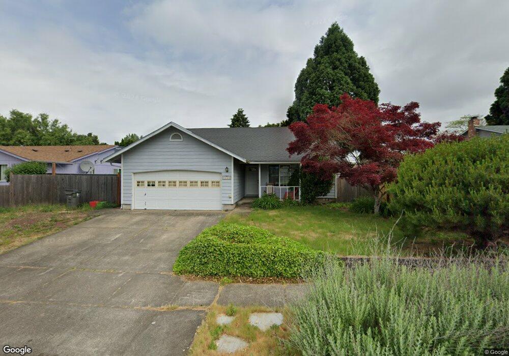
4665 Concord St Eugene, OR 97402
Bethel NeighborhoodEstimated Value: $370,413 - $417,000
3
Beds
2
Baths
1,235
Sq Ft
$323/Sq Ft
Est. Value
About This Home
This home is located at 4665 Concord St, Eugene, OR 97402 and is currently estimated at $399,103, approximately $323 per square foot. 4665 Concord St is a home located in Lane County with nearby schools including Danebo Elementary School, Shasta Middle School, and Willamette High School.
Ownership History
Date
Name
Owned For
Owner Type
Purchase Details
Closed on
Dec 18, 2019
Sold by
Wagner Marni K
Bought by
Winings John L and Winings Marni K
Current Estimated Value
Purchase Details
Closed on
Dec 5, 2001
Sold by
Connolly Patrick I and Connolly Cheryl A
Bought by
Wagner Marni K
Home Financials for this Owner
Home Financials are based on the most recent Mortgage that was taken out on this home.
Original Mortgage
$121,099
Outstanding Balance
$46,640
Interest Rate
6.67%
Mortgage Type
FHA
Estimated Equity
$352,463
Create a Home Valuation Report for This Property
The Home Valuation Report is an in-depth analysis detailing your home's value as well as a comparison with similar homes in the area
Home Values in the Area
Average Home Value in this Area
Purchase History
| Date | Buyer | Sale Price | Title Company |
|---|---|---|---|
| Winings John L | -- | None Available | |
| Wagner Marni K | $123,000 | Western Pioneer Title Co |
Source: Public Records
Mortgage History
| Date | Status | Borrower | Loan Amount |
|---|---|---|---|
| Open | Wagner Marni K | $121,099 |
Source: Public Records
Tax History
| Year | Tax Paid | Tax Assessment Tax Assessment Total Assessment is a certain percentage of the fair market value that is determined by local assessors to be the total taxable value of land and additions on the property. | Land | Improvement |
|---|---|---|---|---|
| 2025 | $3,504 | $201,465 | -- | -- |
| 2024 | $3,416 | $195,598 | -- | -- |
| 2023 | $3,416 | $189,901 | $0 | $0 |
| 2022 | $3,180 | $184,370 | $0 | $0 |
| 2021 | $3,113 | $179,000 | $0 | $0 |
| 2020 | $3,022 | $173,787 | $0 | $0 |
| 2019 | $2,873 | $168,726 | $0 | $0 |
| 2018 | $2,793 | $159,041 | $0 | $0 |
| 2017 | $2,669 | $159,041 | $0 | $0 |
| 2016 | $2,601 | $154,409 | $0 | $0 |
| 2015 | $2,550 | $149,912 | $0 | $0 |
| 2014 | $2,511 | $145,546 | $0 | $0 |
Source: Public Records
Map
Nearby Homes
- 4548 Cambon St
- 4554 Woodsboro St
- 1562 Philip St
- 1145 Ludgate Dr
- 1159 Throne Dr
- 1153 Elizabeth St
- 870 Laurelhurst Dr
- 4280 Avalon St
- 4941 Stagecoach Rd
- 4800 Barger Dr Unit 60
- 4749 Royal Ave
- 1400 Candlelight Dr Unit 162
- 1400 Candlelight Dr Unit 208
- 1400 Candlelight Dr
- 1400 Candlelight Dr Unit 226
- 1199 N Terry St
- 1199 N Terry St Unit 248
- 1199 N Terry St Unit 259
- 1199 N Terry St Unit 139
- 1199 N Terry St Unit 258
- 4673 Concord St
- 4564 Cambon St
- 4552 Cambon St
- 4679 Concord St
- 4574 Cambon St
- 4645 Concord St
- 4656 Concord St
- 4678 Concord St
- 4578 Cambon St
- 4648 Concord St
- 4685 Concord St
- 4536 Cambon St
- 4637 Concord St
- 4684 Concord St
- 4636 Concord St
- 4582 Cambon St
- 4665 Fuller Ave
- 4555 Cambon St
- 4567 Cambon St
- 4677 Fuller Ave
Your Personal Tour Guide
Ask me questions while you tour the home.