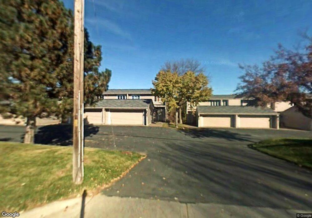
467 County Road C W Saint Paul, MN 55113
South Owasso NeighborhoodEstimated Value: $325,000 - $348,000
3
Beds
4
Baths
1,664
Sq Ft
$204/Sq Ft
Est. Value
About This Home
This home is located at 467 County Road C W, Saint Paul, MN 55113 and is currently estimated at $338,835, approximately $203 per square foot. 467 County Road C W is a home located in Ramsey County with nearby schools including Central Park Elementary School, Roseville Area Middle School, and Roseville Area Senior High School.
Ownership History
Date
Name
Owned For
Owner Type
Purchase Details
Closed on
Dec 30, 2010
Sold by
Davis Thomas H and Davis Melanie G
Bought by
Heo Youngcheul and Park Kyung Ae
Current Estimated Value
Purchase Details
Closed on
Mar 17, 2004
Sold by
Rapach Carole S
Bought by
Davis Thomas H and Josephson Melanie G
Purchase Details
Closed on
May 26, 1999
Sold by
Sajevic Peter John and Sajevic Patricia Steuart
Bought by
Rapach Carole S
Create a Home Valuation Report for This Property
The Home Valuation Report is an in-depth analysis detailing your home's value as well as a comparison with similar homes in the area
Home Values in the Area
Average Home Value in this Area
Purchase History
| Date | Buyer | Sale Price | Title Company |
|---|---|---|---|
| Heo Youngcheul | $170,000 | -- | |
| Davis Thomas H | $232,000 | -- | |
| Rapach Carole S | $145,000 | -- |
Source: Public Records
Tax History Compared to Growth
Tax History
| Year | Tax Paid | Tax Assessment Tax Assessment Total Assessment is a certain percentage of the fair market value that is determined by local assessors to be the total taxable value of land and additions on the property. | Land | Improvement |
|---|---|---|---|---|
| 2025 | $4,588 | $366,900 | $50,000 | $316,900 |
| 2023 | $4,588 | $330,600 | $50,000 | $280,600 |
| 2022 | $3,880 | $330,400 | $50,000 | $280,400 |
| 2021 | $3,432 | $267,100 | $50,000 | $217,100 |
| 2020 | $3,668 | $254,400 | $50,000 | $204,400 |
| 2019 | $3,858 | $254,400 | $22,900 | $231,500 |
| 2018 | $3,924 | $259,300 | $22,900 | $236,400 |
| 2017 | $3,544 | $256,800 | $22,900 | $233,900 |
| 2016 | $3,160 | $0 | $0 | $0 |
| 2015 | $3,098 | $221,000 | $22,900 | $198,100 |
| 2014 | $2,292 | $0 | $0 | $0 |
Source: Public Records
Map
Nearby Homes
- 556 County Road C W
- 2720 MacKubin St
- 437 County Road C W
- 2710 Dale St N Unit B212
- 2730 Dale St N Unit D309
- 2730 Dale St N Unit D101
- 2720 Dale St N Unit C208
- 540 Woodhill Dr Unit 71
- 2748 Kent St
- 350 County Road C W
- 667 County Road C W
- 387 Iona Ln
- 405 Brooks Ave W
- 405 Judith Ave
- 2687 Galtier St
- 500 County Road B2 W
- 2814 Matilda St
- 2821 Galtier St
- 2802 Marion St
- 630 Lovell Ave W
- 469 County Road C W
- 471 County Road C W
- 461 County Road C W
- 473 County Road C W
- 459 County Road C W
- 475 County Road C W
- 457 County Road C W
- 477 County Road C W
- 455 County Road C W
- 453 County Road C W
- 0 Nature View Ct N
- 449 County Road C W
- 2629 Nature View Ct
- 2654 MacKubin St
- 447 County Road C W
- 2656 MacKubin St
- 2630 Nature View Ct N
- 2658 MacKubin St
- 2627 Nature View Ct
- 2660 MacKubin St