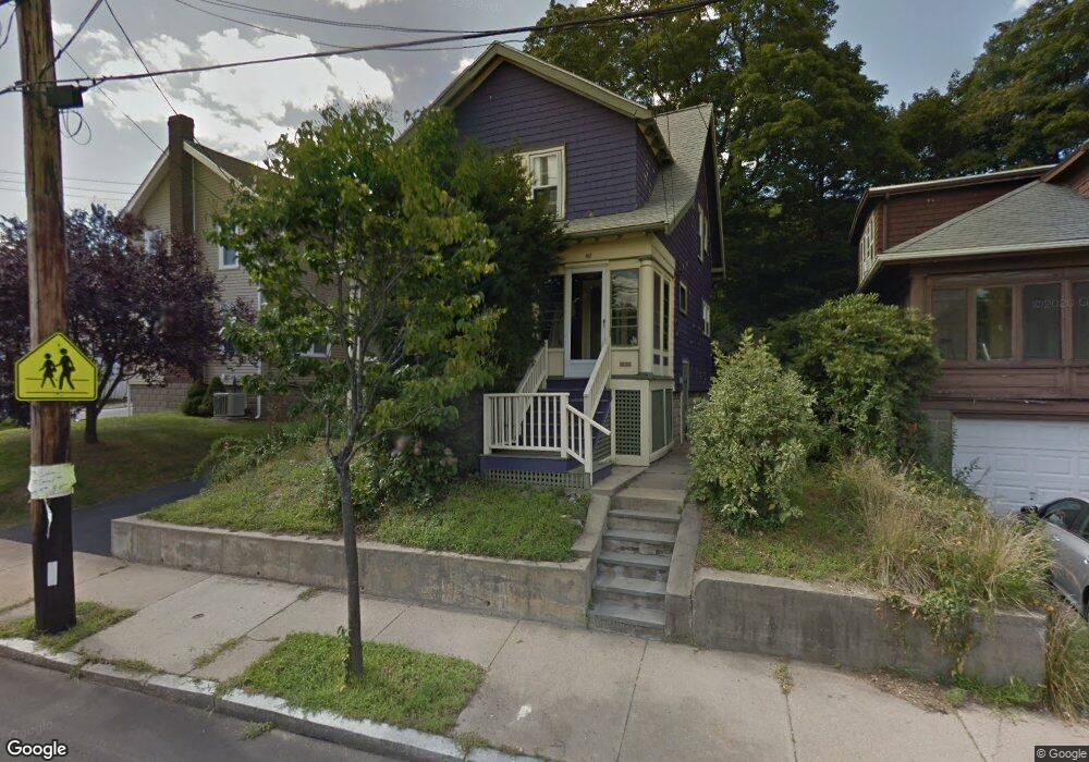
467 Poplar St Roslindale, MA 02131
Roslindale NeighborhoodEstimated Value: $668,056 - $788,000
3
Beds
1
Bath
1,112
Sq Ft
$655/Sq Ft
Est. Value
About This Home
This home is located at 467 Poplar St, Roslindale, MA 02131 and is currently estimated at $728,764, approximately $655 per square foot. 467 Poplar St is a home located in Suffolk County with nearby schools including Brooke Charter School Roslindale, Sacred Heart STEM School, and St. Clare High School.
Ownership History
Date
Name
Owned For
Owner Type
Purchase Details
Closed on
Apr 27, 1995
Sold by
Hewitt Michael S and Hewitt Norberta M
Bought by
Chan Carmen S and Fung Christine C
Current Estimated Value
Purchase Details
Closed on
Jul 1, 1992
Sold by
Avioli Richard C and Avioli Virginia A
Bought by
Hewitt Michael S and Gonzalez Nils
Purchase Details
Closed on
Jun 19, 1987
Sold by
Graff Richard F
Bought by
Avioli Richard C
Create a Home Valuation Report for This Property
The Home Valuation Report is an in-depth analysis detailing your home's value as well as a comparison with similar homes in the area
Home Values in the Area
Average Home Value in this Area
Purchase History
| Date | Buyer | Sale Price | Title Company |
|---|---|---|---|
| Chan Carmen S | $120,000 | -- | |
| Hewitt Michael S | $129,000 | -- | |
| Avioli Richard C | $161,000 | -- |
Source: Public Records
Mortgage History
| Date | Status | Borrower | Loan Amount |
|---|---|---|---|
| Open | Avioli Richard C | $104,000 | |
| Closed | Avioli Richard C | $6,600 | |
| Closed | Avioli Richard C | $108,000 |
Source: Public Records
Tax History Compared to Growth
Tax History
| Year | Tax Paid | Tax Assessment Tax Assessment Total Assessment is a certain percentage of the fair market value that is determined by local assessors to be the total taxable value of land and additions on the property. | Land | Improvement |
|---|---|---|---|---|
| 2025 | $6,627 | $572,300 | $190,900 | $381,400 |
| 2024 | $5,767 | $529,100 | $198,600 | $330,500 |
| 2023 | $5,309 | $494,300 | $185,500 | $308,800 |
| 2022 | $4,980 | $457,700 | $171,800 | $285,900 |
| 2021 | $4,521 | $423,700 | $165,200 | $258,500 |
| 2020 | $4,439 | $420,400 | $160,000 | $260,400 |
| 2019 | $4,196 | $398,100 | $131,100 | $267,000 |
| 2018 | $3,973 | $379,100 | $131,100 | $248,000 |
| 2017 | $3,789 | $357,800 | $131,100 | $226,700 |
| 2016 | $3,610 | $328,200 | $131,100 | $197,100 |
| 2015 | $3,804 | $314,100 | $118,600 | $195,500 |
| 2014 | $3,588 | $285,200 | $118,600 | $166,600 |
Source: Public Records
Map
Nearby Homes
- 42 Doncaster St
- 75 Glendower Rd
- 57 Hemman St
- 89 Glendower Rd
- 42 Hemman St
- 296 Kittredge St Unit 298
- 61 Whitford St
- 30 Macdonald St
- 146 Kittredge St Unit 2
- 2 Pinedale Rd Unit 3
- 69 Metropolitan Ave
- 16 Hilburn Place
- 3 Whitford St
- 250 Poplar St Unit 1
- 29 Rosecliff St
- 15 Beechmont Terrace
- 19-21 Augustus Ave
- 52 Metropolitan Ave Unit 3
- 87 Clare Ave
- 175 Clare Ave Unit B2
- 463 Poplar St
- 7 Cornell St
- 11 Cornell St
- 459 Poplar St
- 44 Chisholm Rd
- 15 Cornell St
- 455 Poplar St
- 475 Poplar St
- 475 Poplar St Unit 1
- 36 Chisholm Rd
- 8 Cornell St
- 451 Poplar St
- 451 Poplar St
- 451 Poplar St Unit CO
- 451 Poplar St Unit 1
- 12 Cornell St
- 32 Chisholm Rd
- 479 Poplar St
- 19 Cornell St
- 16 Cornell St