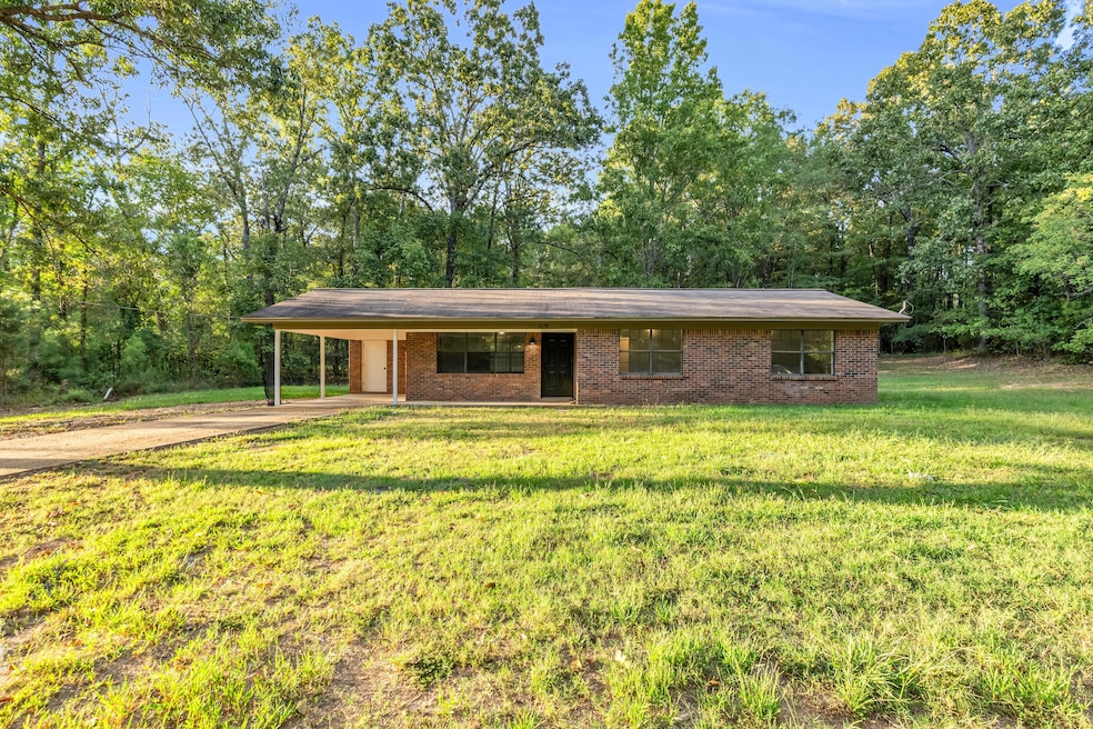
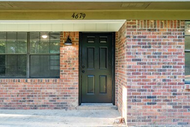
4679 Lagrange Rd Mathiston, MS 39752
Estimated payment $812/month
Total Views
5,587
3
Beds
1
Bath
1,057
Sq Ft
$137
Price per Sq Ft
Highlights
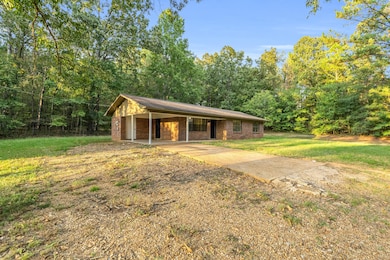
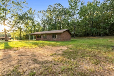
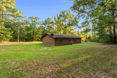
- Ranch Style House
- Ackerman Elementary School Rated A
- Brick Veneer
About This Home
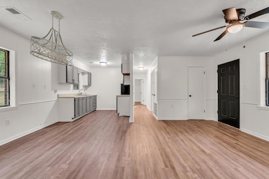
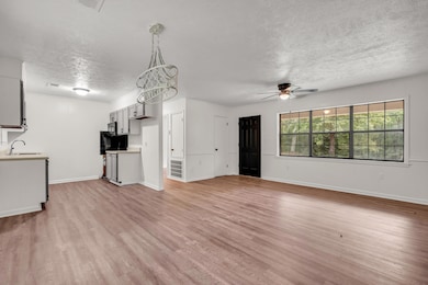
Modern updates, peaceful setting - move-in ready! This 3-bedroom, 1 bath home has been fully remodeled inside, offering a fresh and modern feel throughout. Inside you will find a bright, open layout with updated finished. Nestled on 1.1 acres in a peaceful country setting, this property provides plenty of space to enjoy the outdoors. Whether you are looking for your first home, downsizing, or investing, this property is a smart choice with tons of potential.
Home Details
Home Type
- Single Family
Est. Annual Taxes
- $441
Year Built
- Built in 1984
Lot Details
- 1.1 Acre Lot
Home Design
- 1,057 Sq Ft Home
- Ranch Style House
- Brick Veneer
- Slab Foundation
Bedrooms and Bathrooms
- 3 Bedrooms
- 1 Full Bathroom
Utilities
- Electric Water Heater
- Septic Tank
Listing and Financial Details
- Assessor Parcel Number 010 0017 000200
Map
Create a Home Valuation Report for This Property
The Home Valuation Report is an in-depth analysis detailing your home's value as well as a comparison with similar homes in the area
Tax History
| Year | Tax Paid | Tax Assessment Tax Assessment Total Assessment is a certain percentage of the fair market value that is determined by local assessors to be the total taxable value of land and additions on the property. | Land | Improvement |
|---|---|---|---|---|
| 2025 | -- | $6,827 | $565 | $6,262 |
| 2024 | -- | $5,211 | $565 | $4,646 |
| 2023 | $0 | $5,211 | $565 | $4,646 |
| 2022 | $0 | $5,211 | $565 | $4,646 |
| 2021 | $0 | $5,211 | $565 | $4,646 |
| 2020 | $0 | $5,211 | $565 | $4,646 |
| 2019 | $0 | $5,211 | $565 | $4,646 |
| 2018 | $0 | $5,211 | $565 | $4,646 |
| 2017 | -- | $5,240 | $565 | $4,675 |
| 2016 | -- | $4,975 | $565 | $4,410 |
| 2015 | -- | $4,975 | $565 | $4,410 |
| 2013 | -- | $5,541 | $565 | $4,976 |
Source: Public Records
Property History
| Date | Event | Price | List to Sale | Price per Sq Ft |
|---|---|---|---|---|
| 02/06/2026 02/06/26 | Price Changed | $144,900 | -3.4% | $137 / Sq Ft |
| 09/26/2025 09/26/25 | For Sale | $150,000 | -- | $142 / Sq Ft |
Source: Golden Triangle Association of REALTORS®
Purchase History
| Date | Type | Sale Price | Title Company |
|---|---|---|---|
| Warranty Deed | -- | -- |
Source: Public Records
Mortgage History
| Date | Status | Loan Amount | Loan Type |
|---|---|---|---|
| Open | $65,500 | USDA |
Source: Public Records
Source: Golden Triangle Association of REALTORS®
MLS Number: 25-2013
APN: 010-0017-0002000
Nearby Homes
- 0 Highway 82 W Unit 25-2325
- 0 Highway 82 W Unit 25-532
- 314 Natchez Trace Rd
- TBD Mississippi 15
- 0 Mississippi 15
- 195 Ticky Bend Rd
- 218 College St
- 16370 Mississippi 15
- 14549 U S 82
- 106 Corey’s Dr
- Reed Rd
- 220 Paisley Ln
- 1363 Spring Valley Rd
- 000 Ms-9
- 000 Hwy 9
- 0 N County Line Rd
- Lot 2 Mississippi 15
- Lot 3 Mississippi 15
- 4011 Mississippi 182
- 1799 Maben Starkville Rd
- 2573 Hawkins Rd
- 21 Player Ln
- 1300 Old Highway 12
- 103 Eudora Welty Dr
- 1087 Stark Rd
- 205 Dogwood Dr
- 104 Pilcher St
- 405 Sycamore St
- 300 Carver Dr
- 500 Louisville St
- 205 Lynn Ln
- 110 Lynn Ln
- 905 Louisville St
- 905 Louisville St
- 905 Louisville St
- 905 Louisville St
- 1200 Louisville St
- 1257 Louisville St Unit 21
- 1257 Louisville St Unit 11
- 1257 Louisville St Unit 3

Your Personal Tour Guide
Ask me questions while you tour the home.