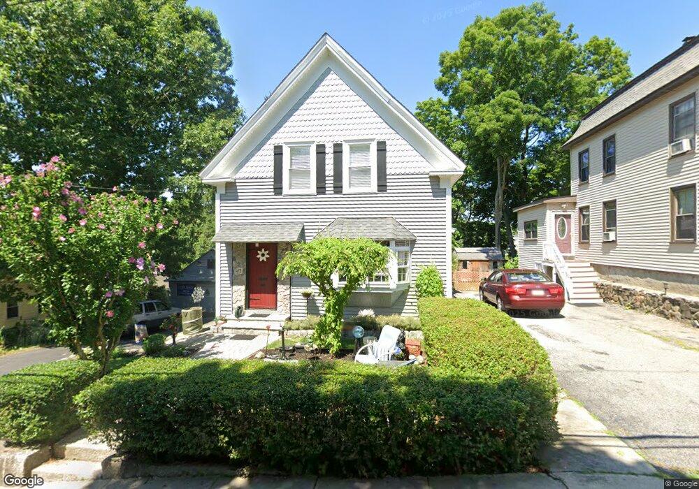
47 Claflin St Milford, MA 01757
Estimated Value: $490,000 - $511,000
3
Beds
2
Baths
1,461
Sq Ft
$345/Sq Ft
Est. Value
About This Home
This home is located at 47 Claflin St, Milford, MA 01757 and is currently estimated at $503,765, approximately $344 per square foot. 47 Claflin St is a home located in Worcester County with nearby schools including Milford High School and Bethany Christian Academy.
Ownership History
Date
Name
Owned For
Owner Type
Purchase Details
Closed on
May 14, 2024
Sold by
Robinson Leland E and Robinson Candace J
Bought by
Robinson Leland E and Robinson Candace J
Current Estimated Value
Purchase Details
Closed on
Feb 1, 1977
Bought by
Robinson Leland E and Robinson Candace J
Create a Home Valuation Report for This Property
The Home Valuation Report is an in-depth analysis detailing your home's value as well as a comparison with similar homes in the area
Home Values in the Area
Average Home Value in this Area
Purchase History
| Date | Buyer | Sale Price | Title Company |
|---|---|---|---|
| Robinson Leland E | -- | None Available | |
| Robinson Leland E | -- | None Available | |
| Robinson Leland E | -- | -- |
Source: Public Records
Mortgage History
| Date | Status | Borrower | Loan Amount |
|---|---|---|---|
| Previous Owner | Robinson Leland E | $10,000 | |
| Previous Owner | Robinson Leland E | $20,000 | |
| Previous Owner | Robinson Leland E | $10,000 |
Source: Public Records
Tax History Compared to Growth
Tax History
| Year | Tax Paid | Tax Assessment Tax Assessment Total Assessment is a certain percentage of the fair market value that is determined by local assessors to be the total taxable value of land and additions on the property. | Land | Improvement |
|---|---|---|---|---|
| 2025 | $5,576 | $435,600 | $152,100 | $283,500 |
| 2024 | $5,385 | $405,200 | $145,100 | $260,100 |
| 2023 | $5,254 | $363,600 | $122,100 | $241,500 |
| 2022 | $5,020 | $326,200 | $111,500 | $214,700 |
| 2021 | $5,318 | $291,800 | $111,500 | $180,300 |
| 2020 | $4,609 | $288,800 | $111,500 | $177,300 |
| 2019 | $27 | $233,500 | $111,500 | $122,000 |
| 2018 | $3,777 | $228,100 | $106,100 | $122,000 |
| 2017 | $3,553 | $211,600 | $106,100 | $105,500 |
| 2016 | $3,338 | $194,300 | $95,500 | $98,800 |
| 2015 | $3,298 | $187,900 | $92,000 | $95,900 |
Source: Public Records
Map
Nearby Homes
- 44 Grove St
- 61 Grove St
- 40 Chestnut St
- 50 S Main St
- 10-12 Orchard St
- 6 Park Terrace
- 48 S Bow St
- 18 Depot St
- 9 Ariana Cir Unit 9
- 7 Ariana Cir Unit 7
- 88 E Street Extension
- 4-6 State St
- 116 Adin St
- 9 Hillside Ave
- 106 Adin St
- 50 Lawrence St
- 30 Pleasant St
- 6 Jenpaul Way Unit B
- 59 Lawrence St
- 7 Madden Ave