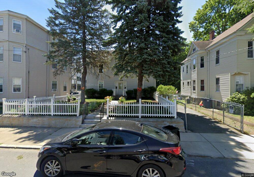
47 Florence St Unit 1 Roslindale, MA 02131
Roslindale NeighborhoodEstimated Value: $741,000 - $1,007,179
1
Bed
1
Bath
1,100
Sq Ft
$813/Sq Ft
Est. Value
About This Home
This home is located at 47 Florence St Unit 1, Roslindale, MA 02131 and is currently estimated at $894,295, approximately $812 per square foot. 47 Florence St Unit 1 is a home located in Suffolk County with nearby schools including Brooke Charter School Roslindale, Sacred Heart STEM School, and St. Clare High School.
Ownership History
Date
Name
Owned For
Owner Type
Purchase Details
Closed on
Nov 23, 1999
Sold by
Farrell James W
Bought by
Vasquez Federico and Vasque Reyna I
Current Estimated Value
Purchase Details
Closed on
Oct 20, 1998
Sold by
Guimond Mary
Bought by
Farrell James W
Purchase Details
Closed on
Jan 29, 1993
Sold by
Florence St T 47 and Larosa Joseph T
Bought by
Guimond Mary
Purchase Details
Closed on
Feb 15, 1991
Sold by
Miele Raymond J and Kozak Virginia F
Bought by
Florence St Tr 47
Create a Home Valuation Report for This Property
The Home Valuation Report is an in-depth analysis detailing your home's value as well as a comparison with similar homes in the area
Home Values in the Area
Average Home Value in this Area
Purchase History
| Date | Buyer | Sale Price | Title Company |
|---|---|---|---|
| Vasquez Federico | $232,000 | -- | |
| Vasquez Federico | $232,000 | -- | |
| Farrell James W | $170,000 | -- | |
| Guimond Mary | $153,000 | -- | |
| Florence St Tr 47 | $60,000 | -- | |
| Florence St Tr 47 | $20,000 | -- |
Source: Public Records
Mortgage History
| Date | Status | Borrower | Loan Amount |
|---|---|---|---|
| Open | Florence St Tr 47 | $292,100 | |
| Closed | Florence St Tr 47 | $25,000 |
Source: Public Records
Tax History Compared to Growth
Tax History
| Year | Tax Paid | Tax Assessment Tax Assessment Total Assessment is a certain percentage of the fair market value that is determined by local assessors to be the total taxable value of land and additions on the property. | Land | Improvement |
|---|---|---|---|---|
| 2025 | $9,503 | $820,600 | $349,200 | $471,400 |
| 2024 | $7,810 | $716,500 | $252,700 | $463,800 |
| 2023 | $7,399 | $688,900 | $242,900 | $446,000 |
| 2022 | $6,813 | $626,200 | $220,800 | $405,400 |
| 2021 | $6,551 | $614,000 | $216,500 | $397,500 |
| 2020 | $5,561 | $526,600 | $195,100 | $331,500 |
| 2019 | $5,235 | $496,700 | $157,500 | $339,200 |
| 2018 | $4,912 | $468,700 | $157,500 | $311,200 |
| 2017 | $4,864 | $459,300 | $157,500 | $301,800 |
| 2016 | $4,678 | $425,300 | $157,500 | $267,800 |
| 2015 | $4,222 | $348,600 | $142,100 | $206,500 |
| 2014 | $3,878 | $308,300 | $142,100 | $166,200 |
Source: Public Records
Map
Nearby Homes
- 67 Cummins Hwy Unit 101
- 108 Florence St Unit 3
- 108 Florence St Unit 4
- 250 Poplar St Unit 1
- 25 Crandall St
- 187 Florence St Unit 2L
- 27 Rowe St
- 65 Birch St Unit 3
- 16 Hilburn Place
- 15 S Fairview St Unit 3
- 80 Roslindale Ave Unit 3
- 142 Birch St
- 142 Birch St Unit 1
- 142 Birch St Unit 2
- 543 Hyde Park Ave Unit 1
- 142 Metropolitan Ave Unit A
- 112 Roslindale Ave Unit 2
- 103 Belgrade Ave Unit 2
- 69 Metropolitan Ave
- 55 Metropolitan Ave
- 47R Florence St
- 47 Florence St
- 73 Cummins Hwy Unit 73
- 75 Cummins Hwy Unit 73A
- 75 Cummins Hwy Unit 75
- 67 Cummins Hwy
- 67 Cummins Hwy Unit 104
- 67 Cummins Hwy Unit 304
- 67 Cummins Hwy Unit 204
- 67 Cummins Hwy Unit 201
- 67 Cummins Hwy Unit 303
- 67 Cummins Hwy Unit 302
- 67 Cummins Hwy Unit 103
- 67 Cummins Hwy Unit 102
- 67 Cummins Hwy Unit 301 aka 9
- 67 Cummins Hwy Unit 202 aka 6
- 67 Cummins Hwy Unit 203 aka 7
- 67 Cummins Hwy Unit 6
- 67 Cummins Hwy Unit 7
- 67 Cummins Hwy Unit 3