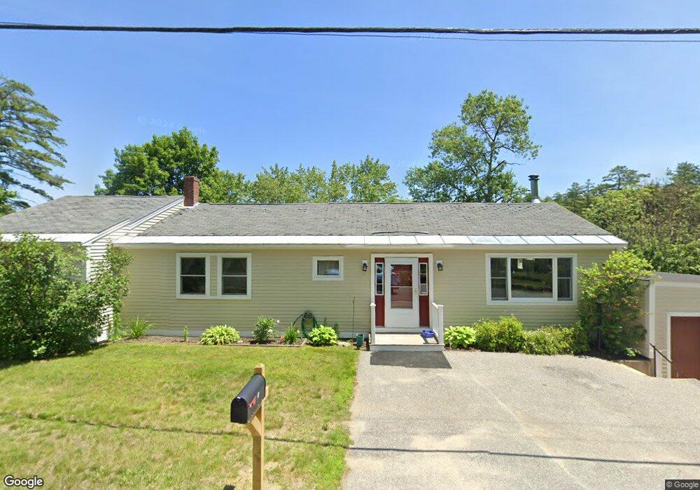
47 High St Bradford, NH 03221
Estimated Value: $548,000 - $608,421
3
Beds
2
Baths
2,017
Sq Ft
$286/Sq Ft
Est. Value
About This Home
This home is located at 47 High St, Bradford, NH 03221 and is currently estimated at $576,355, approximately $285 per square foot. 47 High St is a home located in Merrimack County with nearby schools including Kearsarge Regional Elementary School at Bradford, Kearsarge Regional Middle School, and Kearsarge Regional High School.
Ownership History
Date
Name
Owned For
Owner Type
Purchase Details
Closed on
Nov 16, 2011
Sold by
Household Finance Corp
Bought by
Losik Karen B and Raymond Robert
Current Estimated Value
Home Financials for this Owner
Home Financials are based on the most recent Mortgage that was taken out on this home.
Original Mortgage
$95,000
Interest Rate
3.92%
Mortgage Type
Purchase Money Mortgage
Purchase Details
Closed on
Sep 16, 2010
Sold by
Paine David R
Bought by
Household Finance Corp
Purchase Details
Closed on
Sep 16, 1996
Sold by
Garman Donald A and Garman Joan A
Bought by
Paine David R and Paine Ann C
Home Financials for this Owner
Home Financials are based on the most recent Mortgage that was taken out on this home.
Original Mortgage
$70,000
Interest Rate
8.18%
Mortgage Type
Purchase Money Mortgage
Create a Home Valuation Report for This Property
The Home Valuation Report is an in-depth analysis detailing your home's value as well as a comparison with similar homes in the area
Home Values in the Area
Average Home Value in this Area
Purchase History
We collect this data history from publicly available records. To have your information removed, we recommend requesting removal directly through your county’s website.
| Date | Buyer | Sale Price | Title Company |
|---|---|---|---|
| Losik Karen B | $125,000 | -- | |
| Household Finance Corp | $173,300 | -- | |
| Paine David R | $87,500 | -- |
Source: Public Records
Mortgage History
We collect this data history from publicly available records. To have your information removed, we recommend requesting removal directly through your county’s website.
| Date | Status | Borrower | Loan Amount |
|---|---|---|---|
| Open | Paine David R | $145,600 | |
| Closed | Paine David R | $95,000 | |
| Previous Owner | Paine David R | $70,000 |
Source: Public Records
Tax History
| Year | Tax Paid | Tax Assessment Tax Assessment Total Assessment is a certain percentage of the fair market value that is determined by local assessors to be the total taxable value of land and additions on the property. | Land | Improvement |
|---|---|---|---|---|
| 2025 | $10,269 | $608,000 | $338,500 | $269,500 |
| 2024 | $9,564 | $608,000 | $338,500 | $269,500 |
| 2023 | $8,351 | $300,400 | $143,500 | $156,900 |
| 2022 | $7,417 | $300,400 | $143,500 | $156,900 |
| 2021 | $7,183 | $300,400 | $143,500 | $156,900 |
| 2020 | $7,168 | $300,400 | $143,500 | $156,900 |
| 2019 | $6,433 | $230,500 | $95,100 | $135,400 |
| 2018 | $6,231 | $231,200 | $95,100 | $136,100 |
| 2017 | $6,104 | $231,200 | $95,100 | $136,100 |
| 2016 | $6,104 | $231,200 | $95,100 | $136,100 |
| 2015 | $6,233 | $231,200 | $95,100 | $136,100 |
| 2014 | $5,659 | $243,200 | $111,600 | $131,600 |
| 2013 | $5,453 | $243,200 | $111,600 | $131,600 |
Source: Public Records
Map
Nearby Homes
- 37 High St
- 17 Fairgrounds Rd
- 12 Church St
- 55 Water St
- 123 E Main St
- 00 Route 114 Unit 83
- 3 Cheney Hill Rd
- 311 Fairgrounds Rd
- 44 Pleasant View Rd
- 67 Pleasant View Rd
- 9 Wooddale Cir
- 5 Twin Oaks Rd
- 67 Breezy Hill Rd
- 534 Gillingham Dr
- 7 Newell Rd
- 74 N Ridge Rd
- 0 Bagley Hill Rd Unit 5066107
- 377 Sutton Rd
- 214 Winding Brook Rd
- 21 Crittenden Rd
Your Personal Tour Guide
Ask me questions while you tour the home.