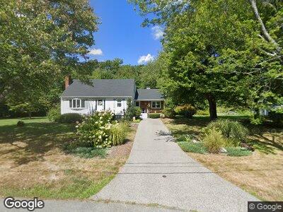
47 Ponderosa Dr Hanover, MA 02339
Estimated Value: $657,740 - $748,000
3
Beds
3
Baths
1,865
Sq Ft
$372/Sq Ft
Est. Value
About This Home
This home is located at 47 Ponderosa Dr, Hanover, MA 02339 and is currently estimated at $694,580, approximately $372 per square foot. 47 Ponderosa Dr is a home located in Plymouth County with nearby schools including Hanover High School, Calvary Chapel Academy, and Holy Family Elementary School.
Ownership History
Date
Name
Owned For
Owner Type
Purchase Details
Closed on
May 8, 2013
Sold by
Oconnell Marcia E
Bought by
Oconnell T T and Oconnell O
Current Estimated Value
Home Financials for this Owner
Home Financials are based on the most recent Mortgage that was taken out on this home.
Original Mortgage
$245,000
Interest Rate
3.55%
Mortgage Type
Stand Alone Refi Refinance Of Original Loan
Create a Home Valuation Report for This Property
The Home Valuation Report is an in-depth analysis detailing your home's value as well as a comparison with similar homes in the area
Home Values in the Area
Average Home Value in this Area
Purchase History
| Date | Buyer | Sale Price | Title Company |
|---|---|---|---|
| Oconnell T T | -- | -- | |
| Oconnell T T | -- | -- |
Source: Public Records
Mortgage History
| Date | Status | Borrower | Loan Amount |
|---|---|---|---|
| Open | Oconnell T | $310,000 | |
| Closed | Oconnell T | $51,400 | |
| Closed | Oconnell T | $45,100 | |
| Closed | Oconnell T | $339,200 | |
| Closed | Oconnell T | $100,000 | |
| Closed | Oconnell Marcia E | $245,000 | |
| Previous Owner | Oconnell Thomas E | $52,000 |
Source: Public Records
Tax History Compared to Growth
Tax History
| Year | Tax Paid | Tax Assessment Tax Assessment Total Assessment is a certain percentage of the fair market value that is determined by local assessors to be the total taxable value of land and additions on the property. | Land | Improvement |
|---|---|---|---|---|
| 2025 | $7,408 | $599,800 | $270,800 | $329,000 |
| 2024 | $7,240 | $563,900 | $270,800 | $293,100 |
| 2023 | $6,931 | $513,800 | $246,100 | $267,700 |
| 2022 | $7,235 | $474,400 | $246,100 | $228,300 |
| 2021 | $7,066 | $432,700 | $212,600 | $220,100 |
| 2020 | $6,997 | $429,000 | $212,600 | $216,400 |
| 2019 | $6,579 | $400,900 | $212,600 | $188,300 |
| 2018 | $6,466 | $397,200 | $212,600 | $184,600 |
| 2017 | $6,223 | $376,700 | $212,500 | $164,200 |
| 2016 | $6,088 | $361,100 | $193,200 | $167,900 |
| 2015 | $5,711 | $353,600 | $193,200 | $160,400 |
Source: Public Records
Map
Nearby Homes
- 385 Whiting St
- 23 Hobart Ln
- 1163 Webster St
- 481 Pond St
- 435 Hingham St
- 454 Hingham St
- 18 Midfield Dr
- 618 Hingham St
- 6 Corn Mill Way
- 687 Hingham St
- 11 Holly Ct
- 652 Liberty St Unit 1
- 51 Gardner Way
- 92-94 Stanton St
- 227 Myrtle St
- 3 Boxberry Ln
- 31 Davis St
- 583-585 Union St
- 21 Liberty Ct
- 18 John Adams Dr
- 47 Ponderosa Dr
- 37 Ponderosa Dr
- 59 Ponderosa Dr
- 40 Ponderosa Dr
- 28 Foxtail Rd
- 58 Ponderosa Dr
- 71 Ponderosa Dr
- 570 Whiting St
- 70 Ponderosa Dr
- 33 Foxtail Rd
- 554 Whiting St
- 14 Foxtail Rd
- 83 Ponderosa Dr
- 22 Ponderosa Dr
- 320 Ponderosa Dr
- 82 Ponderosa Dr
- 329 Ponderosa Dr
- 25 Foxtail Rd
- 542 Whiting St
- 58 Oldfield Dr