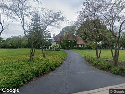
470 King Muir Rd Lake Forest, IL 60045
Estimated Value: $1,929,809 - $2,098,000
6
Beds
7
Baths
5,754
Sq Ft
$347/Sq Ft
Est. Value
About This Home
This home is located at 470 King Muir Rd, Lake Forest, IL 60045 and is currently estimated at $1,998,936, approximately $347 per square foot. 470 King Muir Rd is a home located in Lake County with nearby schools including Deer Path Middle School East, Everett Elementary School, and Lake Forest High School.
Ownership History
Date
Name
Owned For
Owner Type
Purchase Details
Closed on
Dec 28, 2017
Sold by
Revocabl Carter Scott D and Revocabl Scott Demarest Carter
Bought by
Pollard Kenneth G and Pollard Beth
Current Estimated Value
Home Financials for this Owner
Home Financials are based on the most recent Mortgage that was taken out on this home.
Original Mortgage
$1,144,000
Interest Rate
3.62%
Mortgage Type
Adjustable Rate Mortgage/ARM
Purchase Details
Closed on
Jun 28, 2013
Sold by
Duffy Mary N
Bought by
Revocabl Carter Scott D and Revocabl Scott Demarest Carter
Home Financials for this Owner
Home Financials are based on the most recent Mortgage that was taken out on this home.
Original Mortgage
$850,000
Interest Rate
3.5%
Mortgage Type
Adjustable Rate Mortgage/ARM
Create a Home Valuation Report for This Property
The Home Valuation Report is an in-depth analysis detailing your home's value as well as a comparison with similar homes in the area
Home Values in the Area
Average Home Value in this Area
Purchase History
| Date | Buyer | Sale Price | Title Company |
|---|---|---|---|
| Pollard Kenneth G | $1,430,000 | Chicago Title | |
| Revocabl Carter Scott D | $1,000,000 | None Available |
Source: Public Records
Mortgage History
| Date | Status | Borrower | Loan Amount |
|---|---|---|---|
| Open | Pollard Kenneth G | $1,135,000 | |
| Closed | Pollard Kenneth G | $1,171,000 | |
| Closed | Pollard Kenneth G | $135,400 | |
| Closed | Pollard Kenneth G | $1,144,000 | |
| Closed | Pollard Kenneth G | $71,500 | |
| Previous Owner | Carter Scott D | $59,000 | |
| Previous Owner | Carter Scott D | $833,500 | |
| Previous Owner | Carter Scott D | $840,000 | |
| Previous Owner | Revocabl Carter Scott D | $850,000 | |
| Previous Owner | Duffy Mary N | $250,000 | |
| Previous Owner | Duffy Mary N | $294,000 |
Source: Public Records
Tax History Compared to Growth
Tax History
| Year | Tax Paid | Tax Assessment Tax Assessment Total Assessment is a certain percentage of the fair market value that is determined by local assessors to be the total taxable value of land and additions on the property. | Land | Improvement |
|---|---|---|---|---|
| 2024 | $28,487 | $548,194 | $183,455 | $364,739 |
| 2023 | $27,203 | $459,401 | $153,740 | $305,661 |
| 2022 | $27,203 | $455,213 | $152,338 | $302,875 |
| 2021 | $26,393 | $451,287 | $151,024 | $300,263 |
| 2020 | $27,769 | $486,989 | $151,859 | $335,130 |
| 2019 | $24,993 | $478,049 | $149,071 | $328,978 |
| 2018 | $25,150 | $476,619 | $184,588 | $292,031 |
| 2017 | $26,597 | $539,631 | $181,502 | $358,129 |
| 2016 | $25,449 | $513,640 | $172,760 | $340,880 |
| 2015 | $23,137 | $424,855 | $162,674 | $262,181 |
| 2014 | $17,733 | $330,434 | $146,048 | $184,386 |
| 2012 | $20,336 | $386,838 | $147,315 | $239,523 |
Source: Public Records
Map
Nearby Homes
- 811 Larchmont Ln
- 681 Halligan Cir
- 380 Deerpath Square
- 910 Lane Lorraine
- 206 Warwick Rd
- 205 N Savanna Ct
- 172 N Ridge Rd
- 30 Rue Foret
- Lot 5 Whitehall Ln
- Lot 7 Whitehall Ln
- Lot 8 Whitehall Ln
- Lot 6 Whitehall Ln
- Lot 4 Whitehall Ln
- Lot 9 Whitehall Ln
- 1700 Cornell Ct
- 1717 Marquette Ct
- 1106 Winwood Dr
- 1770 Westbridge Cir
- 1200 Winwood Dr
- 720 W Tamarack Trail
- 470 King Muir Rd
- 995 Northcliffe Way
- 980 Parkmead Ln
- 977 Parkmead Ln
- 970 Northcliffe Way
- 500 King Muir Rd
- 990 Northcliffe Way
- 983 Parkmead Ln
- 440 King Muir Rd
- 966 W Deerpath
- 535 N Waukegan Rd
- 435 King Muir Rd
- 550 King Muir Rd
- 975 Inverlieth Terrace
- 990 W Deerpath
- 460 N Waukegan Rd
- 987 Inverlieth Terrace
- 440 N Waukegan Rd Unit 1
- 890 W Deerpath
- 1024 W Deerpath