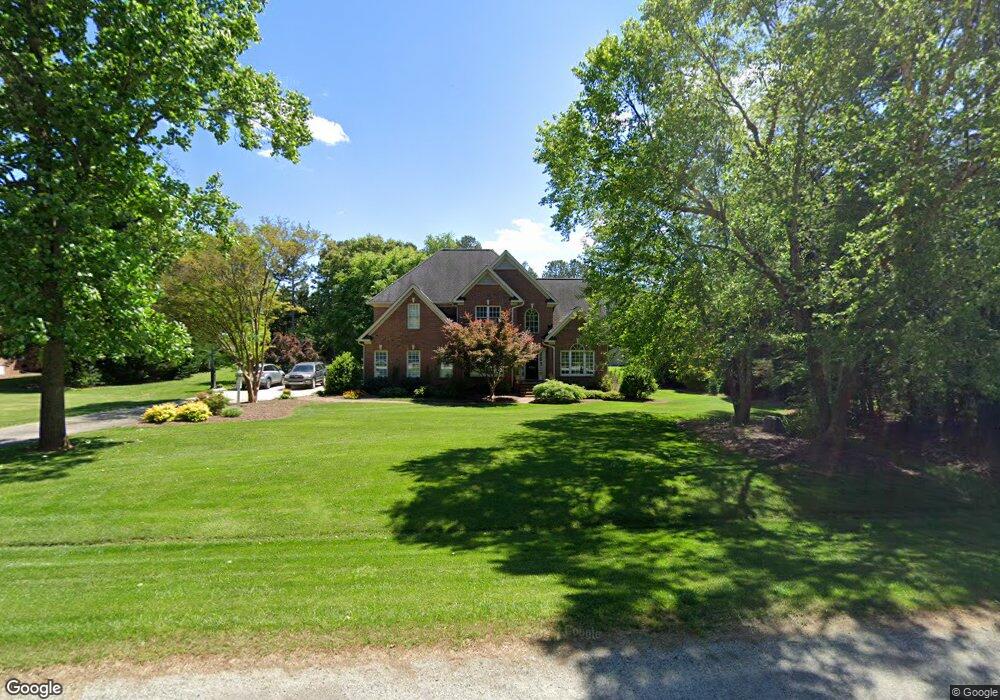
4702 Laurel Oaks Dr Greensboro, NC 27406
Estimated Value: $445,000 - $526,000
3
Beds
3
Baths
2,583
Sq Ft
$186/Sq Ft
Est. Value
About This Home
This home is located at 4702 Laurel Oaks Dr, Greensboro, NC 27406 and is currently estimated at $479,310, approximately $185 per square foot. 4702 Laurel Oaks Dr is a home located in Guilford County with nearby schools including Alamance Elementary School, Southeast Guilford Middle School, and Southeast Guilford High School.
Ownership History
Date
Name
Owned For
Owner Type
Purchase Details
Closed on
Feb 5, 1999
Sold by
Davis Stephen L and Davis April E
Bought by
Fousek Anton Palmer and Fousek Carole Cockman
Current Estimated Value
Home Financials for this Owner
Home Financials are based on the most recent Mortgage that was taken out on this home.
Original Mortgage
$203,000
Outstanding Balance
$56,111
Interest Rate
6.8%
Estimated Equity
$423,199
Create a Home Valuation Report for This Property
The Home Valuation Report is an in-depth analysis detailing your home's value as well as a comparison with similar homes in the area
Home Values in the Area
Average Home Value in this Area
Purchase History
| Date | Buyer | Sale Price | Title Company |
|---|---|---|---|
| Fousek Anton Palmer | $36,000 | -- | |
| Davis Stephen L | -- | -- |
Source: Public Records
Mortgage History
| Date | Status | Borrower | Loan Amount |
|---|---|---|---|
| Open | Fousek Anton Palmer | $203,000 |
Source: Public Records
Tax History Compared to Growth
Tax History
| Year | Tax Paid | Tax Assessment Tax Assessment Total Assessment is a certain percentage of the fair market value that is determined by local assessors to be the total taxable value of land and additions on the property. | Land | Improvement |
|---|---|---|---|---|
| 2025 | $3,231 | $364,700 | $100,000 | $264,700 |
| 2024 | $3,231 | $364,700 | $100,000 | $264,700 |
| 2023 | $3,231 | $364,700 | $100,000 | $264,700 |
| 2022 | $3,231 | $364,700 | $100,000 | $264,700 |
| 2021 | $2,349 | $265,100 | $60,000 | $205,100 |
| 2020 | $2,255 | $265,100 | $60,000 | $205,100 |
| 2019 | $2,249 | $265,100 | $0 | $0 |
| 2018 | $2,238 | $265,100 | $0 | $0 |
| 2017 | $2,201 | $265,100 | $0 | $0 |
| 2016 | $2,218 | $259,500 | $0 | $0 |
| 2015 | $2,231 | $259,500 | $0 | $0 |
| 2014 | $2,257 | $259,500 | $0 | $0 |
Source: Public Records
Map
Nearby Homes
- 4116 & 4120 SE School Rd
- 4507 Oakmoor Dr
- 3927 Fox Grove Trail
- 4581 Worthing Chase Dr
- 4502 Whitby Place
- 3806 SE School Rd
- 4407 Bromley Dr
- 4502 Bromley Dr
- 4704 Chesterton Dr
- 4300 Comanche Trail
- 3803 Oakcliffe Rd
- 5004 Renville Dr
- 2360, 2372 Alamance Church Rd
- 4610 Harwood Rd
- 4600 Harwood Rd
- 4601 Harwood Rd
- 4508 Brookhaven Dr
- 5400/5308/5306 Register Rd
- 4502 Brookhaven Dr
- 5001 Robert Andrew Rd
- 4401 Shaw Farm Cir
- 4705 Bell Tower Ct
- 4703 Bell Tower Ct
- 4403 Shaw Farm Cir
- 4305 Shaw Farm Cir
- 4707 Bell Tower Ct
- 4706 Laurel Oaks Dr
- 4703 Laurel Oaks Dr
- 4701 Bell Tower Ct
- 4800 Laurel Oaks Dr
- 4400 Shaw Farm Cir
- 4119 Southeast Dr
- 4304 Shaw Farm Cir
- 4405 Shaw Farm Cir
- 4303 Shaw Farm Cir
- 4705 Laurel Oaks Dr
- 4802 Laurel Oaks Dr
- 4700 Bell Tower Ct
- 4402 Shaw Farm Cir
- 4709 Laurel Oaks Dr