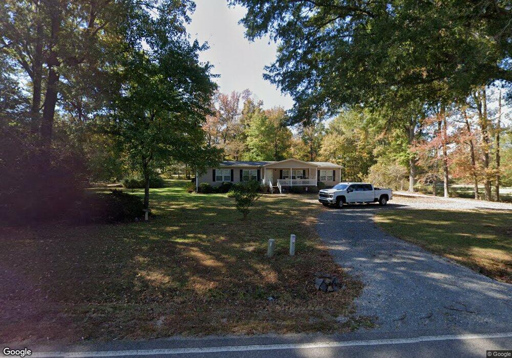
4709 Tom Starnes Rd Waxhaw, NC 28173
Estimated Value: $190,000 - $377,000
3
Beds
1
Bath
1,782
Sq Ft
$170/Sq Ft
Est. Value
About This Home
This home is located at 4709 Tom Starnes Rd, Waxhaw, NC 28173 and is currently estimated at $302,178, approximately $169 per square foot. 4709 Tom Starnes Rd is a home located in Union County with nearby schools including Prospect Elementary School, Parkwood Middle School, and Parkwood High School.
Ownership History
Date
Name
Owned For
Owner Type
Purchase Details
Closed on
Nov 22, 2010
Sold by
Summers James D and Summers Barbara A
Bought by
Phillips Tammy
Current Estimated Value
Purchase Details
Closed on
Dec 16, 1998
Sold by
Crenshaw Ruby Lee
Bought by
Summers James D and Summers Barbara A
Home Financials for this Owner
Home Financials are based on the most recent Mortgage that was taken out on this home.
Original Mortgage
$5,000
Interest Rate
6.72%
Mortgage Type
Seller Take Back
Create a Home Valuation Report for This Property
The Home Valuation Report is an in-depth analysis detailing your home's value as well as a comparison with similar homes in the area
Home Values in the Area
Average Home Value in this Area
Purchase History
| Date | Buyer | Sale Price | Title Company |
|---|---|---|---|
| Phillips Tammy | -- | None Available | |
| Summers James D | $25,000 | -- |
Source: Public Records
Mortgage History
| Date | Status | Borrower | Loan Amount |
|---|---|---|---|
| Previous Owner | Summers James D | $5,000 |
Source: Public Records
Tax History Compared to Growth
Tax History
| Year | Tax Paid | Tax Assessment Tax Assessment Total Assessment is a certain percentage of the fair market value that is determined by local assessors to be the total taxable value of land and additions on the property. | Land | Improvement |
|---|---|---|---|---|
| 2024 | $757 | $118,600 | $28,800 | $89,800 |
| 2023 | $745 | $118,600 | $28,800 | $89,800 |
| 2022 | $745 | $118,600 | $28,800 | $89,800 |
| 2021 | $732 | $118,600 | $28,800 | $89,800 |
| 2020 | $746 | $96,670 | $19,770 | $76,900 |
| 2019 | $807 | $96,670 | $19,770 | $76,900 |
| 2018 | $0 | $96,670 | $19,770 | $76,900 |
| 2017 | $855 | $96,700 | $19,800 | $76,900 |
| 2016 | $803 | $96,670 | $19,770 | $76,900 |
| 2015 | $814 | $96,670 | $19,770 | $76,900 |
| 2014 | $255 | $111,620 | $37,340 | $74,280 |
Source: Public Records
Map
Nearby Homes
- 5105 Tom Starnes Rd
- 7517 Lancaster Hwy Unit 5
- 7517 Lancaster Hwy
- 7513 Lancaster Hwy Unit 6
- 7513 Lancaster Hwy
- Roanoke Plan at Lancaster Hwy
- Charleston Plan at Lancaster Hwy
- 0 Potter Rd S Unit CAR4189519
- 0 Potter Rd S Unit CAR4189518
- 0 Potter Rd S Unit 3 CAR4189516
- 0 Potter Rd S Unit 2 CAR4189515
- 0 Potter Rd S Unit 1 CAR4189512
- 110 Serenity Creek Dr
- 106 Serenity Creek Dr
- 5904 Nesbit Rd
- 8109 Cane Pointe Ln
- 8121 Cane Pointe Ln
- 7006 Nesbit Rd
- 6419 Lancaster Hwy Unit 9, 19
- 5313 Old Highway Rd
- 4701 Tom Starnes Rd
- 4719 Tom Starnes Rd
- 4801 Tom Starnes Rd
- 4801 Tom Starnes Rd
- 4722 Tom Starnes Rd
- 4725 Tom Starnes Rd
- 0000 Mcwhorter Rd
- 0 Mcwhorter Rd
- 00000 Mcwhorter Rd
- 00 Mcwhorter Rd
- 0000 Mcwhorter Rd Unit Lot 7
- 0000 Mcwhorter Rd Unit 7
- 4623 Tom Starnes Rd
- 4624 Tom Starnes Rd
- 3609 Mary Elizabeth Church Rd
- 4617 Tom Starnes Rd
- 4616 Tom Starnes Rd
- 3521 Mary Elizabeth Church Rd
- 4620 Tom Starnes Rd
- 4815 Tom Starnes Rd