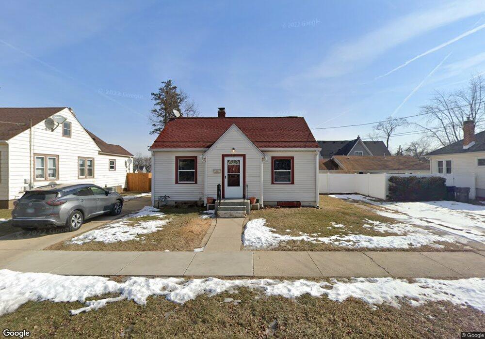
471 Illinois Ave Elgin, IL 60120
Southeast Elgin NeighborhoodEstimated Value: $212,000 - $248,000
3
Beds
1
Bath
1,008
Sq Ft
$230/Sq Ft
Est. Value
About This Home
This home is located at 471 Illinois Ave, Elgin, IL 60120 and is currently estimated at $231,499, approximately $229 per square foot. 471 Illinois Ave is a home located in Kane County with nearby schools including Huff Elementary School, Ellis Middle School, and Elgin High School.
Ownership History
Date
Name
Owned For
Owner Type
Purchase Details
Closed on
Oct 14, 2002
Sold by
Baker Judith Ann
Bought by
Ortiz Arturo and Ortiz Yolanda M
Current Estimated Value
Home Financials for this Owner
Home Financials are based on the most recent Mortgage that was taken out on this home.
Original Mortgage
$130,173
Outstanding Balance
$54,654
Interest Rate
6.18%
Mortgage Type
FHA
Estimated Equity
$176,845
Purchase Details
Closed on
Jul 22, 1994
Sold by
Otte Irvin M
Bought by
Baker Judith Ann
Create a Home Valuation Report for This Property
The Home Valuation Report is an in-depth analysis detailing your home's value as well as a comparison with similar homes in the area
Home Values in the Area
Average Home Value in this Area
Purchase History
| Date | Buyer | Sale Price | Title Company |
|---|---|---|---|
| Ortiz Arturo | $135,000 | First American Title Co | |
| Baker Judith Ann | -- | -- |
Source: Public Records
Mortgage History
| Date | Status | Borrower | Loan Amount |
|---|---|---|---|
| Open | Ortiz Arturo | $130,173 |
Source: Public Records
Tax History
| Year | Tax Paid | Tax Assessment Tax Assessment Total Assessment is a certain percentage of the fair market value that is determined by local assessors to be the total taxable value of land and additions on the property. | Land | Improvement |
|---|---|---|---|---|
| 2024 | $4,259 | $53,220 | $9,827 | $43,393 |
| 2023 | $4,099 | $48,080 | $8,878 | $39,202 |
| 2022 | $3,801 | $43,840 | $8,095 | $35,745 |
| 2021 | $3,657 | $40,987 | $7,568 | $33,419 |
| 2020 | $3,430 | $37,610 | $7,225 | $30,385 |
| 2019 | $3,346 | $35,826 | $6,882 | $28,944 |
| 2018 | $3,242 | $32,794 | $6,483 | $26,311 |
| 2017 | $3,189 | $31,002 | $6,129 | $24,873 |
| 2016 | $3,067 | $28,761 | $5,686 | $23,075 |
| 2015 | -- | $26,362 | $5,212 | $21,150 |
| 2014 | -- | $26,037 | $5,148 | $20,889 |
| 2013 | -- | $30,508 | $5,284 | $25,224 |
Source: Public Records
Map
Nearby Homes
- 689 Bent St
- 631 Bent St
- 513 Cookane Ave
- 457 Arlington Ave
- 450 Villa St
- 518 Raymond St
- 483 Barrett St
- 332-334 St Charles St
- 445 Lucile Ave
- 262 Bartlett Place
- 286 Villa St
- 277 Gifford Place
- 385 Woodview Cir Unit B
- 115 N Porter St
- 833 Forest Ave
- 162 Festival Ct
- 7 National St Unit 7
- 3 National St Unit 3
- 211 Prairie St
- 216 Prairie St
Your Personal Tour Guide
Ask me questions while you tour the home.