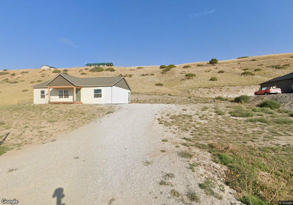
471 Lower Deep Creek Rd Townsend, MT 59644
Estimated Value: $376,000 - $790,000
3
Beds
2
Baths
1,500
Sq Ft
$343/Sq Ft
Est. Value
About This Home
This home is located at 471 Lower Deep Creek Rd, Townsend, MT 59644 and is currently estimated at $514,956, approximately $343 per square foot. 471 Lower Deep Creek Rd is a home located in Broadwater County with nearby schools including Cecelia Hazelton School, Townsend Junior High School, and Broadwater High School.
Ownership History
Date
Name
Owned For
Owner Type
Purchase Details
Closed on
Sep 30, 2025
Sold by
Jalken Llc
Bought by
Smith Hunter and Cook Mackenzie
Current Estimated Value
Home Financials for this Owner
Home Financials are based on the most recent Mortgage that was taken out on this home.
Original Mortgage
$379,050
Outstanding Balance
$378,373
Interest Rate
6.58%
Mortgage Type
New Conventional
Estimated Equity
$136,583
Purchase Details
Closed on
May 28, 2024
Sold by
Schaible Travis and Schaible Kelly
Bought by
Jalken Llc
Purchase Details
Closed on
Apr 7, 2021
Sold by
Stanek and Cindy
Bought by
Schaible Travis
Home Financials for this Owner
Home Financials are based on the most recent Mortgage that was taken out on this home.
Original Mortgage
$37,500
Interest Rate
2.9%
Mortgage Type
Construction
Create a Home Valuation Report for This Property
The Home Valuation Report is an in-depth analysis detailing your home's value as well as a comparison with similar homes in the area
Purchase History
| Date | Buyer | Sale Price | Title Company |
|---|---|---|---|
| Smith Hunter | $473,813 | Rocky Mountain Title | |
| Jalken Llc | -- | Rocky Mtn Title Gnty | |
| Schaible Travis | $46,875 | Rocky Mountain Title |
Source: Public Records
Mortgage History
| Date | Status | Borrower | Loan Amount |
|---|---|---|---|
| Open | Smith Hunter | $379,050 | |
| Previous Owner | Schaible Travis | $37,500 |
Source: Public Records
Tax History
| Year | Tax Paid | Tax Assessment Tax Assessment Total Assessment is a certain percentage of the fair market value that is determined by local assessors to be the total taxable value of land and additions on the property. | Land | Improvement |
|---|---|---|---|---|
| 2025 | $1,384 | $356,800 | $0 | $0 |
| 2024 | $194 | $29,468 | $0 | $0 |
| 2023 | $200 | $29,468 | $0 | $0 |
| 2022 | $290 | $37,046 | $0 | $0 |
| 2021 | $279 | $37,046 | $0 | $0 |
| 2020 | $205 | $27,088 | $0 | $0 |
| 2019 | $179 | $27,088 | $0 | $0 |
| 2018 | $245 | $34,752 | $0 | $0 |
| 2017 | $236 | $34,752 | $0 | $0 |
| 2016 | $271 | $39,780 | $0 | $0 |
| 2015 | $275 | $39,780 | $0 | $0 |
Source: Public Records
Map
Nearby Homes
- 460 Lower Deep Creek Rd
- 225 Skyview Ln
- 157 Skyview Ln
- 52 Diamond Gulch Rd
- 312 Sandhill Ln
- 34 Sharon Loop
- Lot 18 Sharon Loop
- 12 Woodchuck Loop
- Lot 30 Stoney Trail
- 37 Baldy View Ln
- 21 Stoney Trail
- 36 Carroll Dr
- Lot 16 Windy Meadow Dr
- 27 Sautter Ln
- 313 S Harrison Ave
- 71 Fritsche Ln
- 10 Sautter Ln
- 612 S Oak St
- 102 Centennial Ln
- 508 S Walnut St
- TBD 12A Lower Deep Creek Rd
- 433 Lower Deep Creek Rd
- 0 Lower Deep Creek Rd
- 001 Lower Deep Creek Rd
- 18 Lower Deep Creek Rd
- TBD Lot 21D Lower Deep Creek Rd
- TBD Lot 21C Lower Deep Creek Rd
- TBD Lot 12 A Lower Deep Creek Rd
- TBD Lot 12A Lower Deep Creek Rd
- 468 Lower Deep Creek Rd
- TBD Lot 12B Lower Deep Creek Rd
- Lot 11B Skyview Ln
- 485 Lower Deep Creek Rd
- 484 Lower Deep Creek Rd
- Lot 14 A Skyview Ln
- Lot 21B Sky View Ln
- Lot 22B Sky View Ln
- Lot 25C Sky View Ln
- Lot 25A Sky View Ln
Your Personal Tour Guide
Ask me questions while you tour the home.