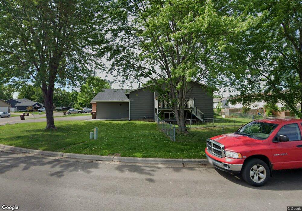
471 Tiffany Dr Hastings, MN 55033
Hastings-Marshan Township NeighborhoodEstimated Value: $245,000 - $282,994
4
Beds
2
Baths
872
Sq Ft
$297/Sq Ft
Est. Value
About This Home
This home is located at 471 Tiffany Dr, Hastings, MN 55033 and is currently estimated at $259,249, approximately $297 per square foot. 471 Tiffany Dr is a home located in Dakota County with nearby schools including Kennedy Elementary School, Hastings Middle School, and Hastings High School.
Ownership History
Date
Name
Owned For
Owner Type
Purchase Details
Closed on
Jun 27, 2008
Sold by
Bank Of New York
Bought by
Lipinski Robin and Lipinski Lisa
Current Estimated Value
Purchase Details
Closed on
Sep 1, 2005
Sold by
Cain Scott
Bought by
Forrest Chad C
Purchase Details
Closed on
May 24, 2002
Sold by
Mccoy Sheryl L
Bought by
Cain Scott L and Cain Shawna M
Purchase Details
Closed on
Aug 18, 2000
Sold by
Garloff Darren L and Garloff Holly A
Bought by
Mccoy Sheryl L
Create a Home Valuation Report for This Property
The Home Valuation Report is an in-depth analysis detailing your home's value as well as a comparison with similar homes in the area
Home Values in the Area
Average Home Value in this Area
Purchase History
| Date | Buyer | Sale Price | Title Company |
|---|---|---|---|
| Lipinski Robin | $80,000 | -- | |
| Forrest Chad C | $162,902 | -- | |
| Cain Scott L | $138,900 | -- | |
| Mccoy Sheryl L | $124,900 | -- |
Source: Public Records
Tax History Compared to Growth
Tax History
| Year | Tax Paid | Tax Assessment Tax Assessment Total Assessment is a certain percentage of the fair market value that is determined by local assessors to be the total taxable value of land and additions on the property. | Land | Improvement |
|---|---|---|---|---|
| 2024 | $2,692 | $232,700 | $40,200 | $192,500 |
| 2023 | $2,556 | $233,000 | $40,200 | $192,800 |
| 2022 | $2,304 | $227,700 | $40,100 | $187,600 |
| 2021 | $2,182 | $187,100 | $34,900 | $152,200 |
| 2020 | $2,194 | $176,000 | $33,200 | $142,800 |
| 2019 | $2,100 | $171,000 | $31,700 | $139,300 |
| 2018 | $1,990 | $155,300 | $30,100 | $125,200 |
| 2017 | $1,844 | $142,100 | $28,700 | $113,400 |
| 2016 | $1,810 | $131,000 | $26,800 | $104,200 |
| 2015 | $1,596 | $125,300 | $26,000 | $99,300 |
| 2014 | -- | $111,100 | $25,100 | $86,000 |
| 2013 | -- | $100,200 | $22,700 | $77,500 |
Source: Public Records
Map
Nearby Homes
- 3575 Vermillion St
- 3525 Vermillion St
- 235 Tiffany Dr
- 365 Hayes Dr Unit 30
- 3525 Douglas Dr
- 182 Sandpiper Cir
- 3200 Malcolm Ave
- 753 Greten Ln
- 782 31st St W
- 115 Kinglet Dr
- 1942 Eddy St
- 2000 Forest St
- 4198 Starling Dr
- 1163 Teal Way
- 2021 Pine St
- 545 Tuttle Dr
- 416 19th St W
- 3125 Village Trail Unit 217
- 528 17th St E
- 2211 Glacier Way
- 469 Tiffany Dr
- 501 Tiffany Dr
- 463 Tiffany Dr
- 503 Tiffany Dr
- 507 Tiffany Dr
- 419 Cari Park Ln
- 509 Tiffany Dr
- 419 419 Cari Park Ln
- 472 Tiffany Dr
- 474 Tiffany Dr
- 476 Tiffany Dr
- 457 Tiffany Dr
- 428 Cari Park Ln
- 513 Tiffany Dr
- 430 Cari Park Ln
- 426 Cari Park Ln Unit 426
- 424 Cari Park Ln
- 420 Cari Park Ln
- 478 Tiffany Dr
- 409 Cari Park Ln